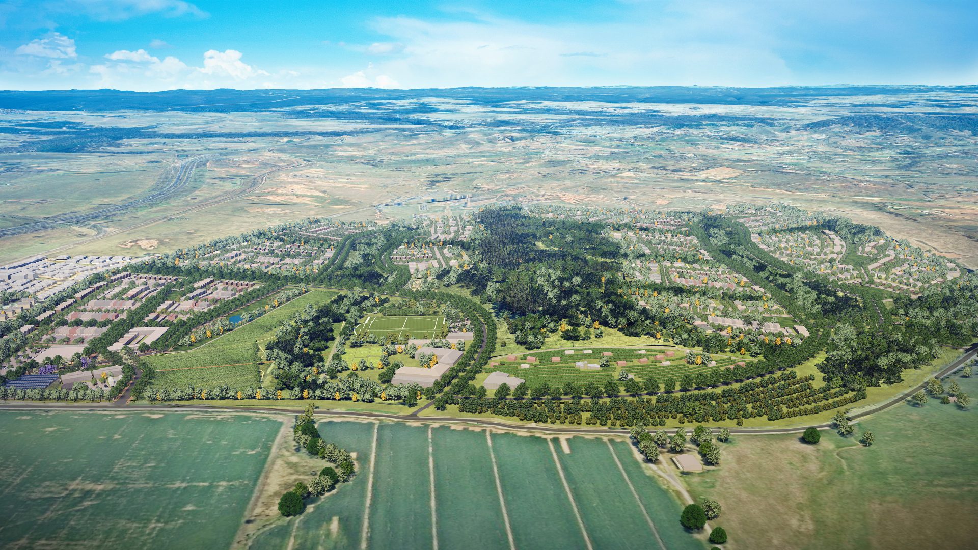
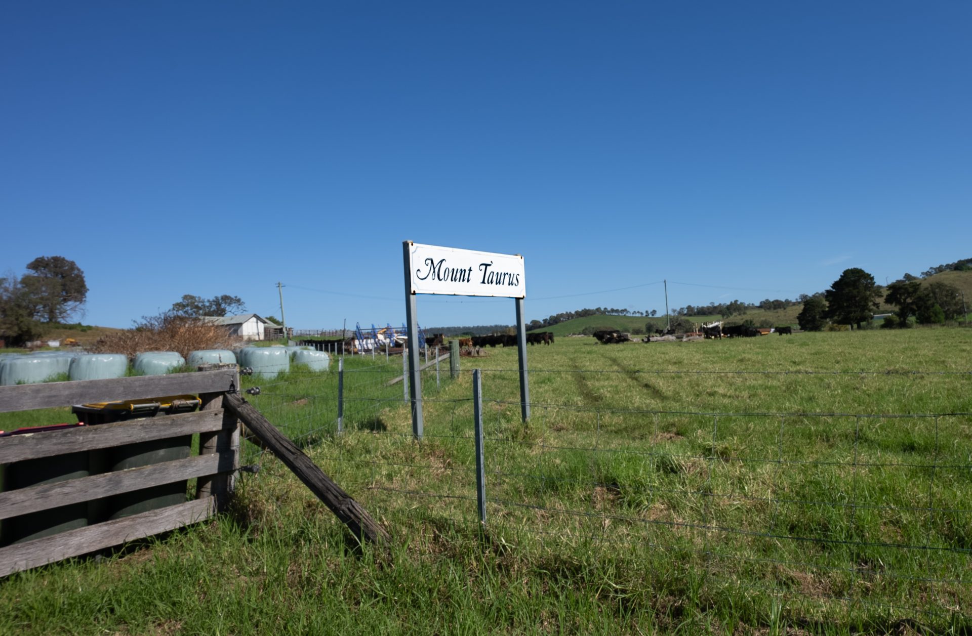
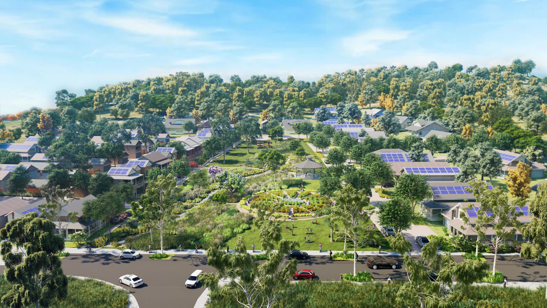
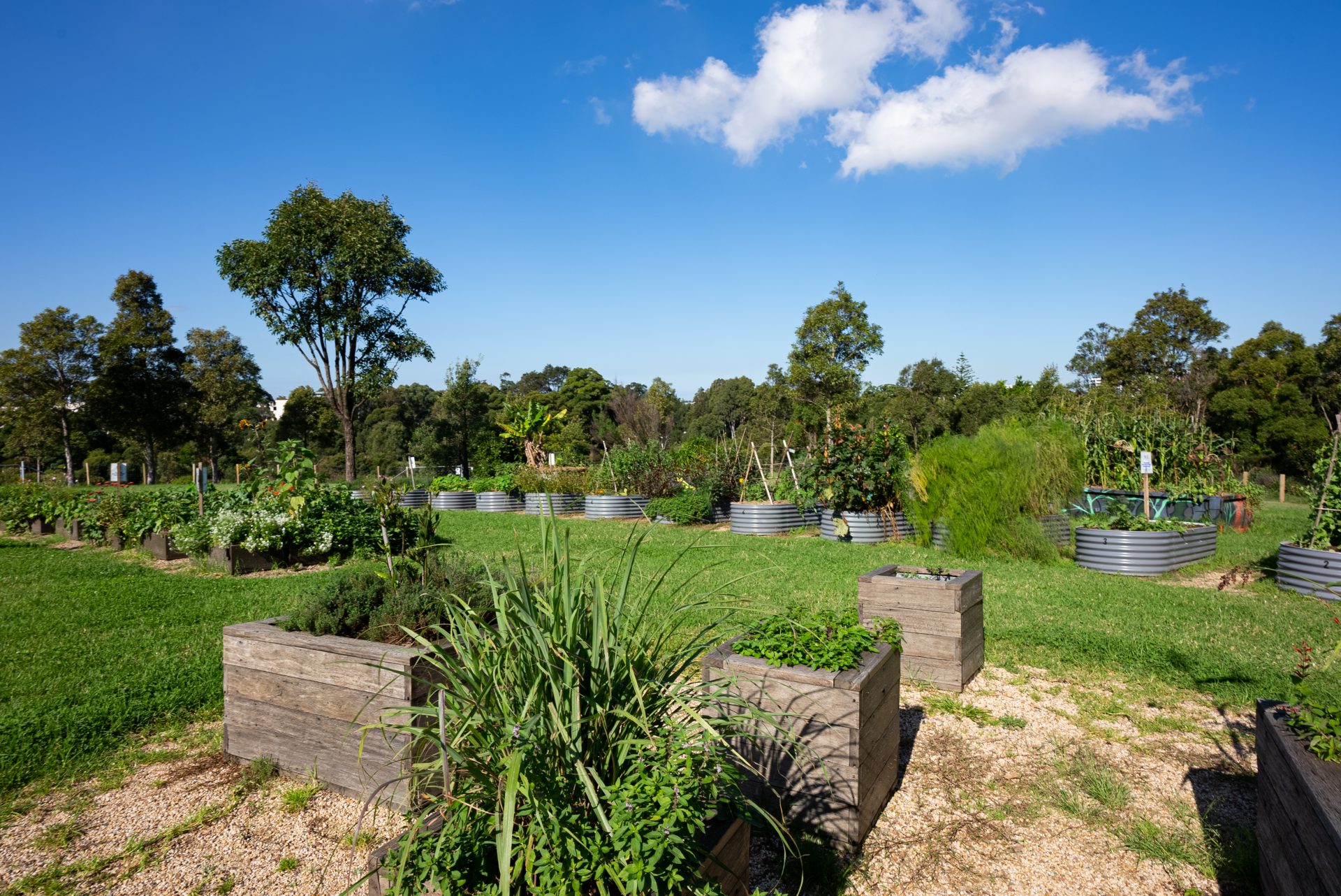
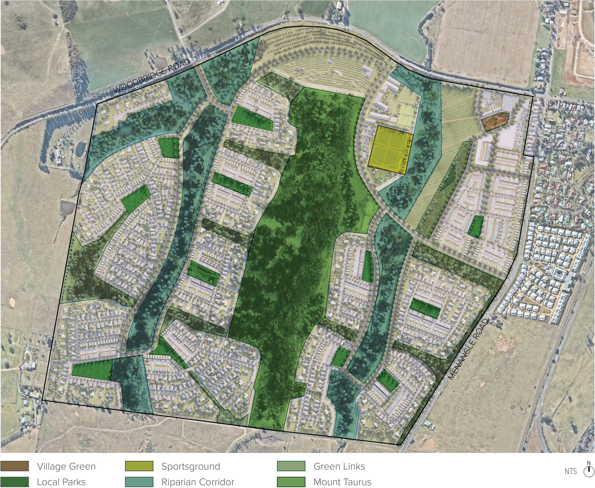
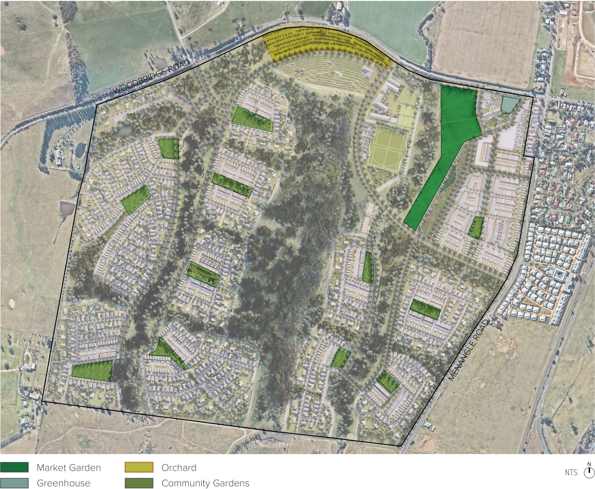
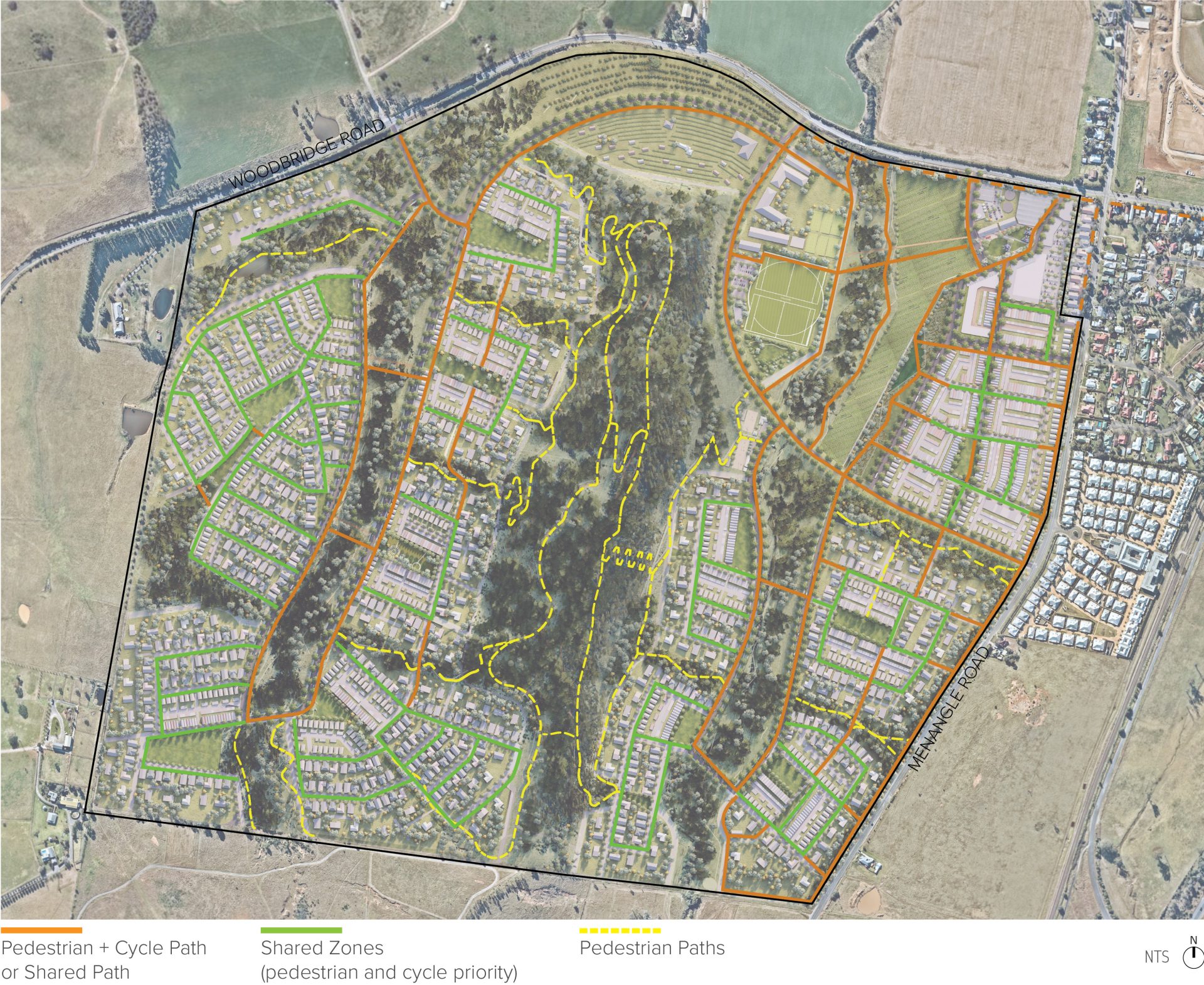
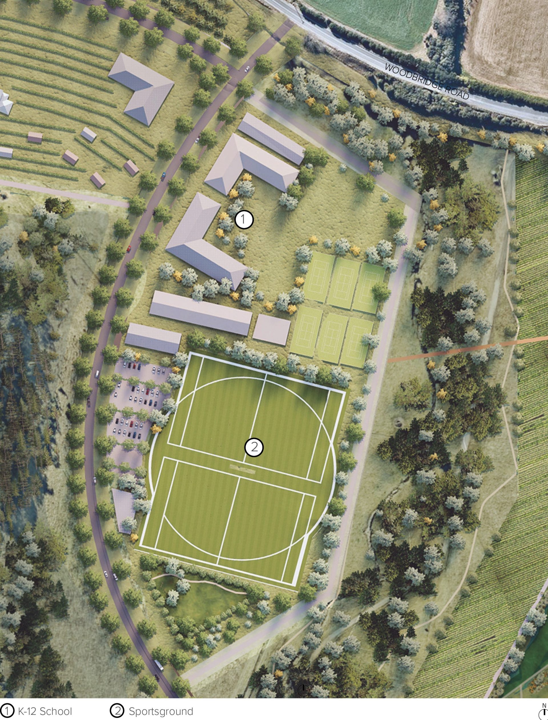
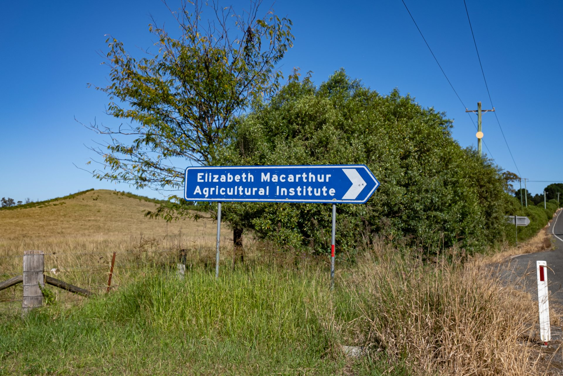
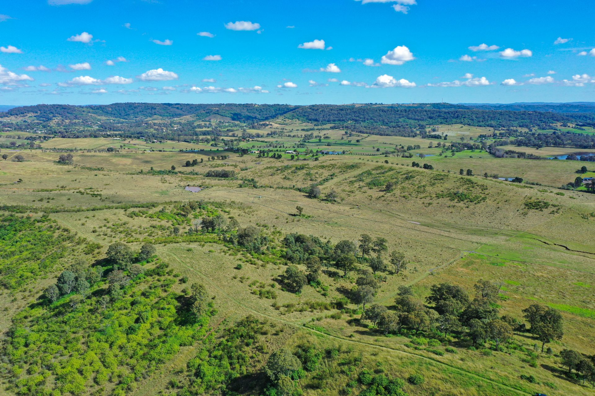
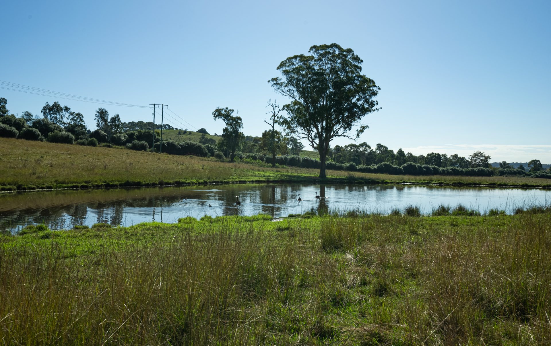
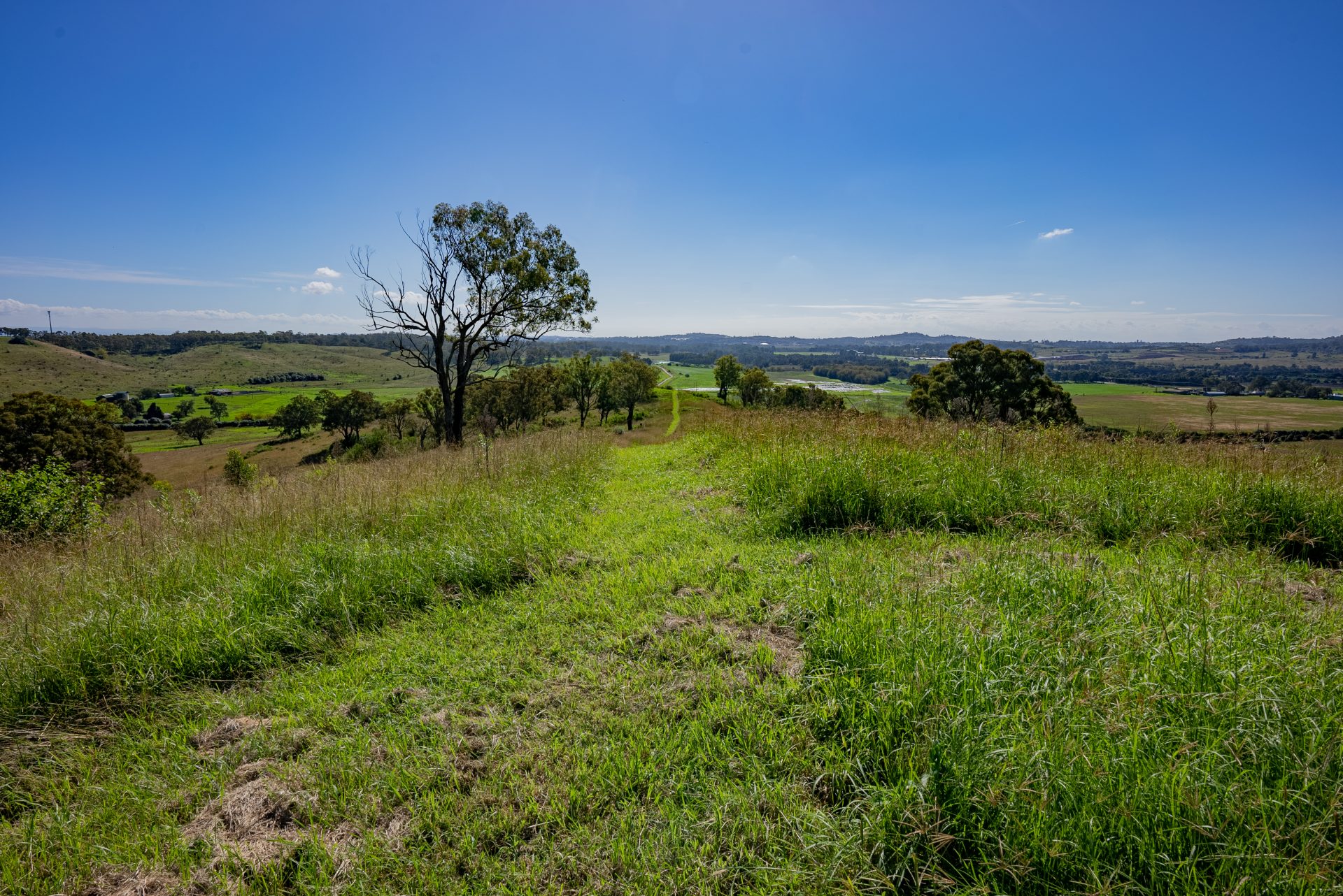
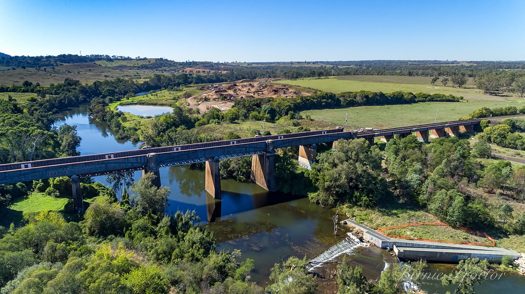
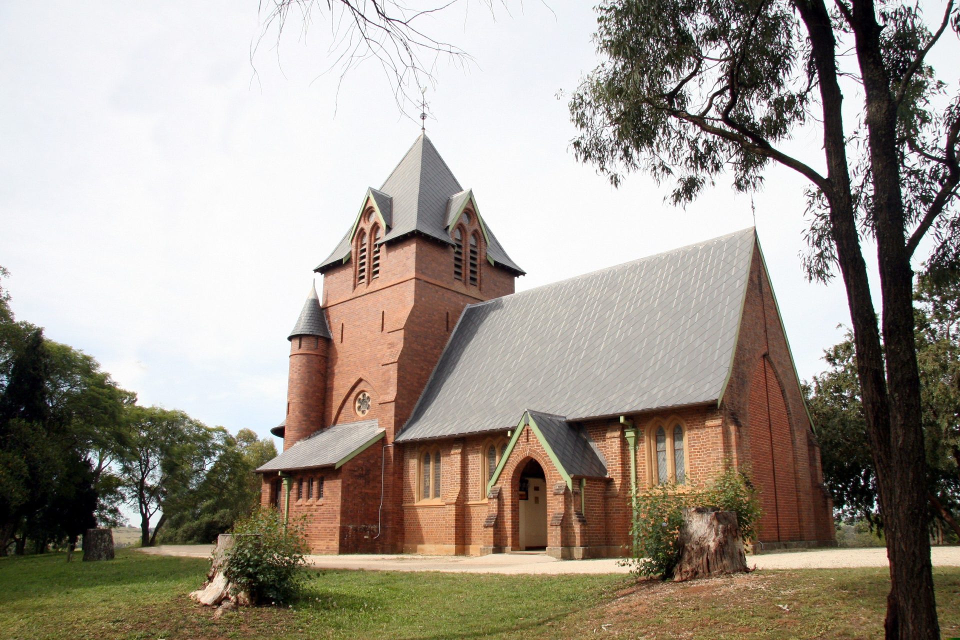
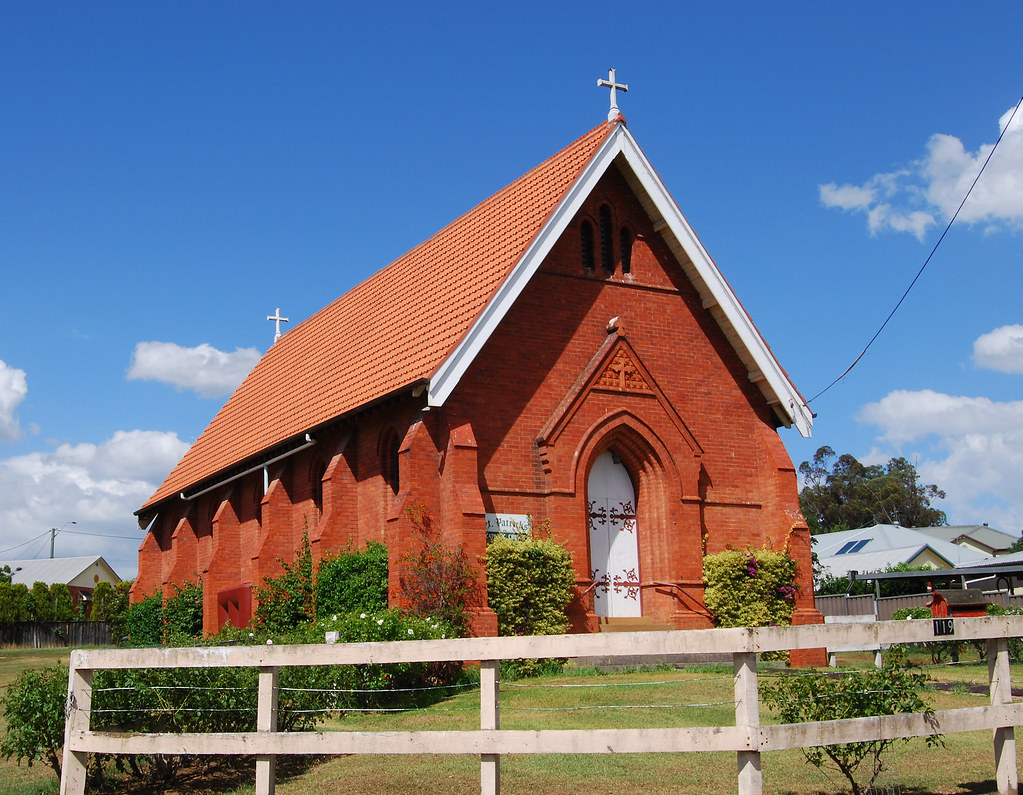
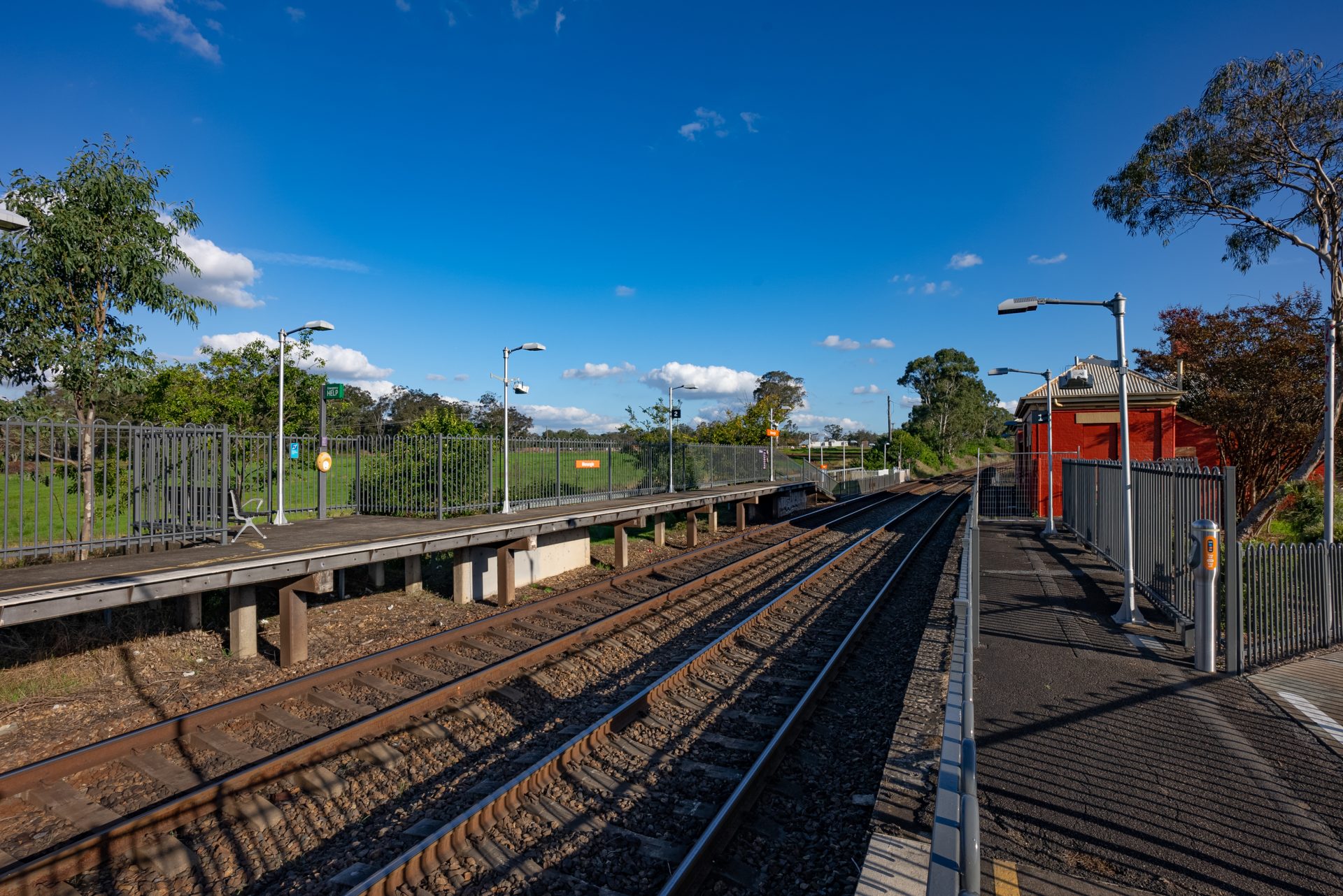
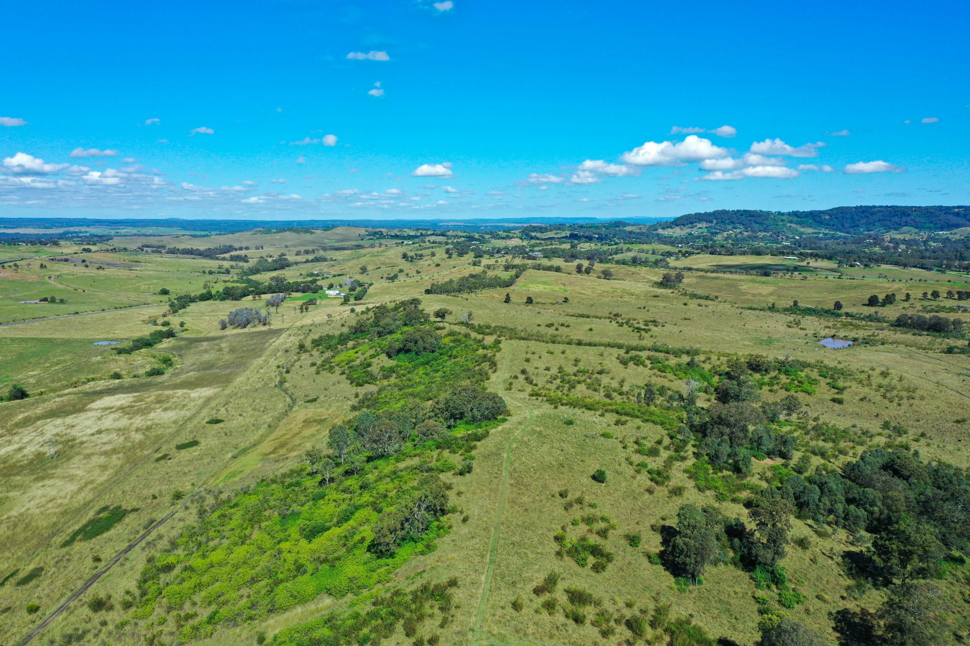
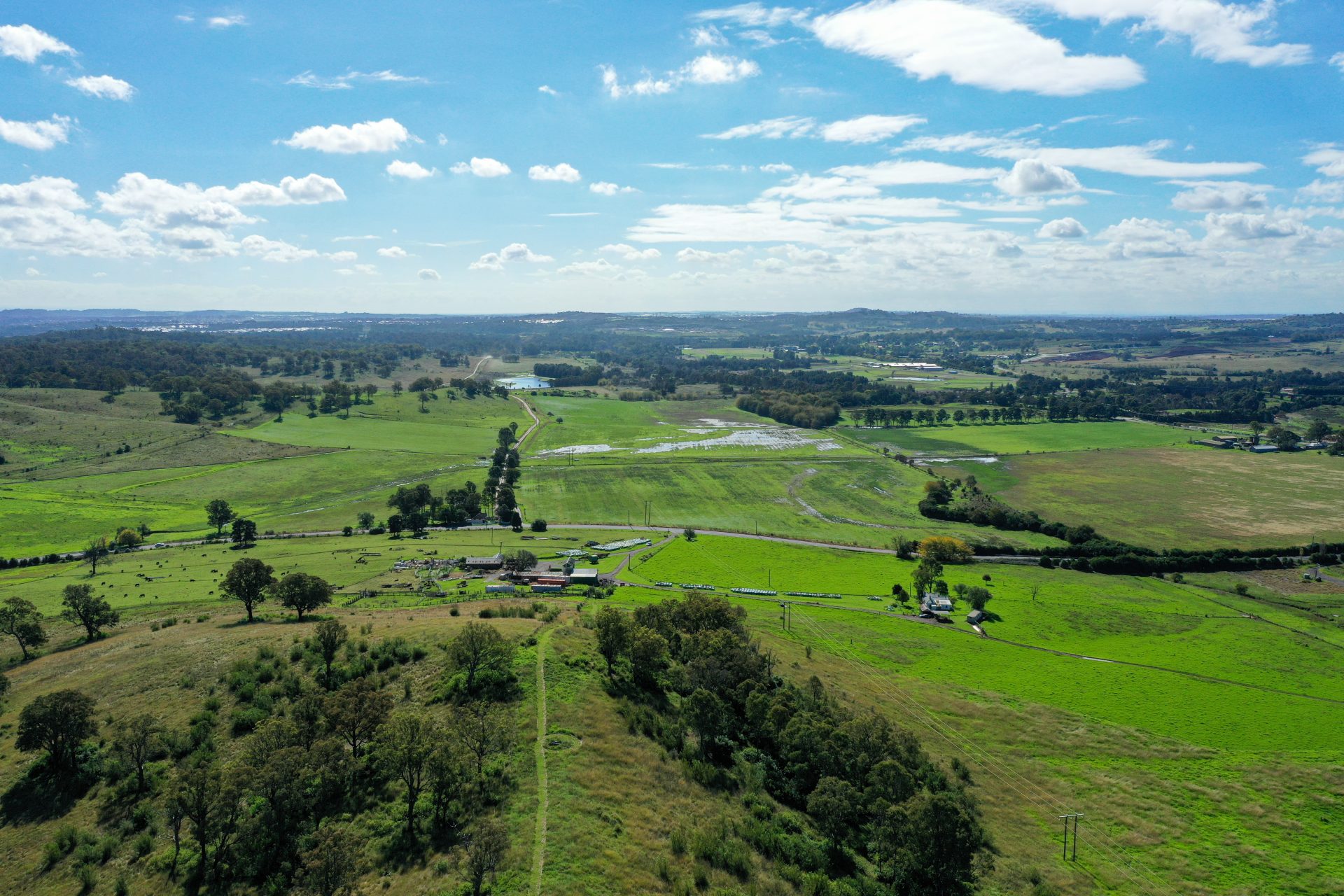
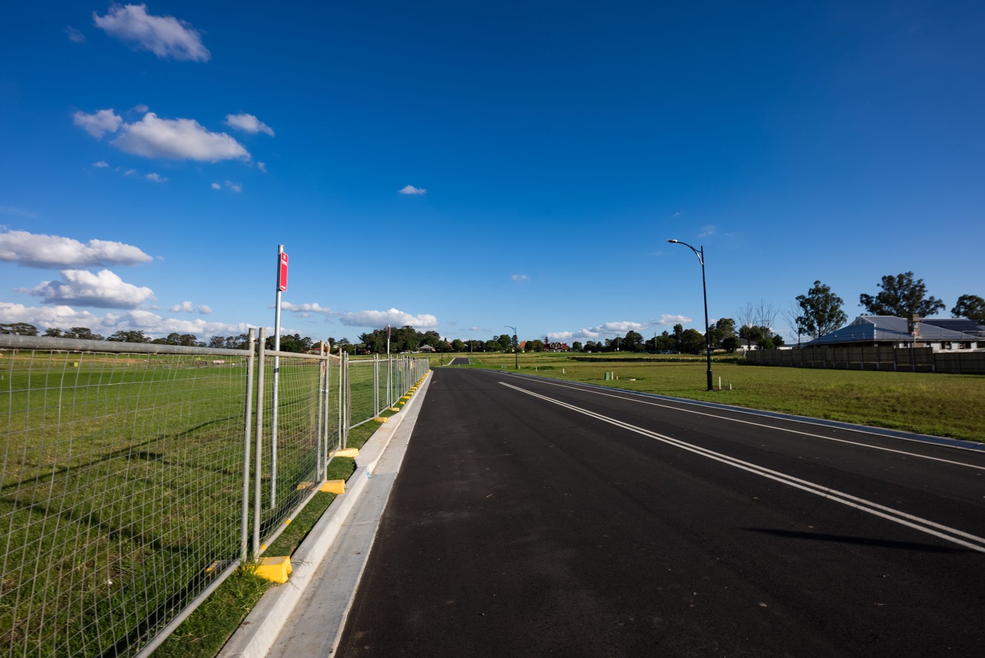
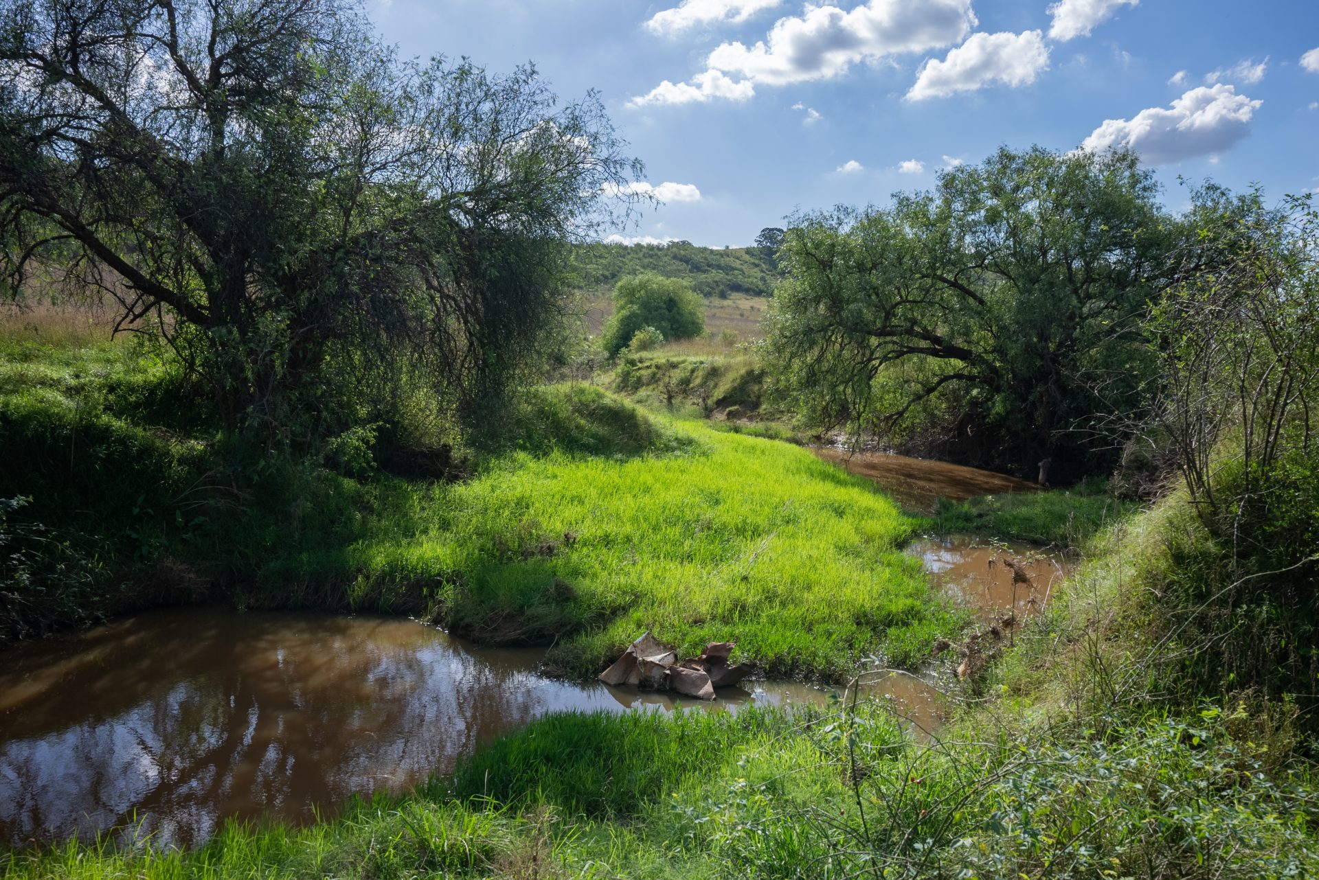
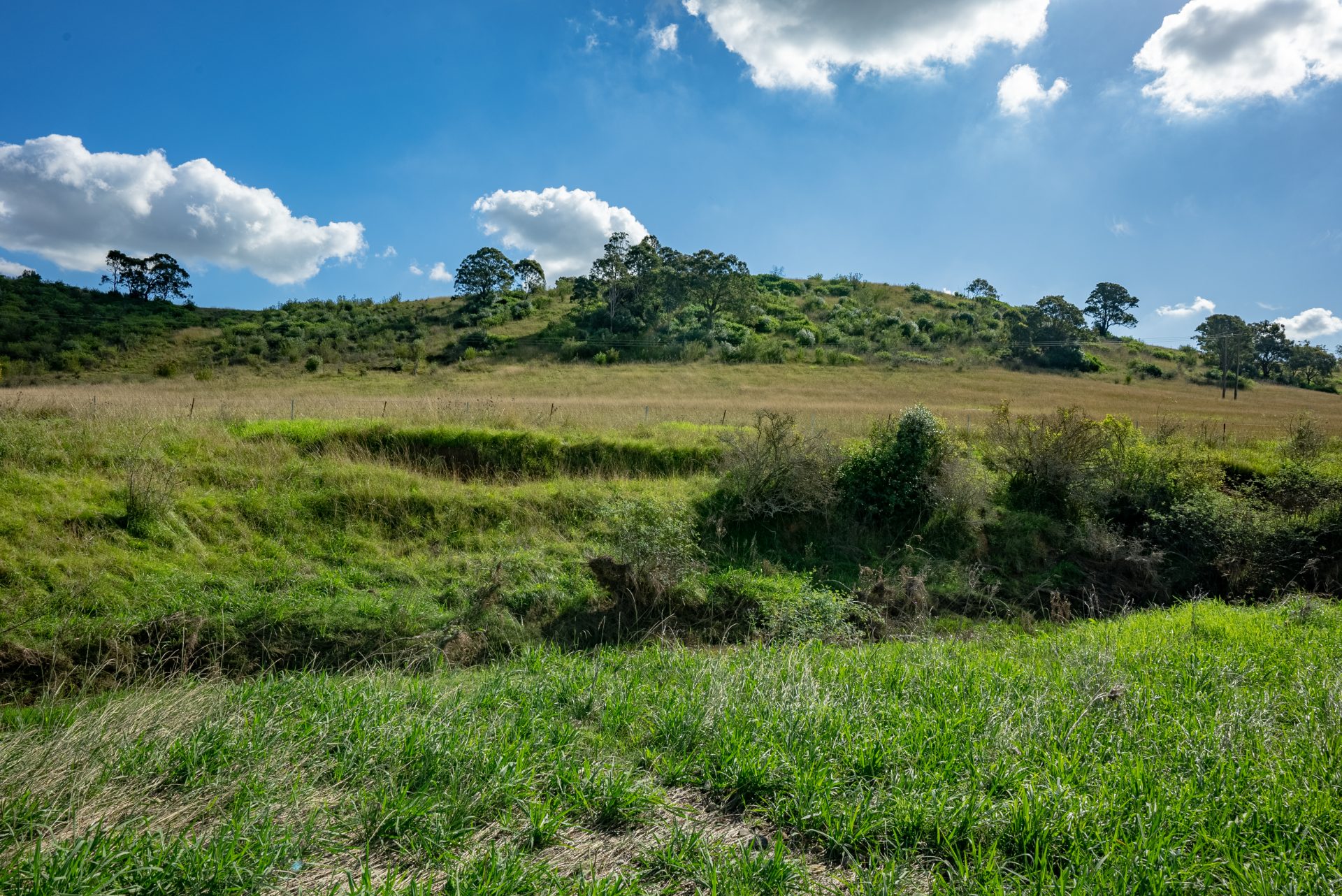
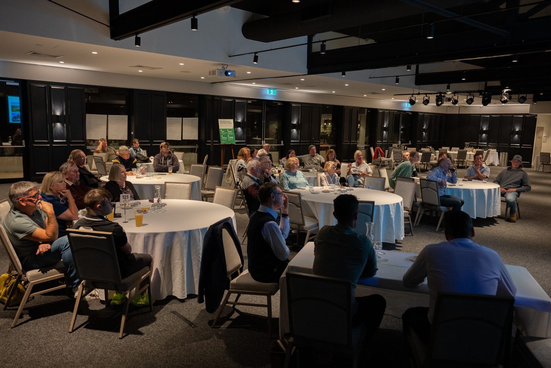
Mount Taurus

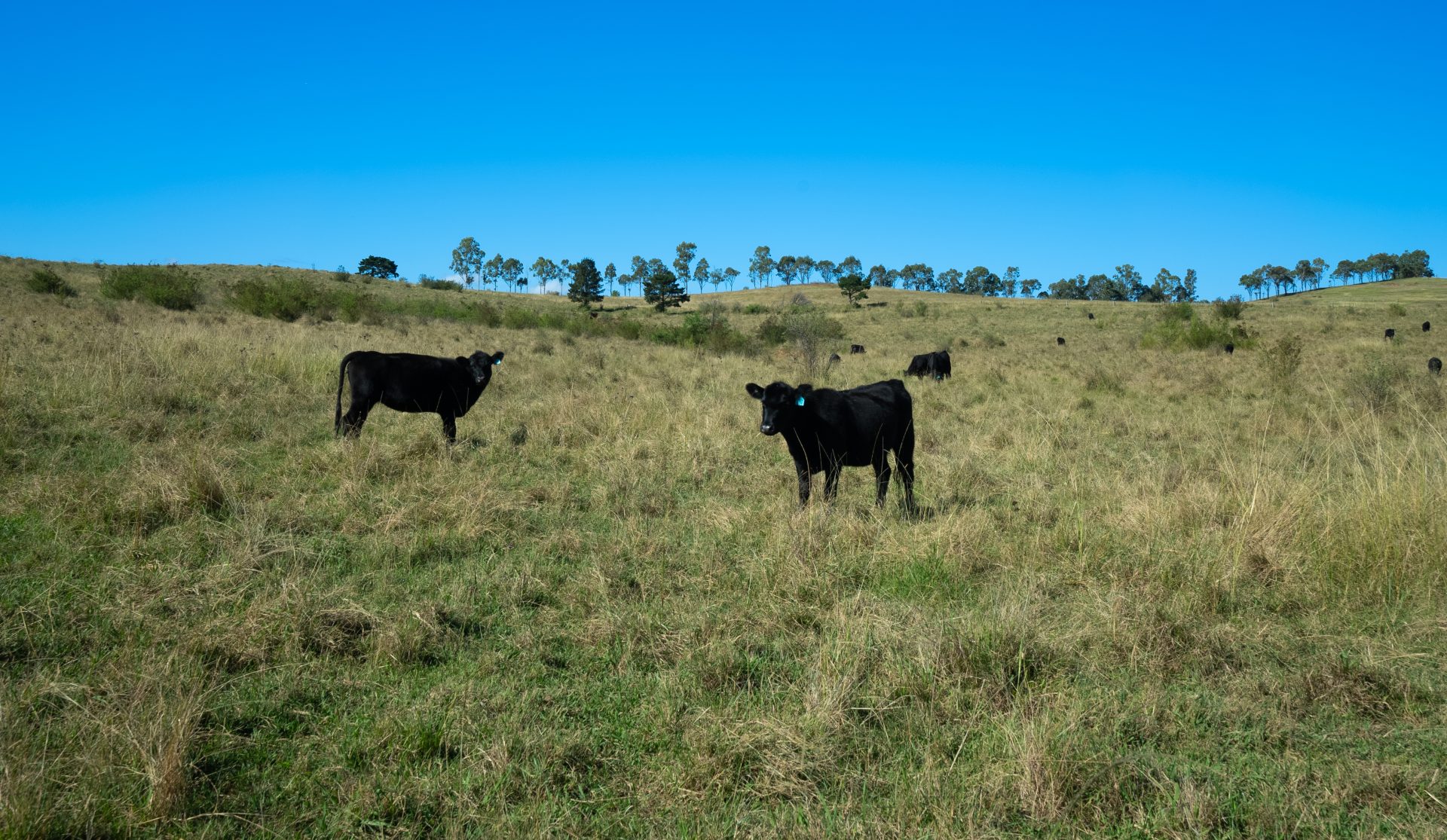
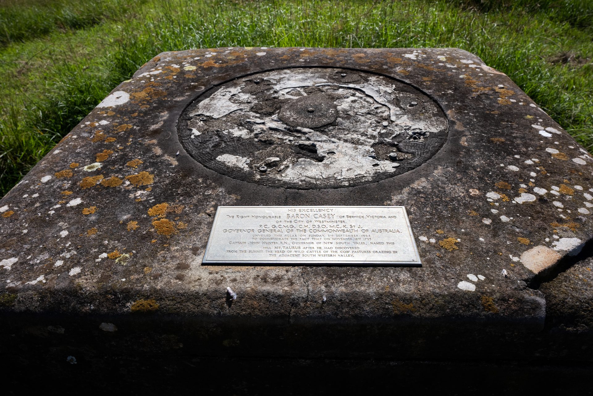
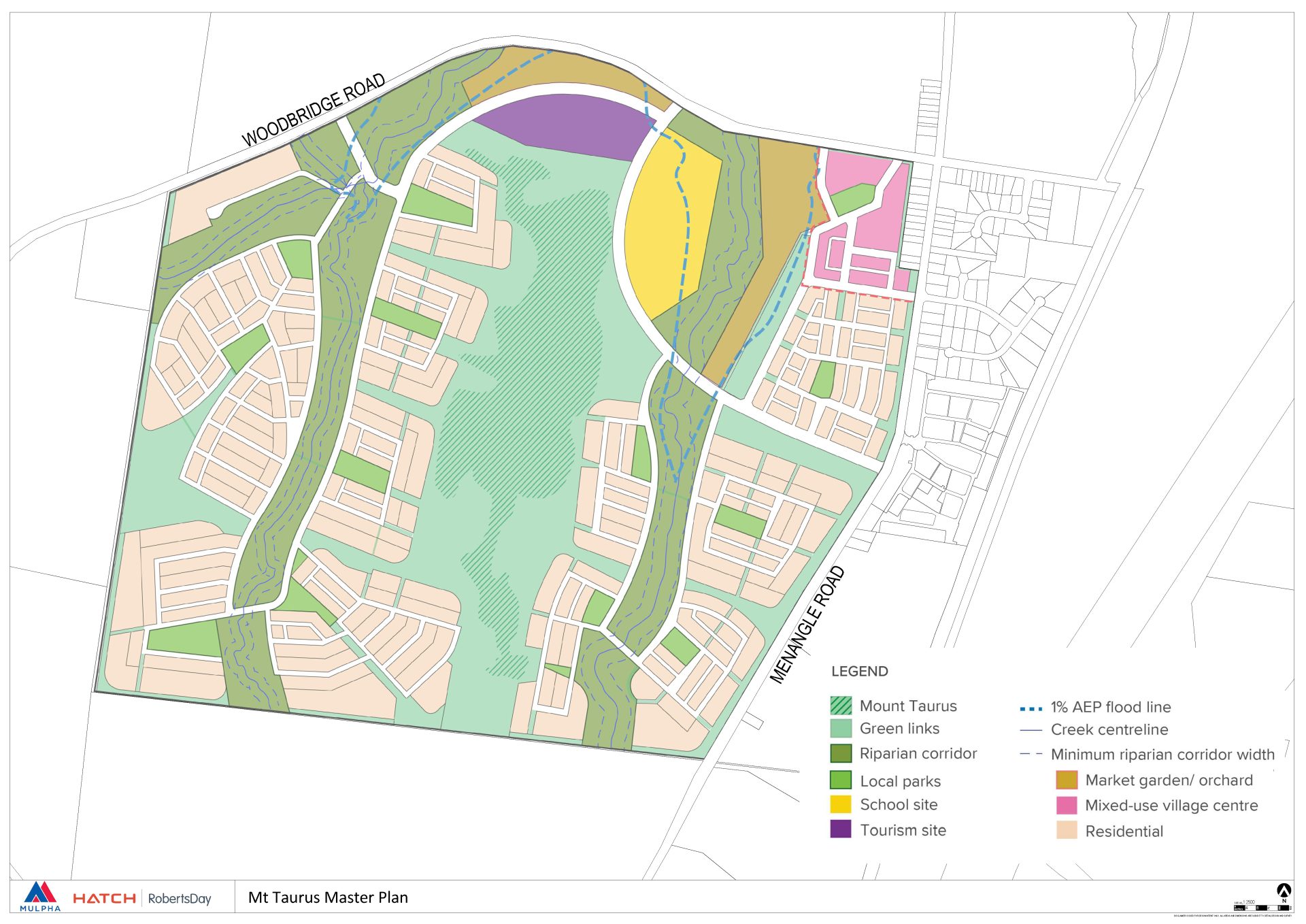
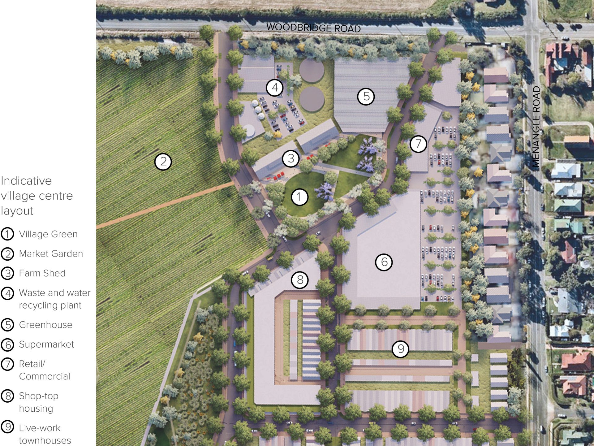
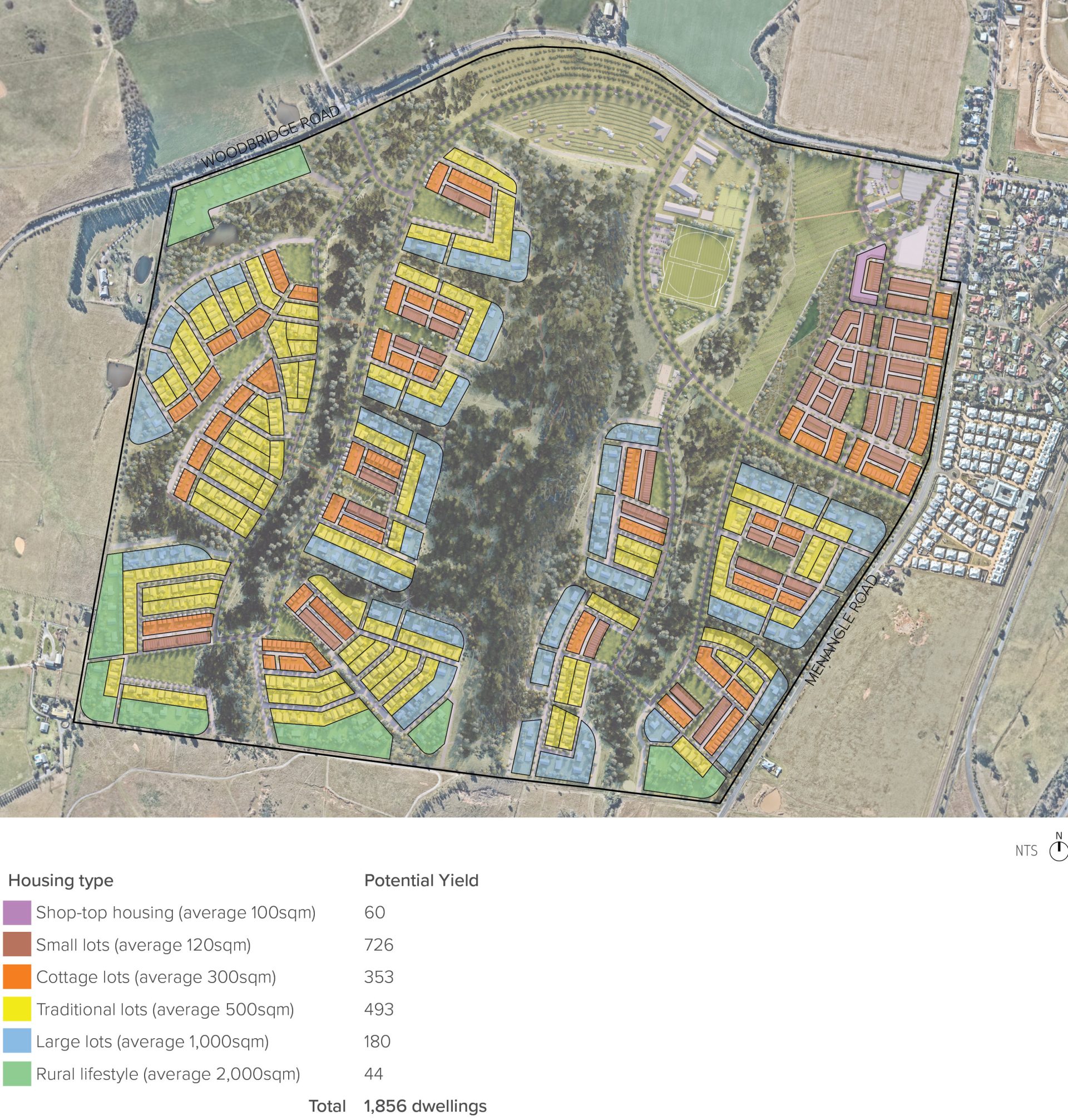
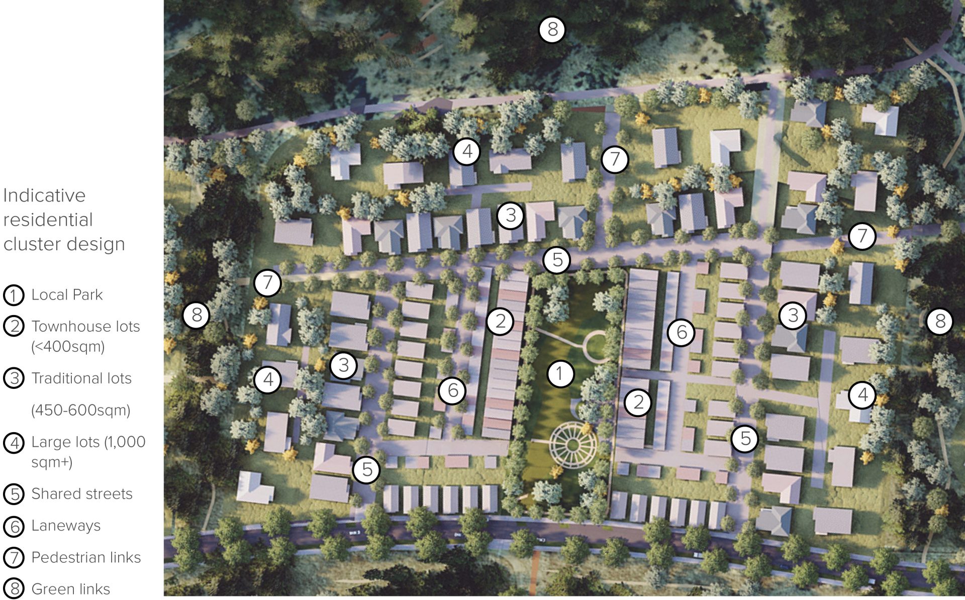
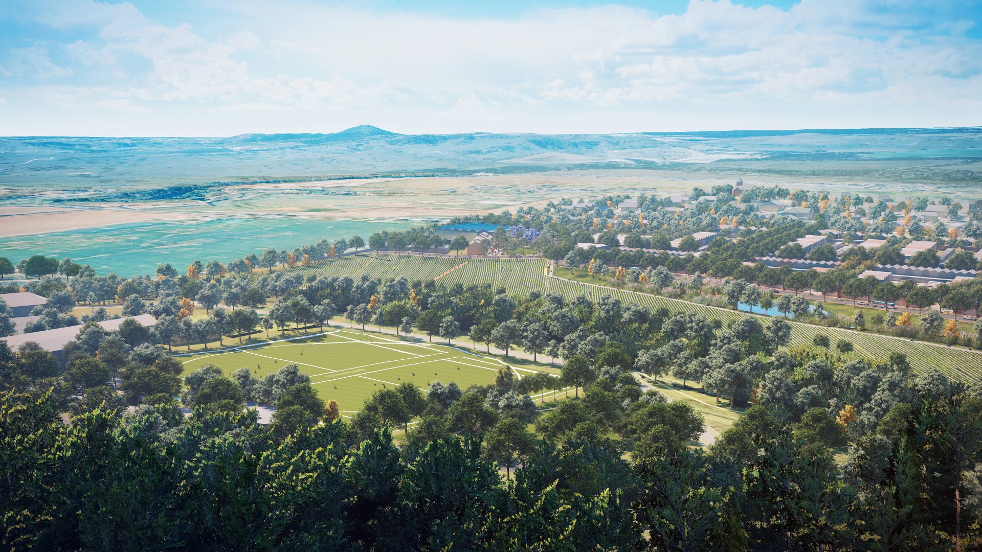
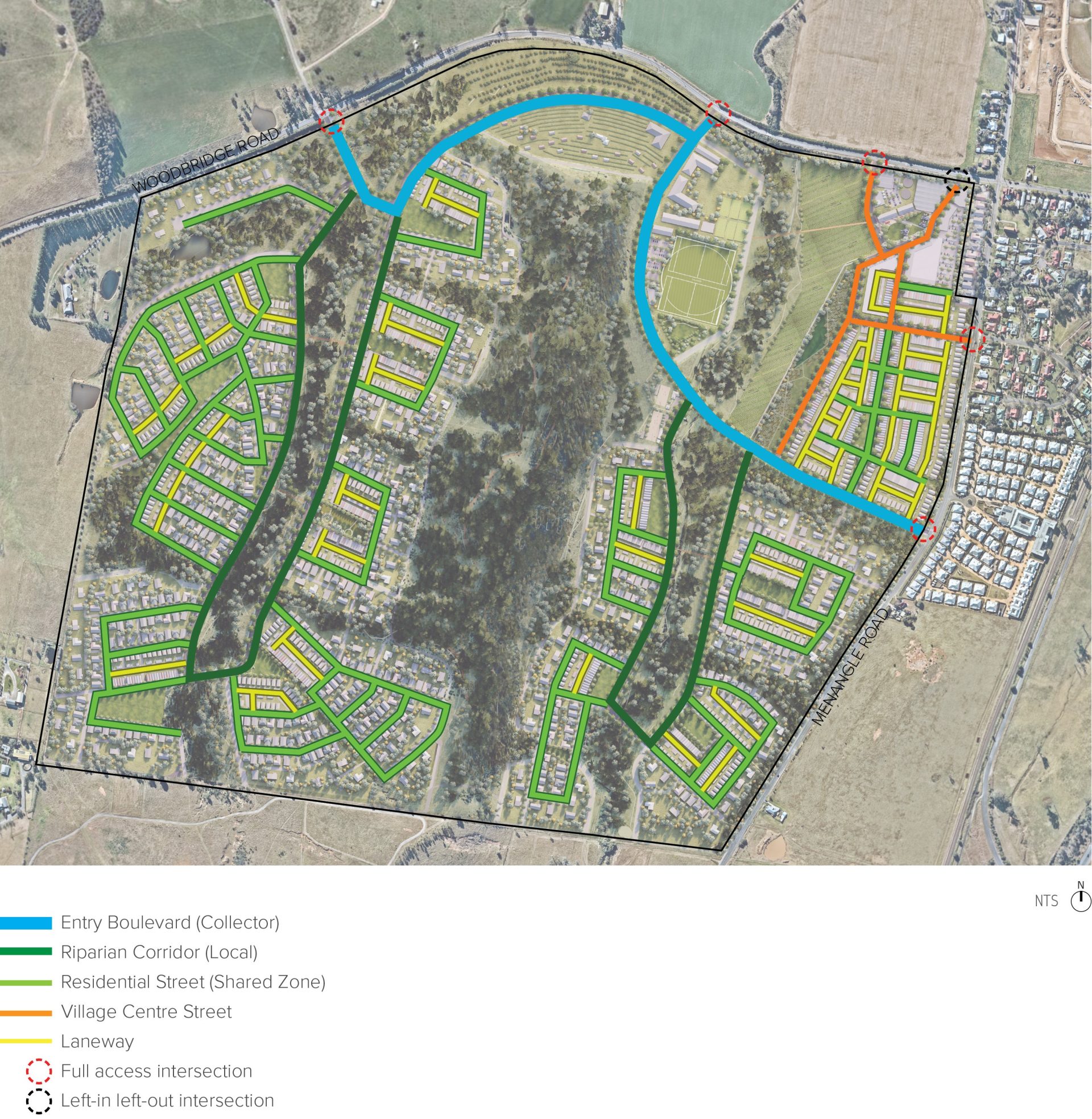
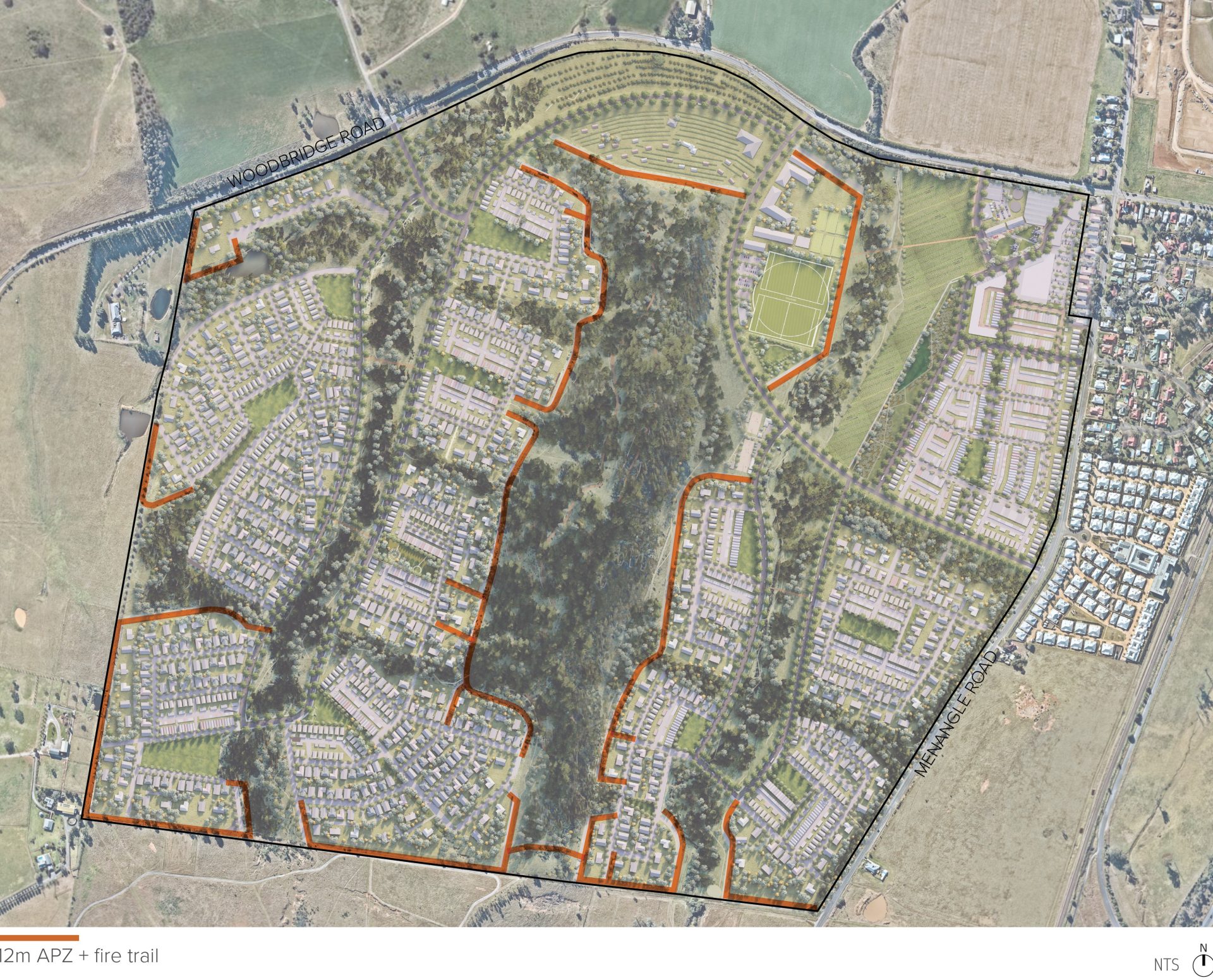
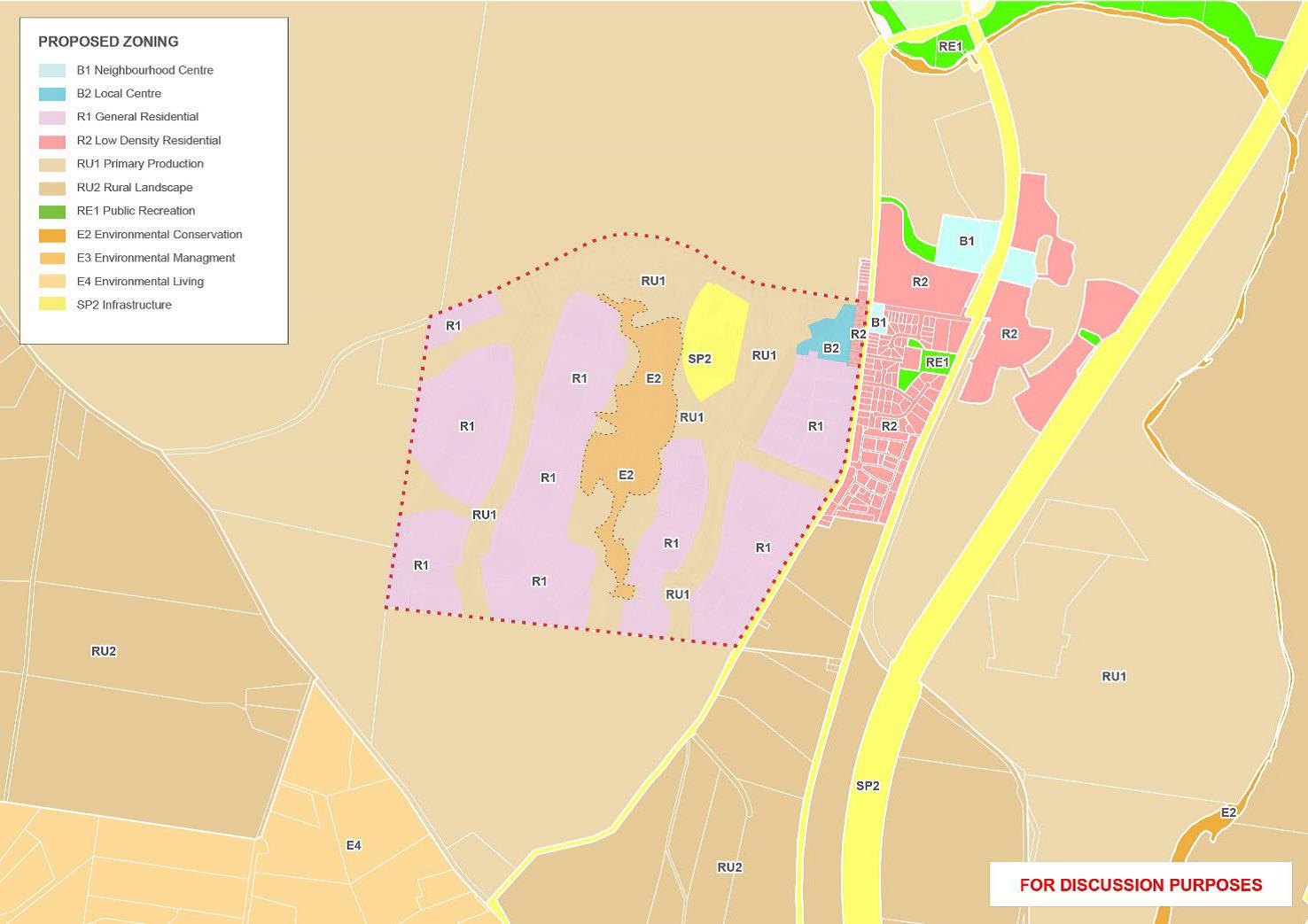
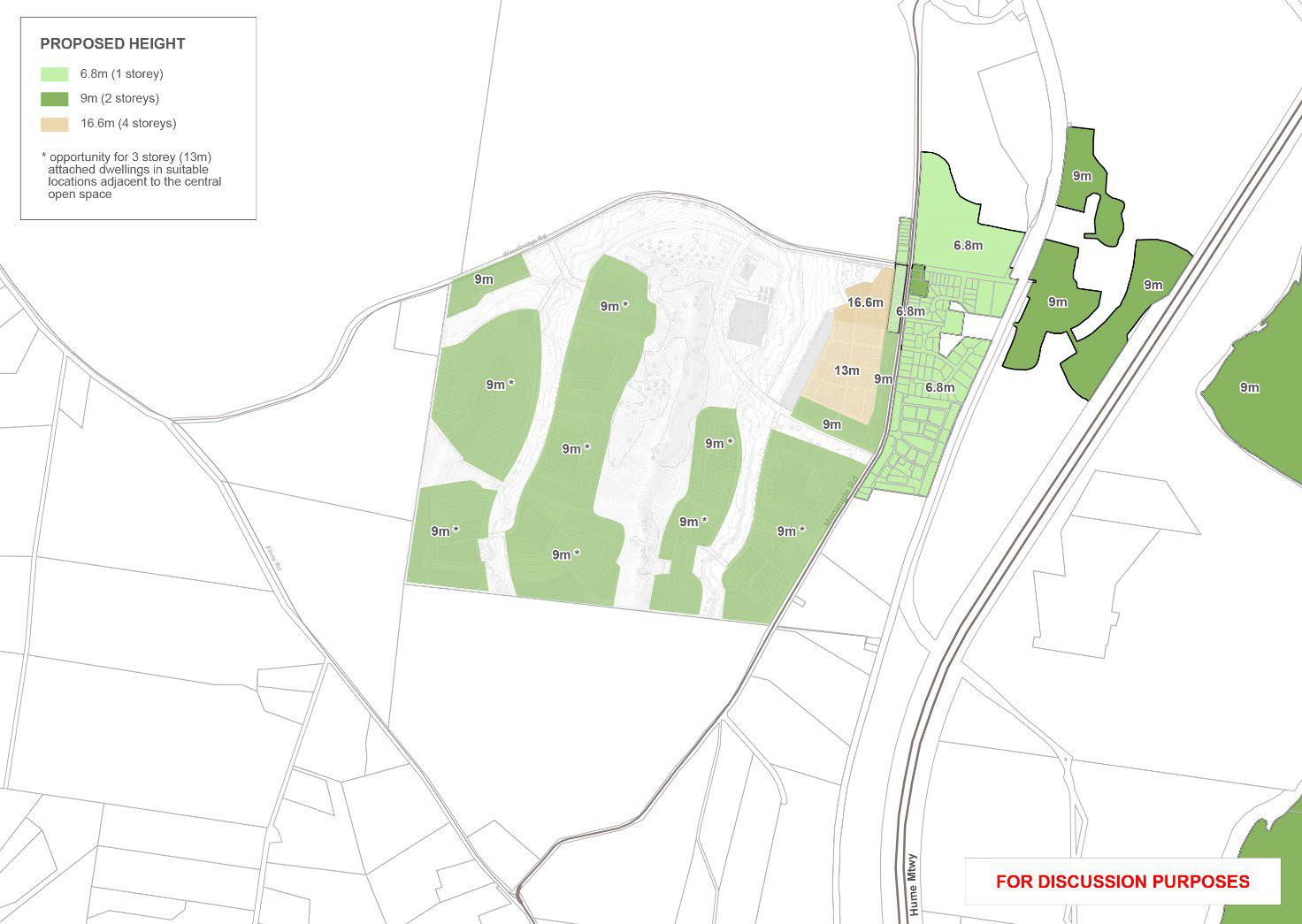
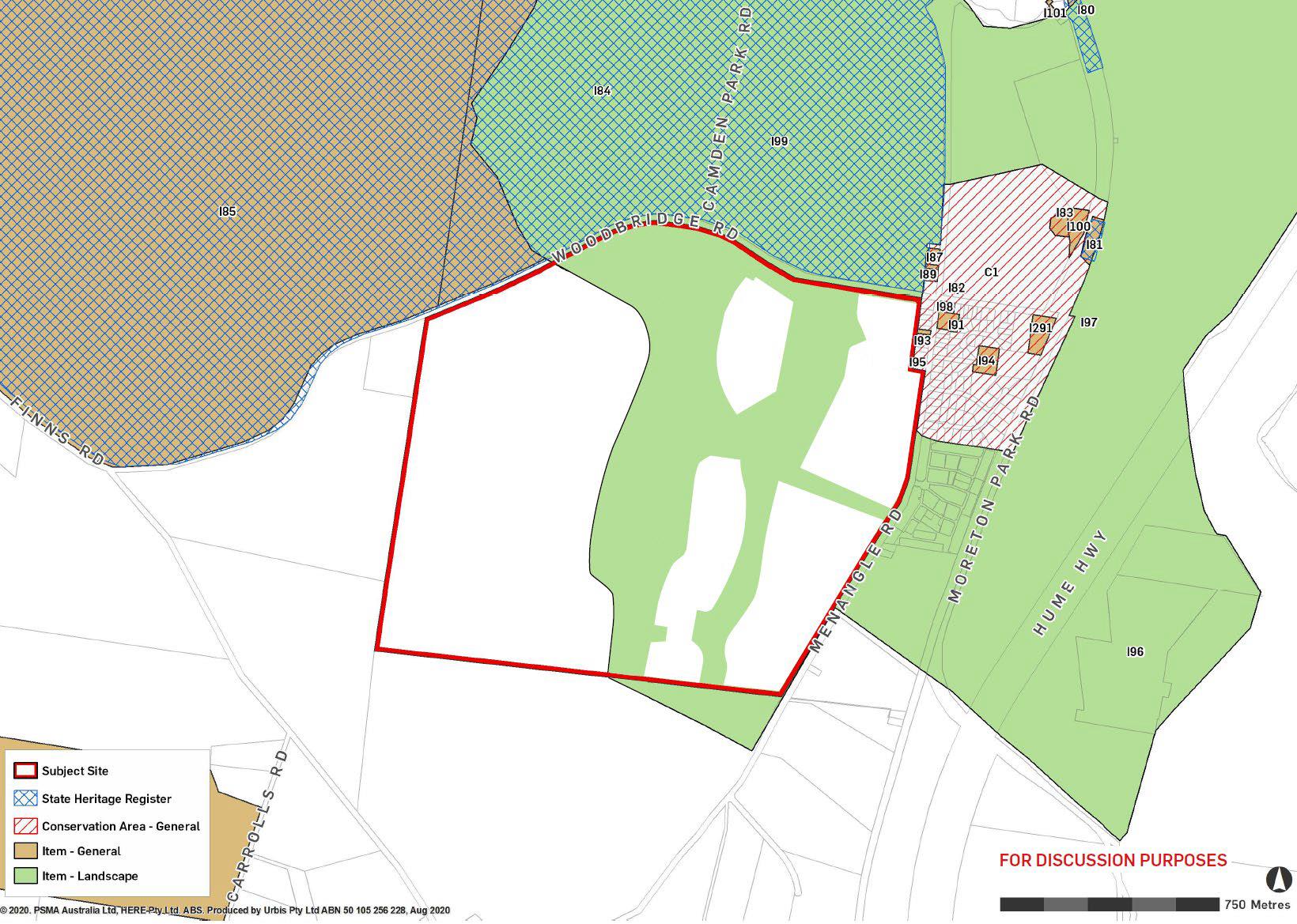
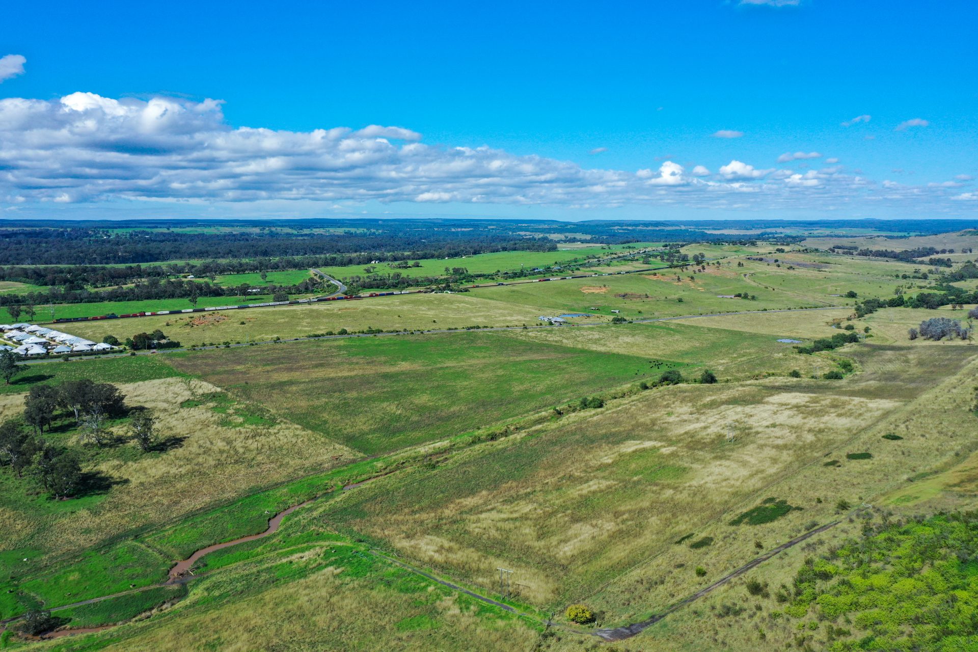
The Mount Taurus Planning Proposal and accompanying Concept Master Plan aim to realise a new land use vision for the 229.5 hectare parcel of land located at 65 Woodbridge Road, Menangle, legally described as Lot 100 in DP 1276755. The vision proposes pioneering residential living integrated with local employment, tourism and education that promotes a rural led lifestyle connected to agriculture, biodiversity and abundant green open space.

Update from Mulpha Menangle

On 22 April 2022, following two years of extensive site investigations and design, Mulpha Menangle lodged the Mount Taurus Planning Proposal and Concept Master Plan for the 229.5-hectare site at 65 Woodbridge Road, Menangle, with Wollondilly Shire Council.

The Mount Taurus land cannot sustain intensive agricultural production and is not economically viable for cattle or crop operation under its current RU1 Primary Production land use zone long term. The Mount Taurus Planning Proposal and Concept Plan presented a new land use mix not previously anticipated by the NSW Department of Planning and Environment or Wollondilly Shire Council.

Familiar with the conventional housing design layouts that are occurring in the Macarthur and Wilton Growth Areas and Menangle Park, Mulpha Menangle appreciated that the agricultural heritage and ecological values of the Mount Taurus site required a fresh and leading-edge approach to development. It is proposed that the Concept Master Plan be a foundation for a new rural-residential village housing model that has sustainable agricultural heritage and ecological conservation at its heart.

In October, Mulpha Menangle held a series of consultation events to coincide with the public exhibition of the Planning Proposal by Wollondilly Shire Council. We greatly appreciated the involvement of Menangle residents and valued the feedback that we received about the Concept Master Plan.

On 26 July 2022, Wollondilly Shire Council resolved not to support the progression of the Mount Taurus Planning Proposal and Concept Master Plan through to Gateway Determination. While Mulpha Menangle is very disappointed by the decision, we fully understand the sensitivity of the project for the Menangle Community.

Mulpha Menangle is not a speculative developer, and we invest in our projects for the long term. While we are three years in, it is still early days for this project which we anticipate will have a 10 to15 year development journey. There has been a substantial body of work and site investigations undertaken on the land to date. Over the next twelve months, we will be making further investments as we work with our multi-disciplinary consultancy team to address the issues that have been raised through our community consultation process and in the public submissions that were received by Wollondilly Council following the preliminary exhibition of the Planning Proposal.

As we navigate the road ahead, we sincerely ask the Menangle community, integral stakeholders and the Wollondilly Shire Council to actively work alongside our team to evolve the Concept Master Plan. We are confident that through our pooled knowledge and learnings, we can deliver a project that achieves:

  • Best practice in rural residential place-making;
  • Respects the agricultural heritage of Menangle and the needs of our adjoining landowners;
  • Delivers sustainable local agricultural food production;
  • Provides 110 hectares of regional open space for the community in perpetuity;
  • Honours the traditional custodians of the land;
  • Secures critical investment in essential stormwater, road and public transport infrastructure;
  • Delivers greater community benefits such as a local K-12 school, sporting amenities and medical facilities (as suggested through the consultation);
  • Provides affordable quality housing suitable for a range of households with appropriate Design Covenants that respect the rural vernacular.
  • Delivers much-needed local employment opportunities across all age groups.

At any time should you have any questions about the project, please do not hesitate to reach out to Mulpha Menangle via UrbanTalk using the feedback form at the bottom of this page.

Mount Taurus by Danielle Mate

This year Mulpha Menangle commissioned Aboriginal Artist Danielle Mate to develop an artwork that explored the on country narrative expressed by Auntie Glenda, a local Elder who’s family resides in the local community to this day.

A descendant of the Murrawari people through her Mother’s maternal side, and Euahlayi people through her Mother’s paternal grandmother, Danielle has created a name for herself within the art world. Danielle is recognised by the Australian Government Department of Foreign Affairs and Trade (DFAT) as an indigenous Business Partner.

Artist’s Statement

‘The work depicts the use of both traditional story telling through symbols and style, as well as a modern layer that represents the new story. The work is painted using an aerial perspective of the landscape, this being Dharawal Country.

At the very base, Country is represented using colour for slope and elevations, to create the layered background. Placed on top of the background in black, are the lines of the proposed main boulevards, which speak of a new story emerging for Mt Taurus. Woven into this, are the symbols of housing, both in a traditional and modern style. The new dwellings proposed are represented by both circles (meeting places) and house roofs. There is also reference to the original and new flora of the country, through the various textures and dot work on the surface.

The different dot work and small lines are depictions of the plantations, flowers and foliage within the space. I have used footprints to represent the story of herding hares. Footprints at the top of Mt Taurus for the people that would scare the hares to the bottom. U shapes at the bottom that represent the people waiting to catch them. Those same footprints will now depict the foot traffic of people using the greenspace along Mt Taurus.

In the bottom right is the shape of Bull horns. This is a reference to the Bull Caves, a significant story on Dharawal Country.’                        

Danielle Mate

Welcome

Welcome to the UrbanTalk Project Listing for the Mount Taurus Planning Proposal.

This Project Listing explains the Concept Master Plan and the intent of the Planning Proposal.

Through the Project Listing, you can also:

• Keep up to date with community events; or

• Ask us a question using the feedback form at the bottom of this listing.

Project details

Address
65 Woodbridge Road, Menangle
Local Government Area
Wollondilly Shire
Project Type
Master Planned Community
Status
Planning Proposal Under Consideration
Developer
Mulpha Menangle Pty Ltd
Urban Design & Master Plan Consultant

Hatch Roberts Day

Landscape Architect

Locally based Distinctive

Planner

Urbis

Overview

Concept Master Plan as viewed looking south

On 22 April 2022, Mulpha Menangle Pty Ltd (the proponent for this project) lodged the Mount Taurus Planning Proposal and accompanying Concept Master Plan with Wollondilly Shire Council.

The Planning Proposal is the culmination of almost two years of substantial vision and technical investigations, including preliminary community engagement, potential stakeholder partnership discussions and extensive design work particularly around infrastructure provision.

The land use mix and development form provided by this Planning Proposal has not previously been anticipated for the Mount Taurus site by the NSW Department of Planning and Environment or Wollondilly Shire Council. Notwithstanding, Mulpha Menangle believe the proposed land use is of significant benefit to the region given the current context of the site.

The starting point for this project was to spend time understanding the historical agricultural landscape and ecological value of the site. Importantly, these investigations concluded that:

  • The land cannot sustain intensive agricultural production and is not economically viable for cattle operation under its current RU1 Primary Production land use zone long term.
  • The site had important local heritage, ecological and rural landscape values; and
  • When considering the future, these values could indeed be retained if developed appropriately.

Familiar with the conventional housing design layouts that are occurring in the Macarthur and Wilton Growth Areas and Menangle Park, Mulpha Menangle knew that Mount Taurus needed and deserved a fresh and leading edge approach.

Mulpha Menangle assembled a multi-disciplinary design team comprising over 20 consultants including urban designers Hatch Roberts Day, landscape architects Distinctive and urban planners Urbis. Having regard to the findings of the extensive technical and site investigations and working collaboratively, a Concept Master Plan was formulated that established a new land use vision for the site

The design thinking that underpins this project respects the pioneering rural heritage of Menangle and Mulpha Menangle’s genuine desire to honour and protect the ecological, indigenous and landscape value of Mount Taurus.

The Mount Taurus Planning Proposal and Concept Master Plan establish a new planning framework and land use vision for the site that:

  • Looks to enshrine the essence and values of a rural and agricultural lifestyle;
  • Conserves 110 hectares of land as green open space;
  • Incorporates agriculture and market gardens to support local community food production;
  • Delivers a series of unique residential clusters, that are designed around a local park and connected to one another by green landscape corridors;
  • Expands the retail and service offering of the existing Menangle Village providing new employment opportunities and locally run shops and businesses;
  • Allows for a new K-12 school campus and tertiary education;
  • Supports local tourism initiatives; and
  • Provides for environmental sustainable design that fosters energy efficiency, water and waste recycling, enhancement of the natural environment and pedestrian and cycling priority to reduce car use.

Introducing Mulpha Menangle

Mulpha Menangle Pty Ltd is the proponent who is taking the Mount Taurus Project forward. The company is a collaboration between the original Mount Taurus land owner and Mulpha Australia. They have worked in partnership to formulate the Concept Master Plan.

Our local partner brings to this project passion for the agricultural heritage of Menangle and a long association with and love for the Menangle community. She appreciates the sensitivity of this project and is committed to working hand in hand with the community to ensure Mount Taurus is a valued and lastign legacy for future generations of Menangle residents.

Mulpha Australia, has a proven track record both in Sydney and abroad, for delivering world class projects that are designed from first principles with a respect for Country, local values and aspirations. Their projects are their legacy and they are immensely proud of Hayman Island, Norwest Business Park, Bella Vista Waters, Mulgoa Rise and Sanctuary Cove.’

‘Our philosophy is such that we never consider that a project comes to an end when construction is finished, we don’t say our work here is done and walk away. Our commitment is such that we see ourselves as community partners. We stand side by side with existing and future residents and businesses providing ongoing investment and expertise to ensure our communities are resilient,  sustainable, progressive and evolving.’

Tim Spencer, Head of Developments Mulpha Australia

If you would like to learn more about Mulpha Australia take this link to the Mulpha Corporate website. https://www.mulpha.com.au/

The Mount Taurus Story

Mount Taurus was given its name by the Governor of New South Wales, Captain John Hunter, in 1795 following his sighting of a herd of wild cattle who were descendants of the original stock brought to Australia. History tells us that six head of cattle, being two bulls and four cows, escaped from the First Fleet Settlement five months after arrival.

Several years on, and having increased in size to over 100 head, Governor Hunter sights the herd while it was grazing and named the site where he is standing Mount Taurus to commemorate the occasion. (Source, Extent Heritage Pty Ltd, Historical Archaeological Assessment, 2021, forms Appendix L of teh Planning Proposal).

A historic monument is located at the top of Mt Taurus, commemorating the modern history moment when Governor Hunter named Mt Taurus. The memorial pillar was unveiled on the 3 September 1967.

The Concept Master Plan

Vision

Essential to the overarching vision for Mount Taurus was identifying how the Mount Taurus site can achieve a mutually beneficial outcome for the existing and future Menangle community. This project is not looking to create a new community on the doorstep of the Menangle village. Instead it recognises that Menangle has one heartbeat, one collective future.

‘Like a country home the Mount Taurus Concept Master Plan is welcoming, it greets all with open arms. It calls ‘come inside, stay for a cuppa, have a chat, and when it’s time to leave–‘I’ll see you tomorrow’.

Tim Spencer, Head of Development Mulpha Australia

The Concept Master Plan aims to provide a seamless transition that offers emotional, physical and social connectivity with the existing Menangle community. This is achieved through the design of its regional and open space networks, walking and cycling trails, Village Centre extension, community and education facilities, market gardens and agricultural amenities, multi-generational housing and local street networks.

The Mulpha Menangle Vision for Mount Taurus is

‘Pioneering residential rural living integrated with employment, tourism and education that is based in a lifestyle connected to agriculture, biodiversity and abundant green open space.

Concept Master Plan Explanation

Figure 1. Indicative view looking south west across Mount Taurus
Figure 2. The Mount Taurus Concept Master Plan
1. A landscape led design that preserves, restores and enhances the natural landscape. (Refer Figure 3).

As the most dominant landform in the locality, Mount Taurus is a local landmark that is celebrated in the Master Plan. It will form the central feature of a new 39 hectare regional open space network. Its ridgeline will be opened to the public with recreational lookouts, walking and cycle trails that provide access to panoramic views of the surrounding hinterland. Cumberland Plain Woodland Vegetation exists on the ridge, and this will be conserved and enhanced with additional plantings.

Figure 3. The Master Plan Local Openspace Network

Running along both sides of Mount Taurus are two watercourses. These will be restored and revegetated as natural riparian corridors. We also envision that these will be aligned with walking and cycling trails.

Wetlands will be re-introduced where possible and will integrate with the site’s natural hydrology reflecting aboriginal understanding and connection to this Country as a place of productive and important wetlands and lagoons. The riparian corridors, including the associated cycling and walking networks, will occupy approximately 37.2 hectares of the site.

2. A strong rural and agricultural identity (Refer Figure 4).

The Master Plan respects Menangle’s history as Australia’s first agricultural community and its direct pedigree to John Macarthur and the Camden Park Estate. It creates a strong rural and agricultural identity for the project. In total, approximately 9 hectares of the site are set aside for local agriculture.

Figure 4. The Master Plan Agricultural Offering

A 4.8 hectare market garden is planned at the Woodbridge Road frontage of the site. It is proposed that this will be supported by a high tech 3000 square metre commercial greenhouse, farm sheds and packing facilities.

These amenities could host a weekend farmers market, promote local producers in the broader area and farm to fork eateries. Further along Woodbridge Road, boutique orchards and an ornamental vineyard are envisioned to provide a picturesque rural backdrop for local tourism initiatives and transition to the Elizabeth Macarthur Agricultural Institute.

The network of local parks that punctuate the residential clusters will also incorporate community gardens. The planned green corridors that connect each cluster provide further opportunities for edible landscapes, including we hope indigenous foods.

3. An extended Village Centre that celebrates the Menangle Community (Refer Figure 5)

The expanded Village Centre at the intersection of Woodbridge Road and Menangle Road incorporates the vision for a Village Green that will provide a focal point for community life. The Village Green will enjoy uninterrupted views of Mount Taurus and the market gardens. It will be framed by a new tree-lined boulevard that will connect with Woodbridge Road. It will support new local shops, cafes, restaurants and community facilities. There is potential to discretely locate a small supermarket if this is feasible due to the desire of the local community.

Figure 5. The Mount Taurus Village Centre

Within the Village Centre, 2-3 storey shop top housing, and 2 storey townhouses and seniors living are also being proposed. Market testing undertaken by Mulpha Menangle indicates this housing would be attractive to young people wanting to purchase their first home and stay in Wollondilly and seniors looking to downsize.

Indicative Shop Top Housing
Indicative Town House

A modern wastewater recycling plant and waste to anaerobic energy digestor is proposed to be located within the Village Centre at the Woodbridge Road frontage. The digestor could potentially service the broader Wollondilly Shire. Landscaping will screen this infrastructure visually, and an odour study undertaken confirms there will be no odour impact on surrounding properties. Mulpha Menangle sees the opportunity for Mount Taurus to set a new benchmark in sustainable design and living.

4. A unique housing layout specifically designed for a rural landscape that uses residential clusters (Refer Figures 6 to 8)

Instead of a conventional suburban street and housing layout, the Master Plan proposes a unique series of discrete residential clusters. Each cluster is centred on a local park and separated from one another by green landscape corridors.

Figure 6. The Master Plan Housing Mix

The local parks will range in size from 4,000-to 6,000 square metres and form the heart of each cluster. The parks can incorporate a community market garden where residents can grow their own food, a communal shed for tools, barbeque, play area and a quiet space for casual interaction and contemplation.

Figure 7. Indicative Residential Cluster Design

The housing configuration of each cluster supports a multi-generational community consistent with the vision for the site allowing people to grow within their community. It is proposed to locate smaller townhouse lots fronting the park to take advantage of the high amenity and outlook they offer and then to transition lots sizes as you go towards the edges of each cluster.

Figure 8. Indicative Residential Cluster

Moving out, housing transitions are proposed to be from detached and semi-detached cottages on smaller lots of 300 square metres, to more traditional lots of 500 square metres and then large lots of around 1000 square metres finally reaching rural lifestyle lots over 2000 square metres. These larger lots are always placed around the perimeter of each cluster, fronting the green corridors to maintain the rural setting of the land and provide appropriate  integration with adjacent rural lands. The proposed housing layout is illustrated in Figure 6.

On completion, the Master Plan would deliver approximately 1,856 dwellings across the 229.5 hectare site.

Indicative Small Lot Housing
Indicative Cottage Lot Housing
Indicative Traditional Lot Housing
Indicative Large Lot Housing
Indicative Rural Lifestyle Lot Housing
5. A connected and healthy living open space network (Refer Figure 9)

In addition to the natural landscape conservation of Mount Taurus and the associated riparian corridors, the Master Plan establishes an efficient local open space network that provides a hierarchy of open spaces ranging from:

  • A multipurpose oval of sufficient size for AFL, rugby and cricket,
  • A 4,750 square metre central Village Green,
  • 7 hectares of local parks that form the heart of each residential cluster;
  • 8 hectares of green links that separate and connect each cluster and provide walking and cycling trails to key areas of interest and activity.
Figure 9. The Master Plan Proposed Pedestrian & Cycleway Network
6. An education and sports precinct with full size oval and multipurpose sports courts (Refer Figures 10 & 11)

The Master Plan incorporates land allocation to facilitate an educational precinct  that will service the needs of the existing and future Menangle community and the broader catchment. The 6.26 hectare site could accommodate approximately 1,000 students from K to 12 and potentially incorporate tertiary level facilities. The campus would be accessed off a new collector loop road that provides convenient access to both Woodbridge Road and Menangle Road.

Figure 10. The proposed K-12 School campus
Figure 11. Indicative View Of The School And Oval
7. Eco-tourism to enhance Menangle and the Wollondilly Shire as a tourism destination (Refer Figure 12)

The Master Plan recognises and respects the high landscape quality of the land to the north of Mount Taurus that forms part of the Elizabeth Macarthur Agricultural Institute and Camden Park Estate by setting  the overlooking land as an eco-tourism precinct. An orchard and ornamental vineyard is proposed to provide the visual transition at the Woodbridge Road frontage and the adaptive reuse of the existing dairy farm shed (part of the original No.3 Dairy) will further enhance the retention of the existing rural scenery.

Figure 12. The Proposed Eco Tourism Precinct

Incorporating a tourism use will enhance the destination quality of Menangle and the broader Wollondilly Shire providing a further opportunity for visitors to stay in the region and explore the locality.

Initial investigations suggest the site could accommodate a 200 person restaurant and function centre with conference facilities and boutique eco cabins nestled into the lower part of the hillside without impact to district views to Mount Taurus.

8. A connected local street network with dedicated walking and cycling trails (Refer figure 13)

The proposed street network has been designed to provide efficient access for residents, visitors, workers, students and commercial vehicles. It would provide direct connectivity from Menangle and Woodbridge Road through six new intersections with Menangle Road and Woodbridge Road.

Figure 13. The Master Plan Proposed Street Network

The residential clusters to the east and west of Mount Taurus will be accessed by the main boulevard loop road and local streets that align with the riparian corridors. Residential streets branch off the local riparian street and service each residential cluster. This design is intended to restrict traffic to local users, thereby maintaining unimpeded green links between the clusters which can accommodate the walking and cycling trails.

The proposed Mount Taurus Development Control Plan that forms part of the Planning Proposal establishes design principles for each road type within the hierarchy which include:

  • Entry boulevards;
  • Village centre streets;
  • Riparian corridor local roads;
  • Residential streets; and
  • Laneways
9. Bushfire Access (Refer Figure 14)

In order to minimise bushfire risk, a 12 metre asset protection zone is provided around all development edges in line with specialist bushfire advice. Where required, a Rural Fire Service compliant bushfire access road will be provided. It is proposed that these will be constructed of compacted gravel to complement the rural character. They will also form part of the recreational walking trail network.

Figure 14. Proposed Bushfire Access
10. Local Employment Opportunities

The new land use scenario proposed by the Master Plan will facilitate a range of local job opportunities. The Housing Needs and Economic Impact Report prepared by Atlas Economics that forms Appendix D of the Planning Proposal anticipates a total of 741 new local jobs will be created. The breakdown of jobs by employment sector is presented in Table 1 below. These are in addition to the 6,505 jobs that will flow from construction.

Local Job Creation
Employment SectorCreation
Hospitality and events15
Agri-business40
Commercial Office192
Education99
Retail150
TourismRural lifestyle lots (2000sqm)49
Indirect196

The Planning Proposal

The Mount Taurus Planning Proposal comprises three key documents that together establish the statutory and design framework that guide how the site could be developed. They are:

  1. The Mount Taurus Planning Proposal Report which has been prepared in accordance with NSW planning legislation and NSW Department of Planning and Environment Guidelines. It explains the amendments that need to be made to the Wollondilly Local Environmental Plan 2011 to enable the Mount Taurus Concept Master Plan to be realised. Importantly it also provides the justification for why the amendments should be supported. The Planning Proposal includes the following technical reports that form appendices A to Z:
  • Appendix A Concept Master Plan
  • Appendix B Urban Design Report
  • Appendix C Draft Site-Specific Development Control Plan
  • Appendix D Housing Market Needs and Economic Impact Assessment
  • Appendix E Demographic, Social Infrastructure and Community Needs Assessment
  • Appendix F Communications and Engagement Strategy
  • Appendix G Retail Demand Analysis
  • Appendix H Landscape Master Plan and Landscape Architecture Philosophy Report
  • Appendix I Preliminary Geotechnical and Salinity Assessment
  • Appendix J Preliminary Site Investigation (Contamination)
  • Appendix K Aboriginal Archaeology Survey Report
  • Appendix L Historical Archaeological Assessment
  • Appendix M Heritage Opportunities and Constraints Analysis
  • Appendix N Watercycle Management Report
  • Appendix O Biodiversity and Riparian Assessment
  • Appendix P Sustainability Assessment
  • Appendix Q Agricultural Assessment
  • Appendix R Strategic Bushfire Study
  • Appendix S Infrastructure Servicing Strategy
  • Appendix T Traffic, Transport and Access Assessment
  • Appendix U Noise and Vibration Impact Assessment
  • Appendix V Mining Subsidence
  • Appendix W Planning Proposal Pre-Lodgement Meeting Minutes and Response
  • Appendix X Infrastructure Delivery Plan
  • Appendix Y Community Consultation Engagement Report
  • Appendix Z Operational Odour Impact Assessment

2. The Mount Taurus Concept Master Plan (described above and illustrated at Figures 1 – 14) sets out where development can could occur on the site, and the proposed land uses, the landscape and riparian corridors to be preserved and the road and pedestrian/cycle circulation network.

3. The draft Mount Taurus Site Specific Development Control Plan (DCP), once adopted, would form part of the Wollondilly DCP 2016. It incorporates a suite of development controls and design standards to ensure the site is developed in a sensitive and sustainable manner that reflects the heritage and rural character found in Menangle today. The draft DCP is presented in Appendix C to the Planning Proposal report.

The intended outcome of the Mount Taurus Planning Proposal is to amend the Wollondilly Local Environmental Plan 2011 (WLEP 2011). The proposed amendments are described below.

1. Proposed Land Use Zoning

The entire site is currently zoned RU1 Primary Production under the WLEP 2011. The Proposal rezones part of the site to:

  • E2 Environmental Conservation
  • R1 General Residential
  • B2 Local Centre
  • SP2 Infrastructure (Education)

Those areas not proposed for rezoning, which include the riparian corridors, eco-tourism facility, waste water treatment plant, new green links and areas within the 1 in 100 year flood zones retain the existing RU1 Primary Production Zone. The new land use zones are illustrated in Figure 15.

Figure 15. Proposed Land Use Zones
2. Height Controls

The site currently has no height control. The Proposal introduces height controls as provided for under the Concept Master Plan that range from 6 to 16 metres (m):

  • A 9m height control applies to low-density residential uses, allowing for developments of up to two storeys in height.
  • A 13m height applies to medium-density residential uses, allowing for the development of up to three storeys in height.
  • A 16m applies to the medium-density mixed uses within the Village Centre, allowing for the development of up to four storeys in height.

The height controls are illustrated in Figure 16.

Figure 16. Proposed Height Controls
3. Floor Space Ratio (FSR) Controls

A floor space ratio is a density control that determines how much floor space can be built on a site. The Proposal introduces a maximum FSR consistent with the Master Plan for the Village Centre to ensure future development is consistent with the existing Menangle village character and scale. An FSR of 0.4:1 is proposed.

Refer to Figure 17.

Figure 17. Proposed Floor Space Ratio Control
4. Minimum Lot Sizes

At the present time, the site has a minimum lot size control of 100 hectares. The Proposal introduces a range of lot sizes in order to achieve the village cluster concept that promotes diversity in the community. The proposed lot sizes range from:

  • <450 m2 – small lots
  • 450 m2 – 900 m2 – traditional detached dwellings (includes cottages and traditional lots within the Master Plan)
  • >900 m2 – large lots (includes lifestyle lots and rural living within the Master Plan)
5. Heritage Map Amendment

The Proposal includes amendments to the Landscape Conservation Area (LCA) that currently applies to the site. These amendments are detailed on the Map at Figure 18. The new proposed LCA is reconfigured from some parts of the site (to allow for development) to a broader and further reaching area that incorporates the full extent of the Mount Taurus ridgeline, which is proposed to be protected and preserved. The revised LCA will also apply to the riparian corridors, eco-tourism facility, sporting fields and open space corridors.

Figure 18. Proposed Heritage Map

The Site

Locational Context

The site is located in Menangle within the Wollondilly Shire and is bordered by Menangle Road to the east, Woodbridge Road to the north and privately owned rural lands to the west and south. It has a total area of 229.5 hectares and is commonly referred to as 65 Woodbridge Road. It is comprised of one lot which is legally described as Lot 100 in DP 1276755.

Key features of the site and its location include:

  • It is within walking distance of both the Menangle Station which services the Southern Highland Railway Line and the Menangle Village.
  • The Hume Highway is to the immediate east and provides direct access to Campbelltown –Macarthur and Greater Sydney. The site is approximately 12km from Campbelltown-Macarthur strategic centre, 33km from the Liverpool CBD, 65km from Parramatta CBD and 70km from Sydney CBD. The site is also approximately 33km from the future Western Sydney Airport and Aerotropolis.
  • The planned M9 Outer Sydney Orbital will form an interchange with the Hume Highway to the immediate south of the site.
Railway and Highway Running to the East of the Site
  • Its topography is dominated by the ridgeline of Mount Taurus which runs north-south and forms a local landmark.
  • It is part of the Menangle Landscape Conservation Area listed by the NSW Office of Environment and Heritage.
  • Its landscape character is formed by moderately rolling hills, steep in parts, cleared and heavily grazed with some remnant trees, shrub colonies and two sparsely vegetated and vulnerable watercourses.
  • It is classified as Metropolitan Rural Area land under State Government planning policies.

Surrounding Development

Surrounding development comprises of:

  • The Elizabeth Macarthur Agricultural Institute forming part of the Camden Park Estate that is located opposite the site at its northern Woodbridge Road frontage. This Estate is State Heritage listed.
  • Single detached houses (including three (3) that have local heritage listings) and the Durham Green Retirement Village are located to the east of the site along the Menangle Road frontage.
  • Rural landscape and farmland adjoin the southern and western boundary.
  • The Menangle Village is located to the north east of the site at the junction of Station Street and Menangle Road and comprises the Menangle General Store, the St James Anglican Church and St Patricks Catholic Church.
Elizabeth Macarthur Agricultural Institute
Southwest of the Site

Indigenous Heritage

The site sits on Dharawal Country between the Razorback Range and the Nepean River. The site is also near the overlapping Darug and Gandangara Country. The history of indigenous people has been documented for this project by Extent, and their report forms Appendix K to the Planning Proposal report.

The Dharawal people called the area Menangle, which means “place of swamps and lagoons”. They used the natural lagoons to cultivate and raise eels for food and canoes were used to access the major waterways of the Cumberland Plain.

Extent has identified three areas of archaeological potential, including Waterway Corridor: Unnamed Creek, Waterway Corridor: Foot Onslow Creek and Mount Taurus Crest.

The Master Plan looks to enhance and restore the natural landscape and systems of the site and respect the prominence and significance of the Mount Taurus landform. Mulpha Menangle is committed to connecting with Country and will continue their listening and working with the local aboriginal custodians in their approach of Designing on Country to ensure the history of the site is respected.

European Heritage

Menangle is the home of Australia’s agricultural heritage. It was originally established to service the operations of the Camden Park Estate, which was formed from the early land grants that were given to John and Elizabeth Macarthur within the Cowpastures District. Camden Park Estate was Australia’s first pastoral company. The Macarthur family is a prominent colonial family who progressed innovative pastoral, agricultural and horticulture techniques through the 19th and 20th Century.

The Mount Taurus site was formerly used for grazing purposes related to dairying and includes one of the six nine model dairies that were originally established across the Menangle area. The site contains ‘No. 3 shed which was constructed between 1926 and 1932. The site was continued to be used for agricultural purposes in the later parts of the 20th and early 21st Century when several dams were constructed.

The Menangle Village includes many items of significance as a result of its agricultural heritage including:

  • The Menangle railway bridge, the oldest surviving bridge in NSW;
  • St James Anglican Church;
  • St Patricks Catholic church; and
  • A number of original houses on Menangle Road.

Traffic and Transportation

Mulpha Menangle engaged Gennaoui Consulting to undertake a traffic and transport assessment of the Concept Master Plan. It is detailed in Appendix T of the Planning Proposal report. The Assessment examines the existing road network surrounding the site and provides a series of future road improvements to manage the increased traffic volumes generated by the Master Plan.

Key attributes of the site are: its location and proximity to existing and proposed transport infrastructure, such as the Menangle Station, Hume Highway and the future Outer Sydney Orbital (OSO). Its strong connection to sustainable public transport, primarily due to the site’s proximity to the Menangle Railway Station and also being well served by three bus routes. The frequency and number of these services are likely to increase as development increases around the area.

The traffic assessment indicates that the Master Plan may generate approximately 1,850 and 1,800 vehicle trips in the AM and PM peak hours, respectively. The Master Plan provides six vehicular access points to the site which are considered reasonable to serve the increased traffic that will be generated by the site and identifies a number of road improvements to mitigate traffic impacts both within the site and the existing Menangle village. Mulpha Menangle would undertake these works as part of the project.

The extensive network of walking and cycle trails provided in the Master Plan help to reduce the number of vehicular movements in and out of the site for amenities and services.

The parking requirements for the site have been calculated in accordance with the Wollondilly DCP 2016. The Master Plan provides a total of 2,386 parking spaces across the site, with 286 dedicated to servicing the extended Village Centre. The provision of onsite parking complies with Wollondilly Council requirements.

Mining And Subsidence

The site lies above part of the Southern Coalfield of NSW. This means that the site lies above valuable coking coal resources in the Bulli Seam which are covered by Exploration Licence EL4470 and Authorisation No. 248, which is held by Illawarra Coal Holdings Pty Ltd (Illawarra Coal), a subsidiary of South 32.

Beneath the site, the depth of cover to the Bulli Seam varies from 560 metres to 600 metres and the seam thickness varies from 3.0 metres to 3.2 metres. Current mining activities are located to the south of the site and are planned to head in a north-west direction in the future. South 32 is yet to commit to where it will extract coal in the future, either directly beneath or adjacent to the site.

Looking South of the Site

The proposed surface Appin Ventilation and Mine Access project is located at 345 Menangle Road, Menangle. This project is currently under assessment by the NSW Department of Planning and Environment (NSW DPE) and is located some 900 metres south of the southern boundary of the Mount Taurus site.

In preparing the Planning Proposal, Mulpha Menangle has undertaken investigations to understand the impact of regional coal mining and coal seam gas exploration on the project. These investigations are discussed in the Mine Subsidence Investigations Report undertaken by MSEC in Appendix V of the Planning Proposal report.

Mulpha Menangle is currently considering a number of options to manage the resolution of mining rights and subsidence issues and will conduct further investigations throughout 2022.

Flood Prone Land

The site is partially identified as flood prone land. Mulpha Menangle commissioned Calibre to undertake flood impact and water cycle management investigations for the site. These are detailed in Appendix N of the Planning Proposal report.

The hydrological modelling results indicate that the proposed detention basins within the Master Plan provide sufficient area and volume to cater for the catchments. The flood impact assessment found that in the event of the 1 in 100 year storm event, significant flooding would occur at the northern end of the site where the playing fields are proposed. The Master Plan has been designed to ensure that no buildings lie within the 1 in 100 year flood zone.

Flood Prone Land North of the Site

The Project At A Glance

Site Area229.5 hectares (ha)
Land area dedicated to natural landscape and open spaceJust over 110 ha which includes:
• 39 ha conserved as natural regional open space inclusive of the Mount Taurus ridgeline;
• 37.2 ha restored as riparian corridor;
• 16.8 ha of green links that connect each cluster and provide high walking amenity and cycling trails;
• 7 ha of local parks that form the heart of the residential clusters;
• 2ha of sports fields; and
• 0.475ha as a new community green space located in the Village Centre.
Land area dedicated to market garden, greenhouse and farms sheds5.1 ha next to the Village Centre
Land area allocated to retail and commercial uses in the Village1.71 ha
Land area dedicated to housing and anticipated total dwelling yield 71ha supporting approximately 1856 dwellings
Size of school campus • 6.26 ha
• Caters for 1,000 K-12 Students
• Offers potential for tertiary education
Size of tourism precinct• 3.62 ha
Proposed Wollondilly LEP 2011 Amendment to land use zones• Environment Conservation E2
• Residential R1
• Local Centre B2
• SP2 Infrastructure (Education)
• Areas not proposed for rezoning, which include the riparian corridors, new green links, tourism facilities and waste water treatment plant and areas within the 1 in 100 year flood zones, retain the existing RU1 Primary Production Zone.
Proposed Wollondilly LEP 2011 Amendment to height control for residential uses• 2 storey (9 metres) for detached houses and townhouses
• 3-4 storeys (13-16 metres) for shop top housing
Proposed Wollondilly LEP 2011 Amendment for Floor Space Ratio (FSR) for village centre expansionFSR 0.4:1
Proposed Wollondilly LEP 2011 Amendment for Minimum Lot Sizes• <450 m2 – small lots
• 450 m2 – 900 m2 – for traditional detached dwellings (includes cottages and traditional lots within the Master Plan)
• >900 m2 – large lots (includes rural lifestyle lots approximately 2000 square metres)
Total jobs created excluding construction• 741 local jobs at completion; and
• 6,505 direct and indirect jobs during construction
Vehicle trips generated by the Master Plan• 1,850 in the morning AM Peak Hour
• 1,800 vehicle trips in PM Peak Hour
Total Number of Parking Spaces Provided2,386 parking spaces across the site, with 286 spaces to support the village centre.

Parking provision complies with the Wollondilly Development Control Plan 2016 requirements.
Staged Development ProposedYes
Timeframe for delivery of the project to final construction10-15 years
Infrastructure delivery• Electricity transmission lines to be placed underground.
• Sydney Water to provide town water supply via Narellan Reservoir with Mulpha Menangle to fund trunk mains and internal reticulation.
• Sustainable water and waste recycling initiatives incorporated and funded by Mulpha Menangle.

Planning Considerations

The Role Of Planning Proposals

Projects like Mount Taurus require changes to planning zones and controls to permit new development and land uses, and this often means that it is necessary to amend the Local Environmental Plan (LEP) that applies to the land.

LEPs are used by Local and State Governments to guide planning decisions. They provide a local framework for the way land can be developed and used.

Amendments to LEPs are generally undertaken through the preparation and assessment of Planning Proposals. A Planning Proposal is a formal planning application that seeks to amend the statutory planning controls that apply to a parcel of land under a Local Environmental Plan. A Planning Proposal must set out the amendments being proposed and the justification for why the intended amendments should be supported.

As we have already discussed in the project listing, the Mount Taurus Planning Proposal is proposing to amend the land use zoning, height, floor space ratio, minimum lot size and Landscape Conservation Area controls that apply to the site under the Wollondilly LEP 2011.

The Wollondilly LEP at the time that it was gazetted did not foreshadow the redevelopment of the Mount Taurus site. As will be discussed below, a number of strategic growth decisions and plans have been advanced in the intervening period that provide justification for now considering a new land use and development scenario for the site.

The LEP planmaking process

Division 3.4 of the Environmental Planning and Assessment Act 1979 prescribes the process that must be followed when an amendment is made to an LEP. The NSW DPE LEP Plan Making Guidelines identify that there are six key stages involved in the plan making process. These are illustrated below by Figure 20.

Pre-Lodgement

This stage involves identifying the development potential of the land and identifying if changes are required to the land use zoning and development controls.

Prepare and Lodge the Planning Proposal WE ARE HERE

Mulpha Menangle prepared and lodged the Planning Proposal with Wollondilly Council on 22 April 2022. The Council must now review, assess and decide whether to support and submit the Planning Proposal to the Department of Planning and Environment (NSW DPE) for Gateway Determination.

In accordance with Wollondilly Council’s own process, the Planning Proposal was placed on Preliminary Exhibition for 28 days from 4 May 2022 to gauge the level of community support. The Planning Proposal is now under consideration.

Gateway Determination

The NSW DPE assesses the merit of the Planning Proposal and issues a Gateway determination specifying if it should proceed.

Post-Gateway

The Gateway determination will be reviewed by Wollondilly Council and actions any required conditions prior to public exhibition.

Public Exhibition and Assessment

The Proposal is again exhibited and the community, key authorities and government agencies (as required) are invited to make public submissions. Wollondilly Council reviews the Planning Proposal to address conditions of Gateway determination and submissions. Mulpha Menangle is required to address concerns raised and modify the Proposal where required.

Making the LEP

Wollondilly Council undertakes its final assessment of the Planning Proposal and, if supported, prepares the draft LEP. Once finalised, the LEP may be made, notified and come into effect.

Strategic Growth Context & Justification For Planning Proposal

To obtain an in-depth understanding of the justification for the Planning Proposal we recommend that you read Section 7 of the Planning Proposal report by Urbis. Below we have set out some of the key strategic arguments that Mulpha Menangle have put forward to justify the Proposal:

1. Mount Taurus is directly adjacent to a strategic growth corridor which consists of the Campbelltown-Macarthur Metropolitan Cluster, the Greater Macarthur Growth Area and Wilton Growth Area. Each is anticipated to experience significant growth in housing supply and employment opportunities as well as upgrades to infrastructure.

2. State and local strategic plans are currently solely focused on the Wilton and Greater Macarthur Growth Areas and have not holistically considered the attributes of the Mount Taurus site and how its proximity to major transport and road corridor infrastructure will organically open up its growth potential.

3. Mount Taurus is identified in the NSW Government Western Parkland City District Plan as part of the Metropolitan Rural Area (MRA). The MRA seeks to minimise the urban development footprint and retain lands for rural and agricultural activities. Mulpha Menangle understand that the NSW Government, through the Greater Cities Commission intend to review the MRA and it is likely that parts of the MRA may be reclassified for future urban growth.

Investigations undertaken by Edge Planning for Mulpha Menangle (documented in Appendix Q of the Planning Proposal report) have established that the Mount Taurus site cannot sustain long term primary agricultural production, thus requiring the investigation of other suitable alternative uses, such as those being proposed under the Concept Master Plan.

4. A number of future developments have already been approved within the vicinity of Mount Taurus, including the Mirvac Station Street and Dahua Menangle Park developments.

Both of these projects are also situated adjacent to the strategic growth corridor that defines south western Sydney. Mount Taurus is consistent with the intent of these projects, and the broader function of the Greater Macarthur Growth Area by bringing a large site in single ownership into the future urban structure of the area.

5. The Mount Taurus proposal is a unique housing offering that will deliver a quintessential rural lifestyle that fits with the landscape and rural character of Menangle. It is significantly different from the suburban housing layouts currently being planned and developed in the Growth Centres. It provides the opportunity to set a new national benchmark for multi-generational rural residential living. The proposed housing types and yields (refer Table 1) are supported by a Housing Market Needs Analysis carried out by Atlas Economics which is detailed in Appendix D of the Planning Proposal report. The Proposal also supports the Wollondilly Strategic Planning Statement which identifies ‘the need to provide housing options that meet local needs and match the local character of towns and villages.’

6. The Concept Master Plan has been informed by landscape and nature led design and will preserve over 110 hectares of the site, as open space for future generations. This includes a regional open space network that encompasses the entire Mount Taurus ridgeline and riparian network. The protection of these natural assets will also form a strong connection to Country, something which has been explored by the Mulpha Menagle consultant team.

7. The amendments to the Landscape Conservation Area (LCA) in the Wollondilly LEP 2011 Heritage Map are supported by the Heritage Opportunities and Constraints Analysis that was conducted by Austral. This report can be found in Appendix M of the Planning Proposal report. While the LCA is to be removed from those parts of the site that will be occupied by the Village Centre expansion, school campus and three residential clusters it will:

  • Be extended to the east to preserve the entire Mount Taurus ridgeline;
  • Maintain important view corridors within the LCA curtilage and district views from the Village to Mount Taurus; and
  • Provide opportunities to enhance the heritage value of the site through sensitive urban design that responds to the rural landscape of the site and its environs.

8. The Planning Proposal supports the Wollondilly Employment Land Strategy which identified the need for an increase in employment land and job opportunities. The Strategy highlights that 73% of the Wollondilly workforce travels outside of the Shire, which equates to a self-containment rate of only 27%. The Mount Taurus Project will make a significant contribution to locally based employment generating over 741 jobs. During construction, it is anticipated the project will generate 6,505 direct and indirect jobs.

9. On completion Mount Taurus will deliver substantial investment and economic growth for Menangle and the Wollondilly Shire. Mulpha Menangle forecast it will have a total economic output of $156 .5 million, make an $81.9 million contribution to GDP and contribute $49.3 million in incomes and salaries payable to local households.

10. Mount Taurus will deliver new education infrastructure for the existing and future Menangle community.

11. The incorporation of commercial and retail floor space in the new B2 Local Centre Zone, will provide for the viable expansion of the existing Menangle Village and local business opportunities for existing and future residents.

12. Wollondilly Council is keen to promote the tourism potential of the Shire as a holiday destination. The inclusion of the tourism precinct will support the Council’s tourism initiatives as it will draw tourists to stay at the site and visit attractions within the Shire.

13. Mount Taurus will give the site a new agricultural identity that both reflects Menangle’s agricultural heritage and recognises the important role it can play in building social connectivity and sustainable local food production.

14. Mount Taurus is a staged development that will occur over 10-15 years. The Master Plan is supported by an Infrastructure Delivery Plan developed by GLN Consulting and included in Appendix X of the Planning Proposal report.

The development timeline provides for the upfront delivery of essential infrastructure by Mulpha Menangle and its construction will coincide with the delivery of regional road, water and sewer projects planned by State Agencies for the Wollondilly Shire.

Community Consultation

Village Centre Consultation Session for Menangle Road Residents

For residents that live along Menangle Road, Mulpha Menangle and UrbanTalk held a Consultation Session to discuss the proposed Mount Taurus Village Centre on 30th June 2022.

Wollondilly Shire Council Public Exhibition Of The Planning Proposal

Wollondilly Shire Council is publically exhibiting the Planning Proposal between the 4th and 31st May 2022. During this time local residents and interested stakeholders are invited to make a submission to the Council expressing their view about the Planning Proposal. All submissions need to be made in writing directly to Wollondilly Shire Council by the 31 May 2022. Public submissions should not be made to UrbanTalk or Mulpha Menangle.

Following the exhibition, Wollondilly Shire Council will determine whether it supports the Planning Proposal proceeding through the Gateway Local Environmental Plan Making Process. Further information about this process is provided in this project listing. Scroll up to Planning Considerations to learn more.

To view the Mount Taurus Planning Proposal documents currently on public exhibition the Wollondilly Shire Council website please use the following link:

Mulpha Menangle Community Q&A Information Sessions

In May of 2022 Mulpha Menangle in conjunction with UrbanTalk and their design team hosted a series of information sessions to explain the Planning Proposal documentation to the local community and interested stakeholders while it is on pubic exhibition. The intent of these sessions was to help you make an informed decision about the project while it is on public exhibition.

We had some fantastic sessions with the local community full of robust discussion of the project. There will be further information sessions in the future.

If you weren’t able to attend one of these sessions, you can view a recording of one of our online Q&A Webinars and download the PowerPoint slides below.

O&A Webinar Recordings

Ask a question

I am interested in the project because I am*