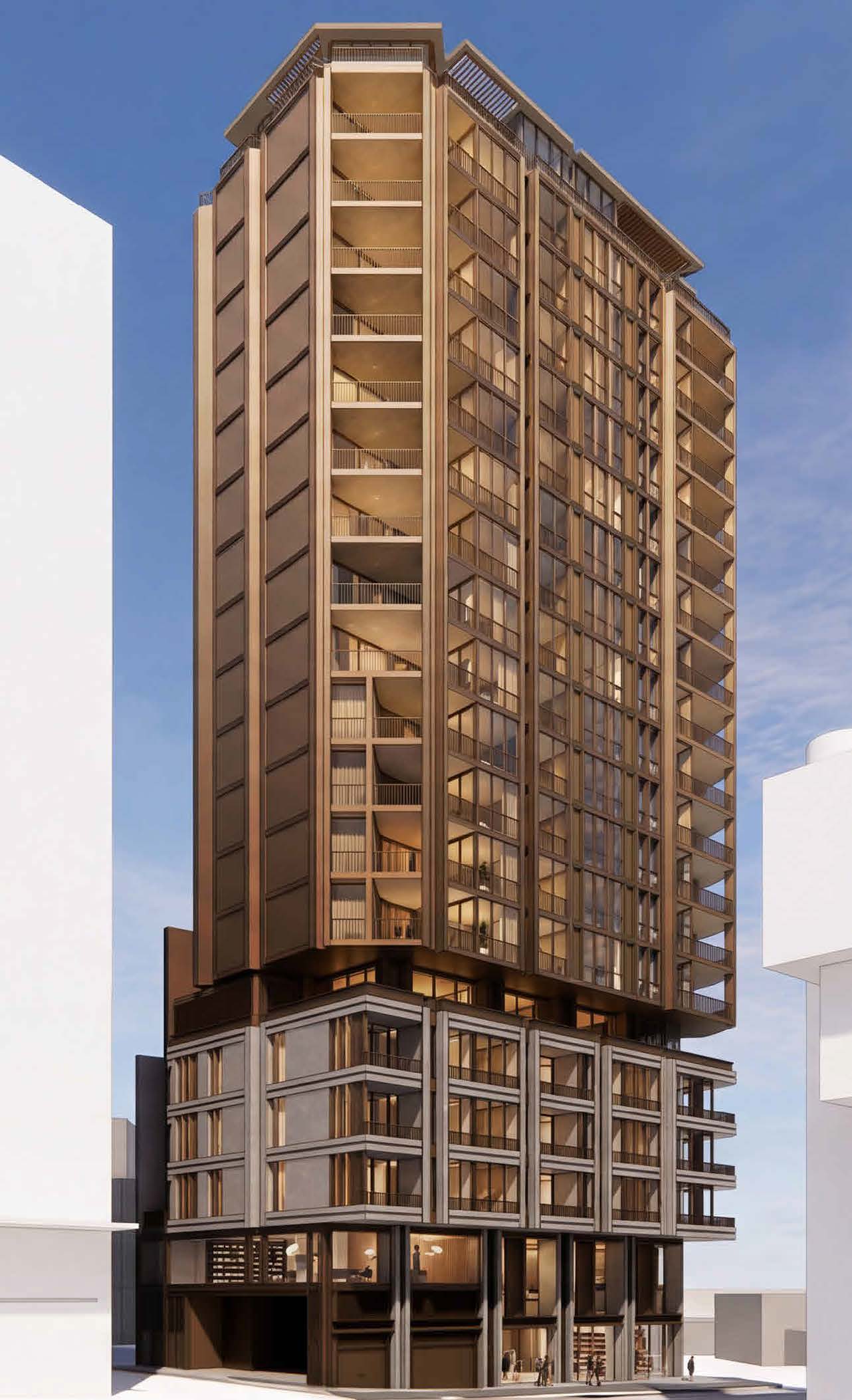
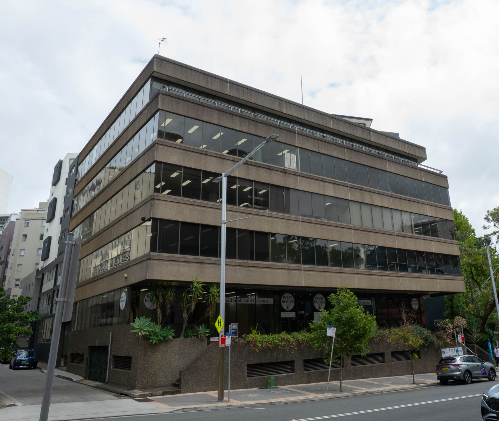
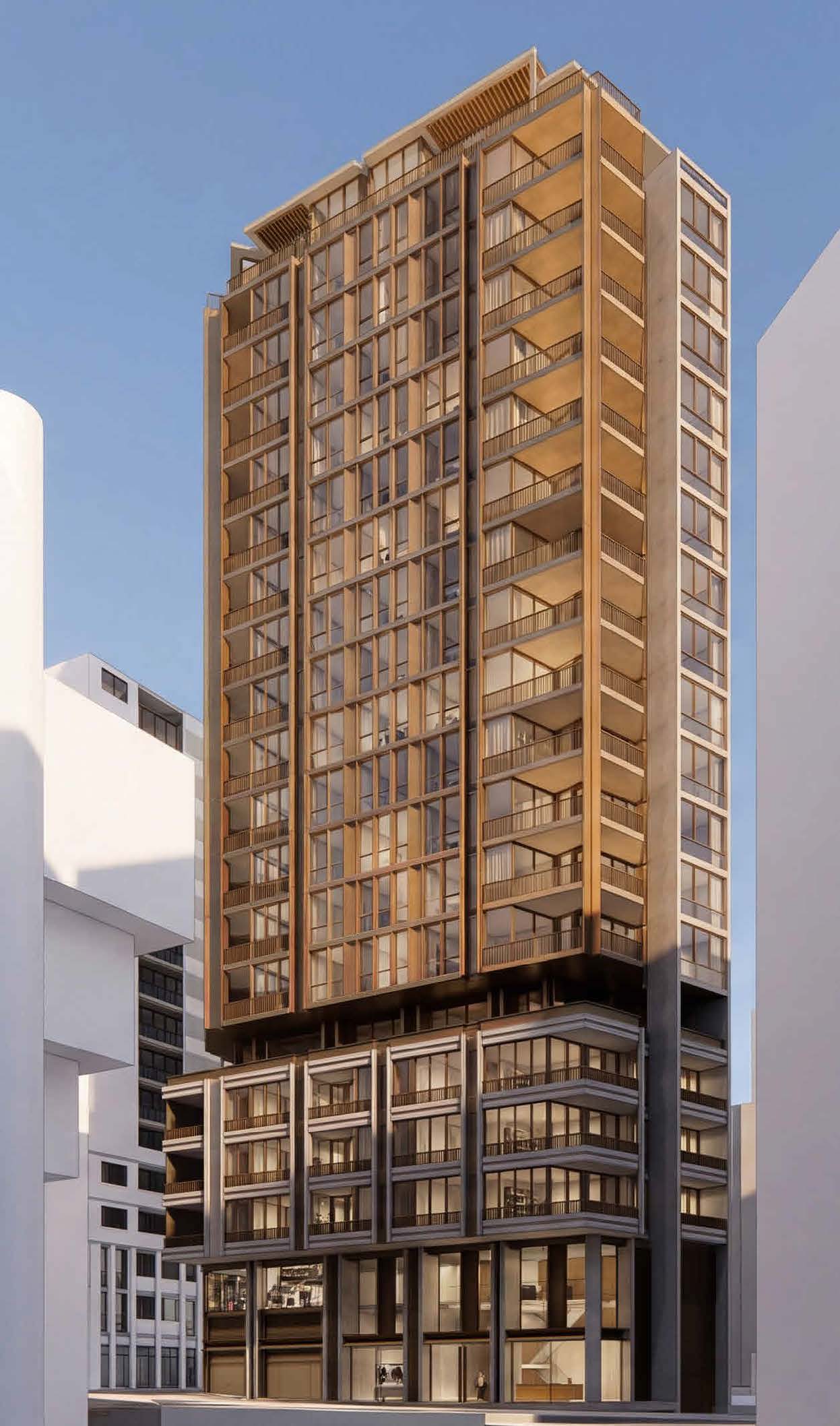
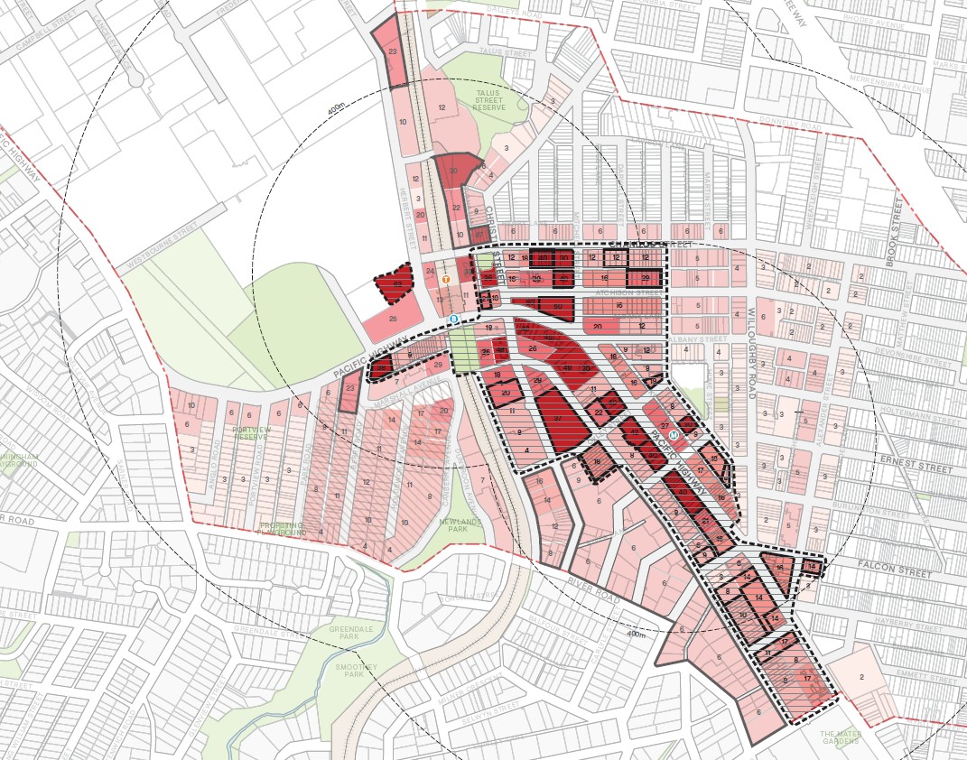
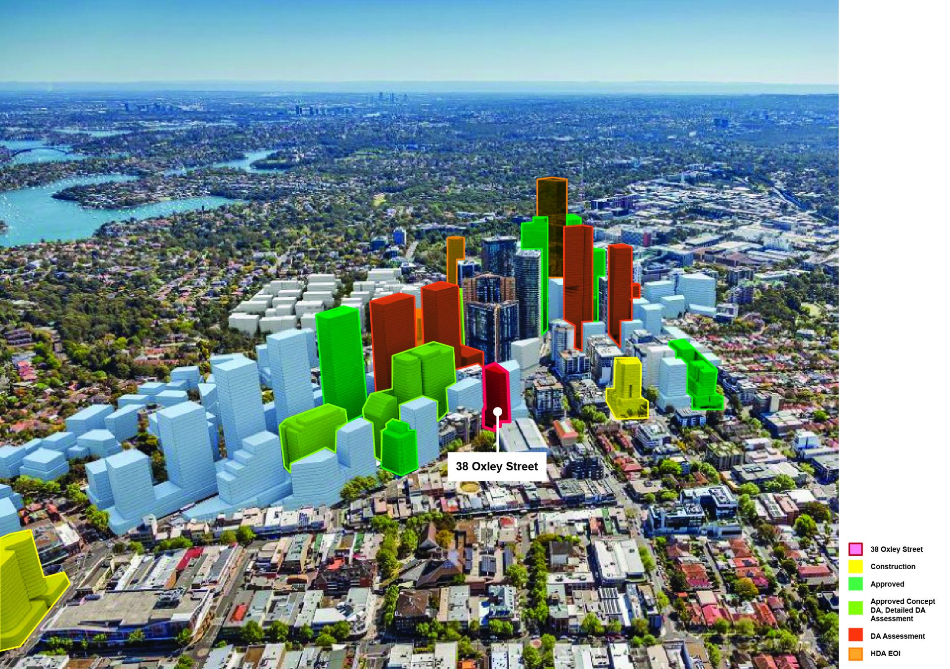
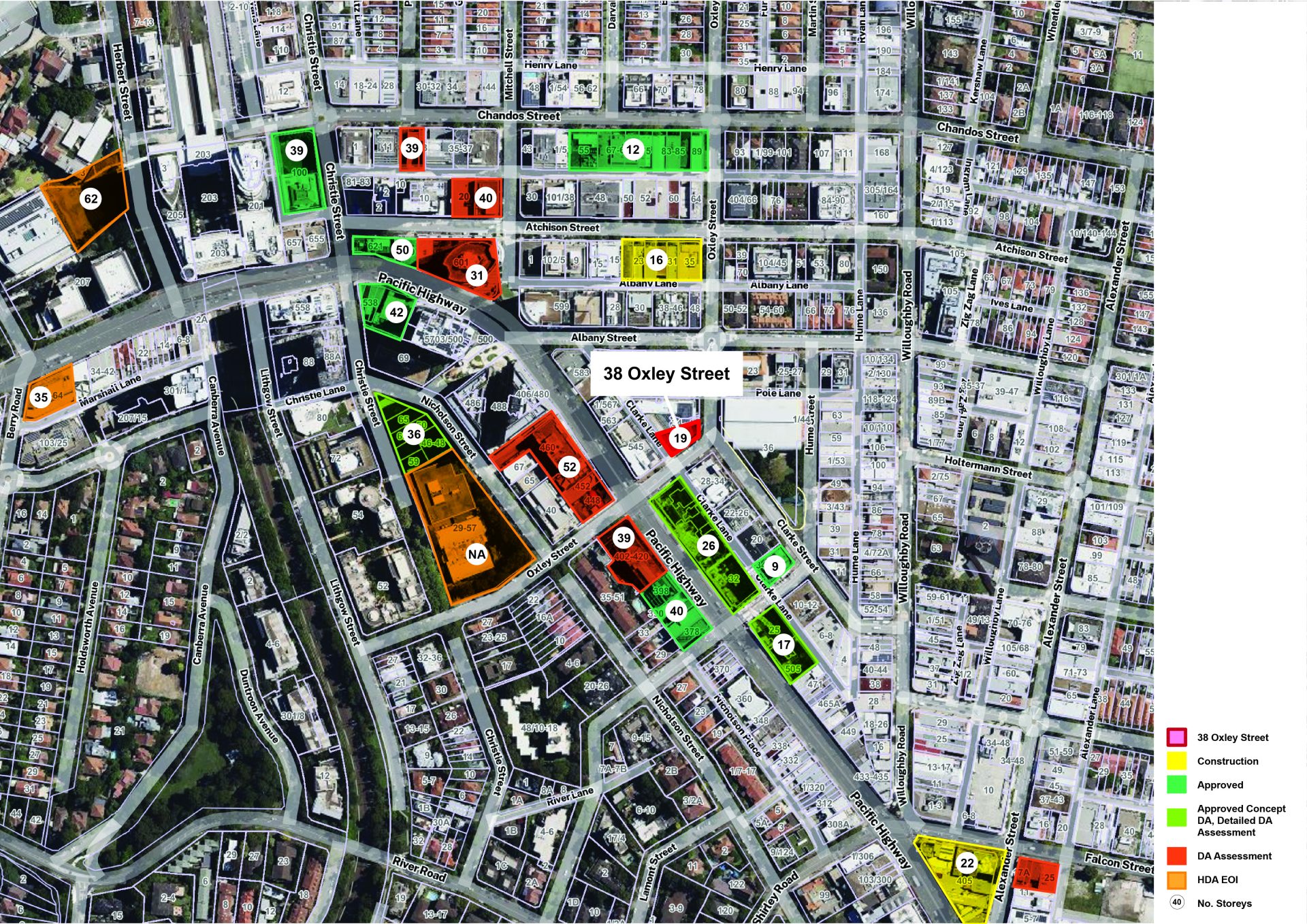
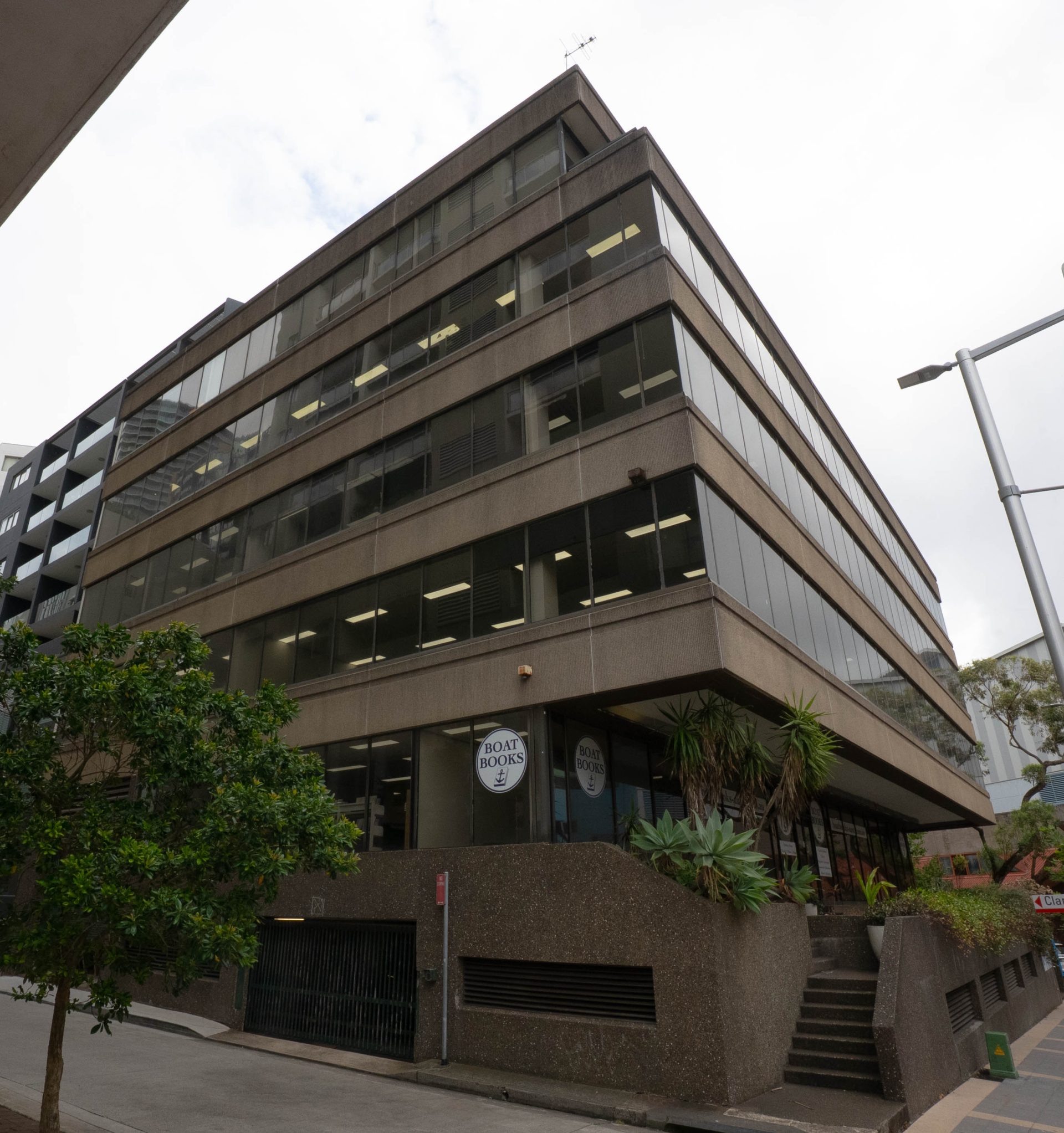
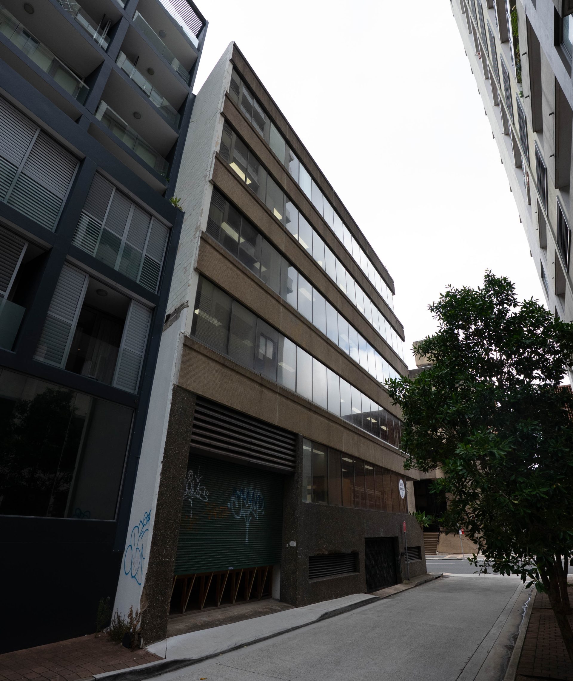
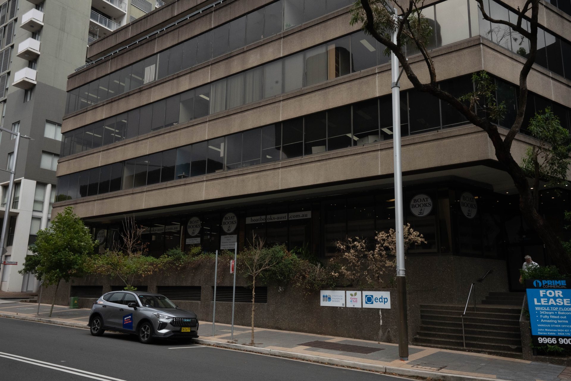
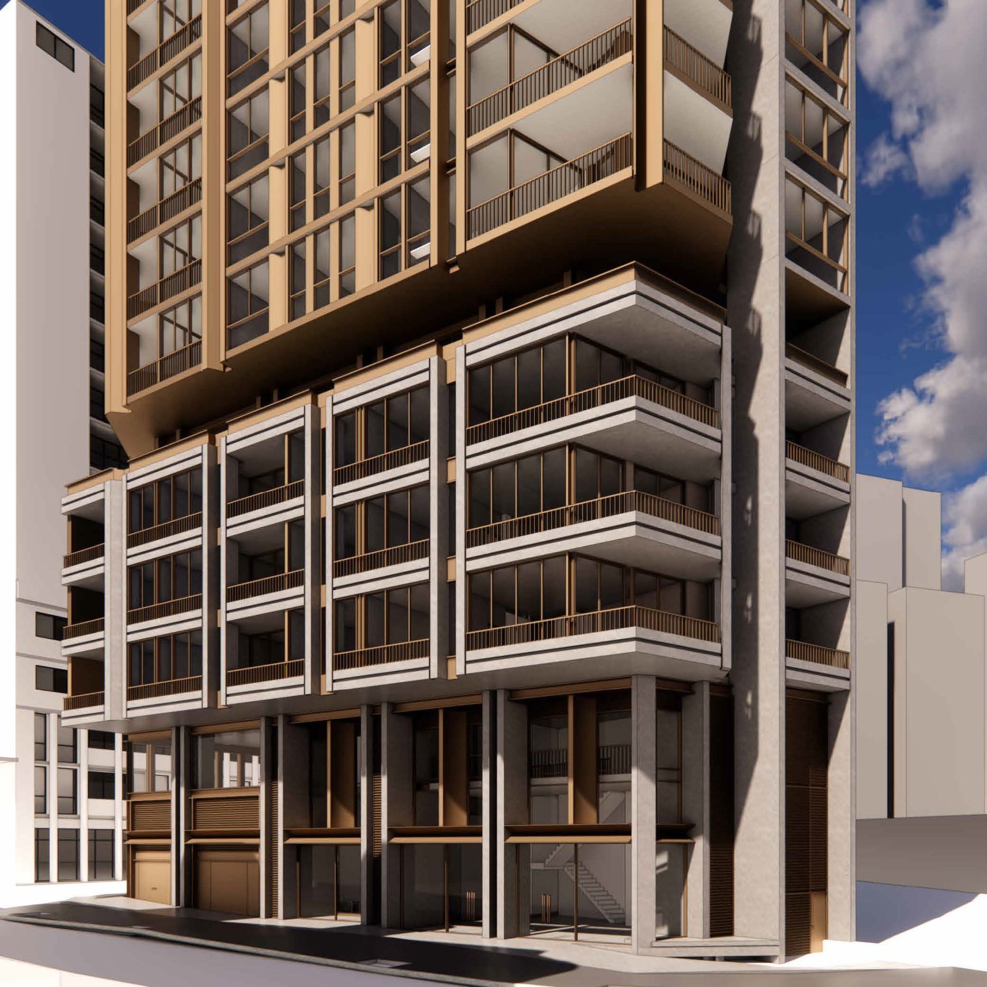
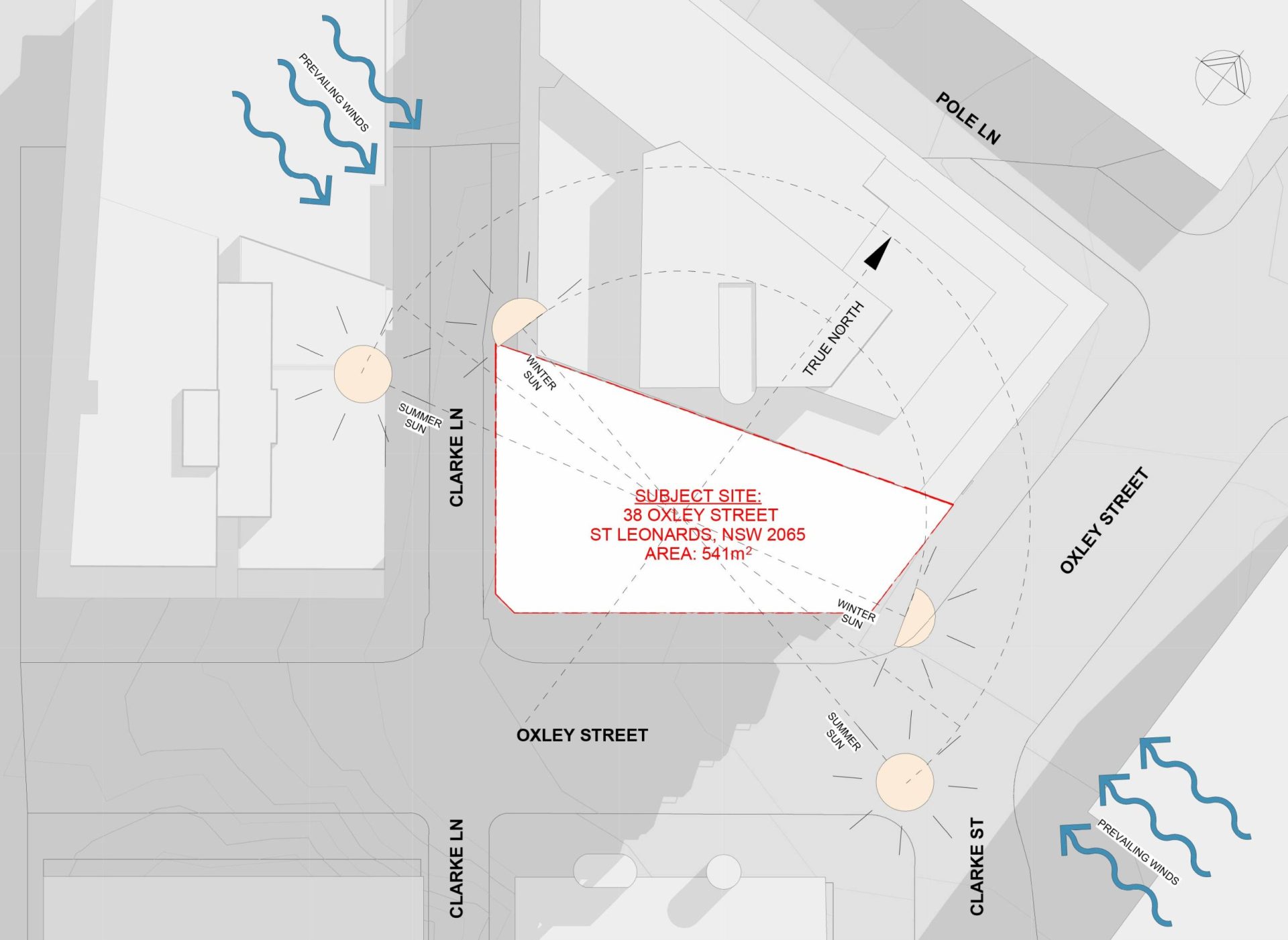
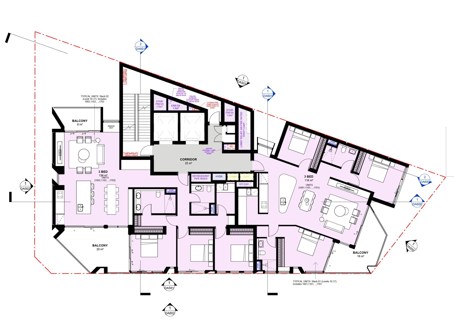
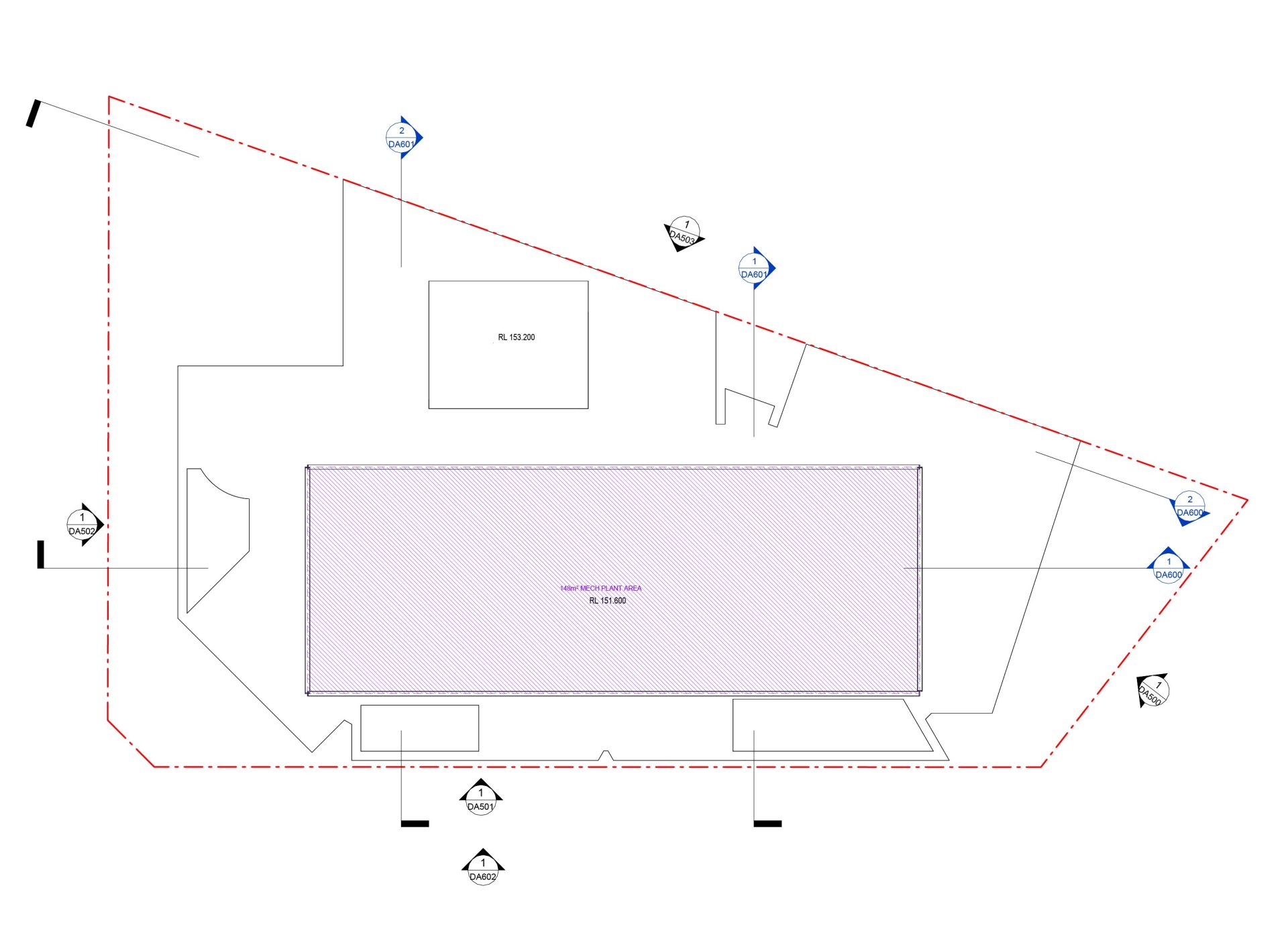
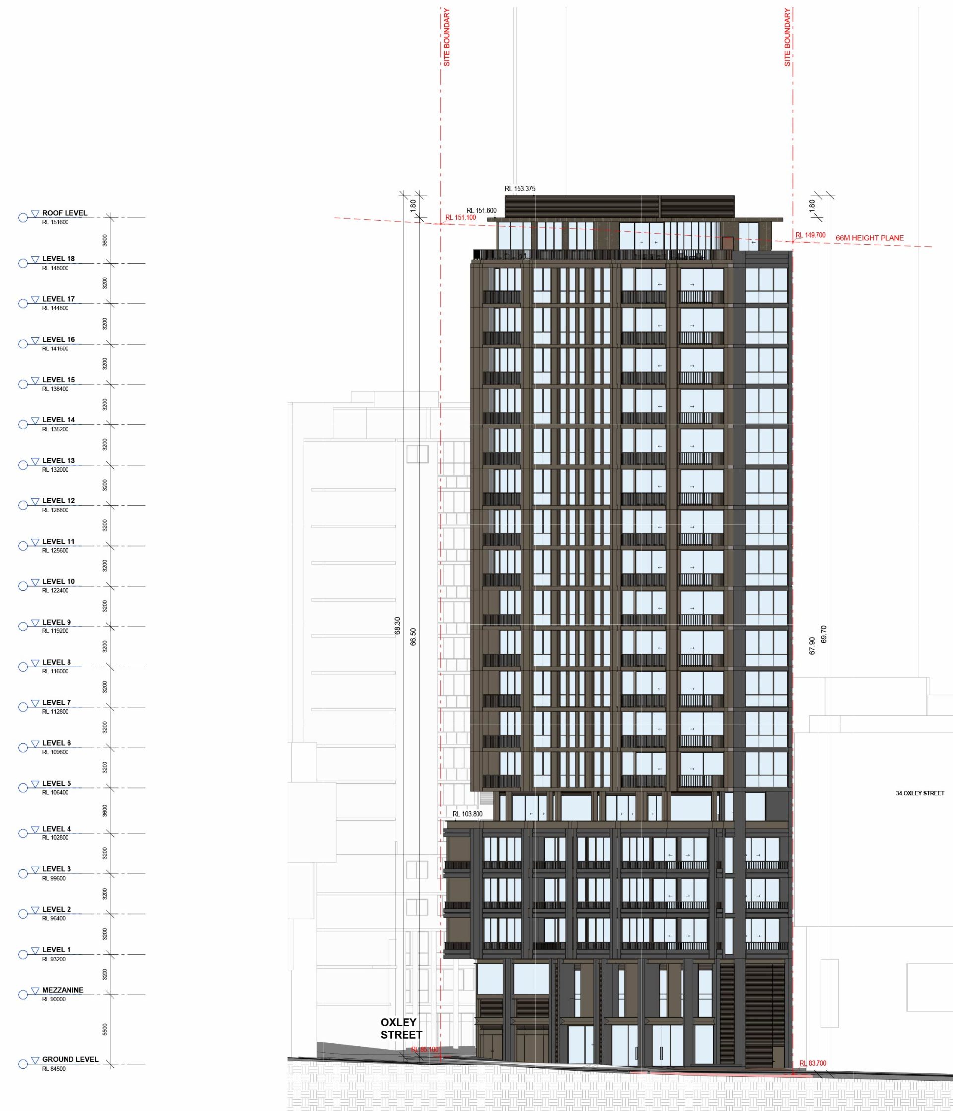
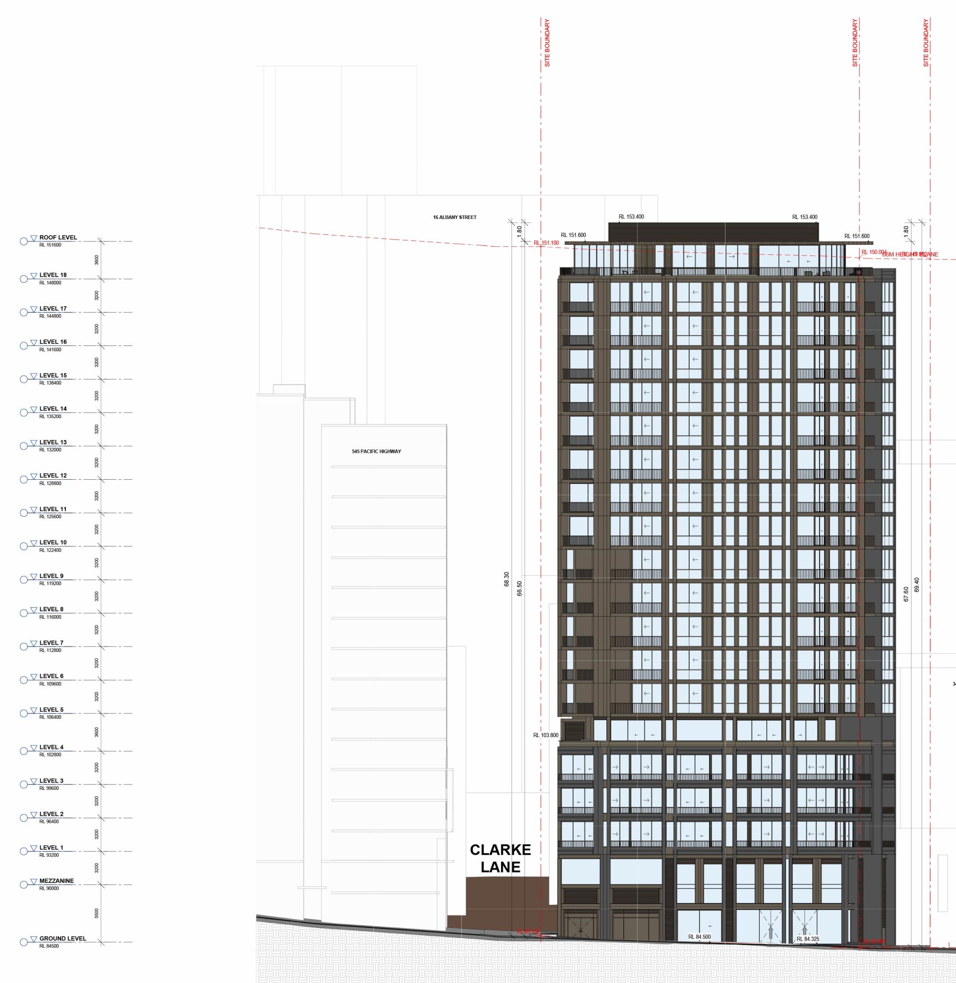
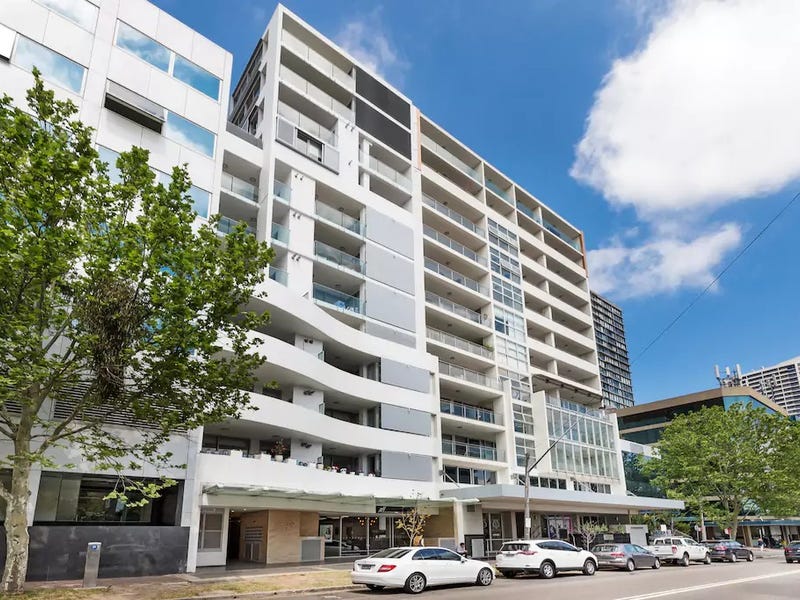
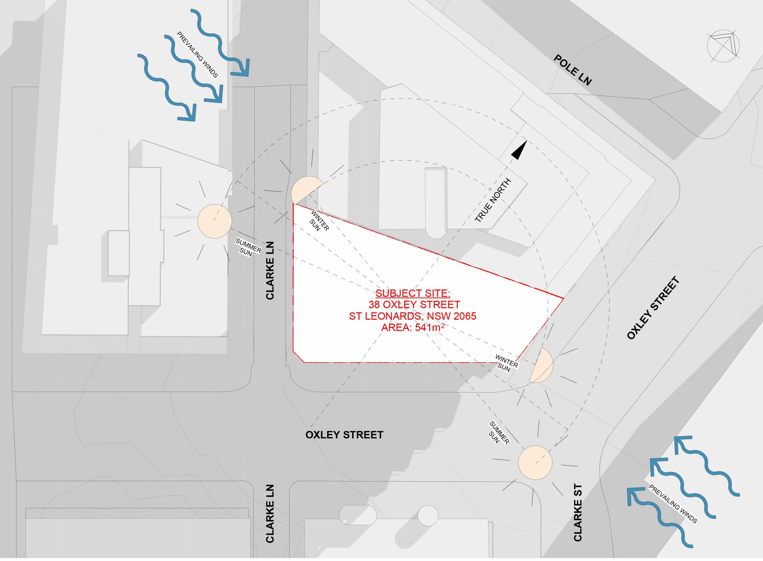
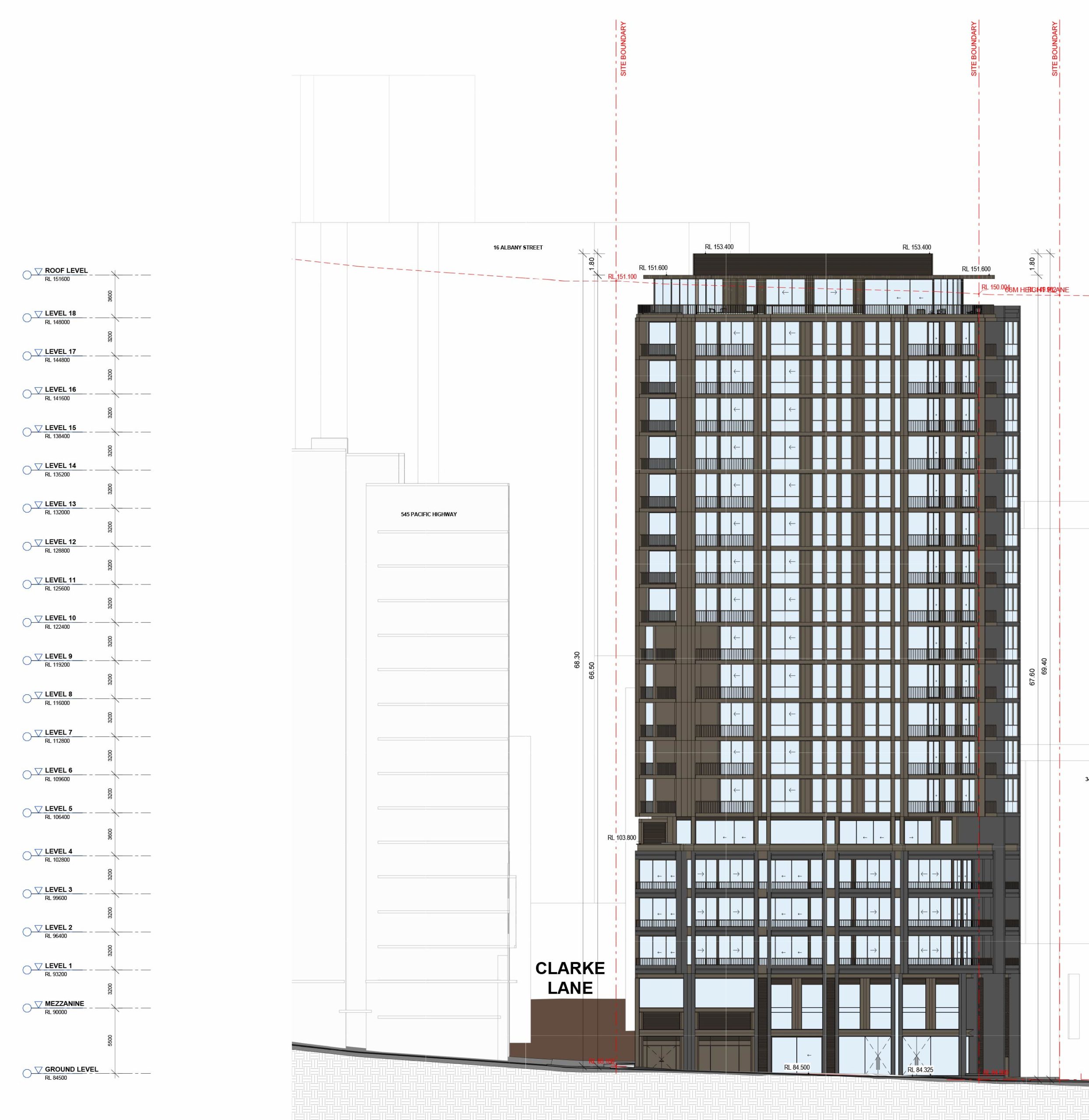
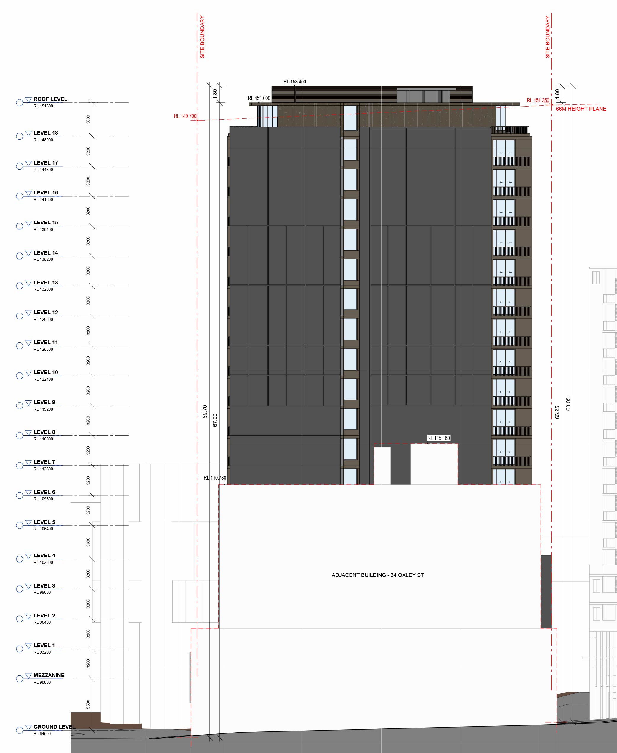
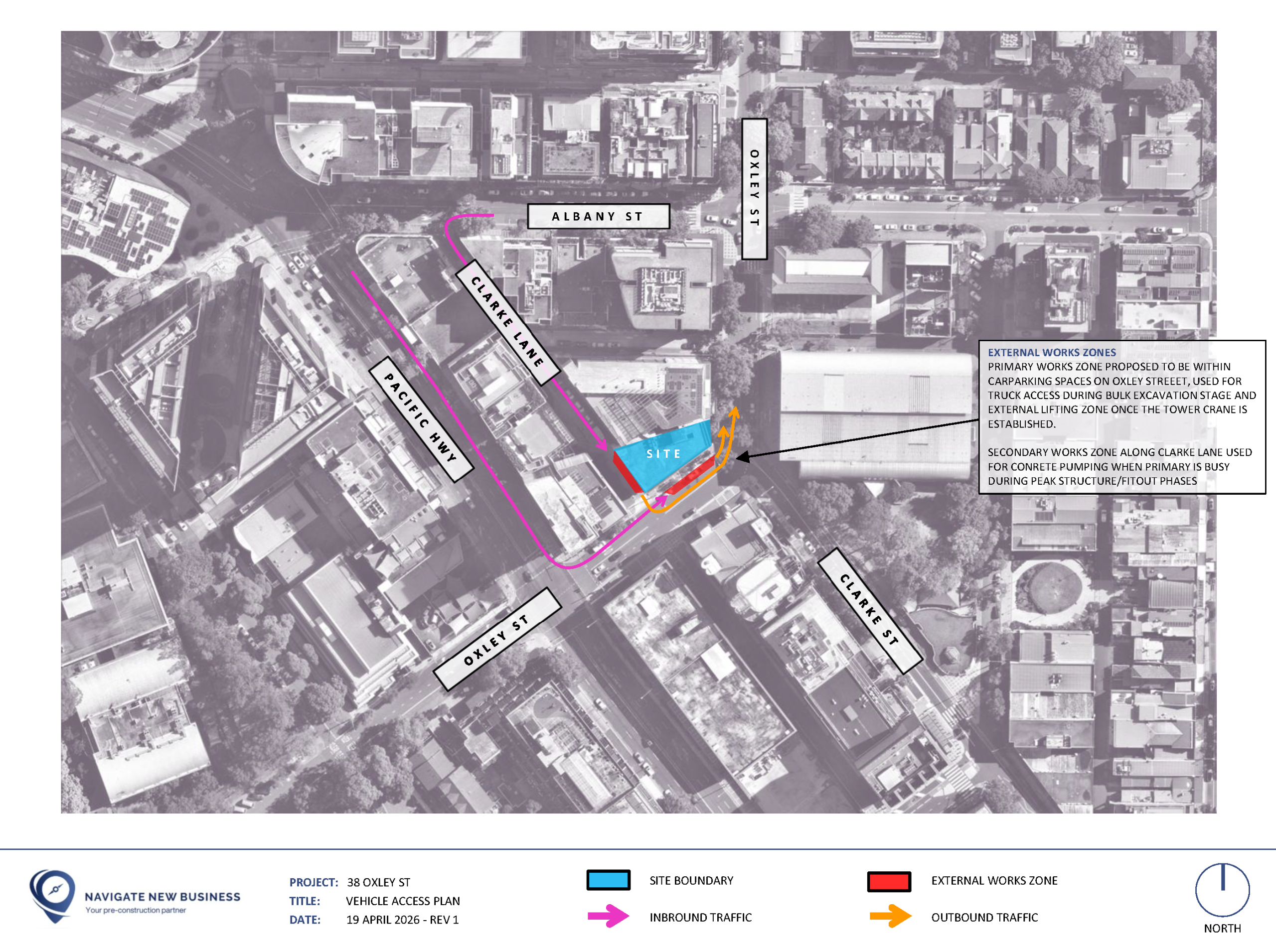
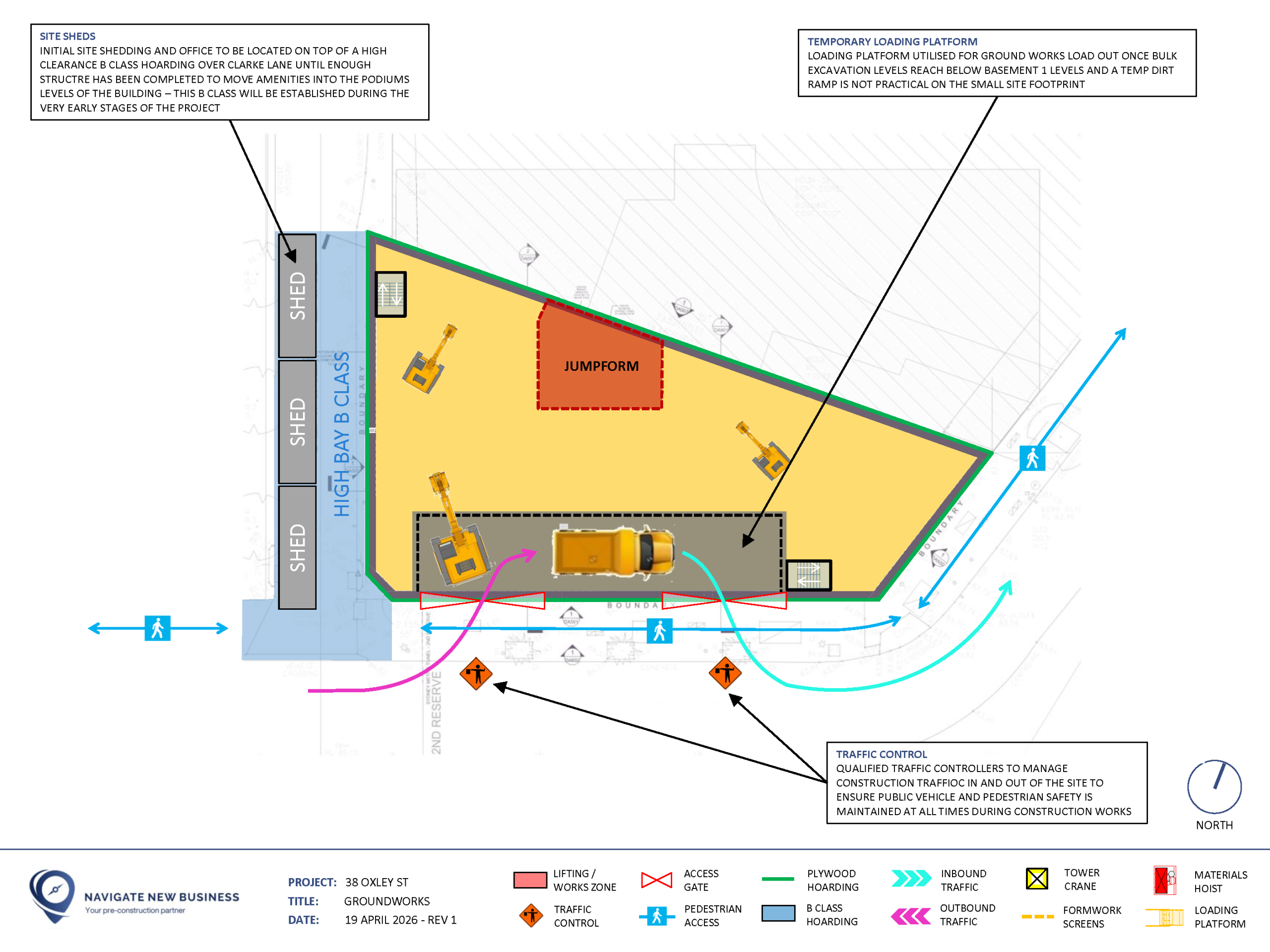
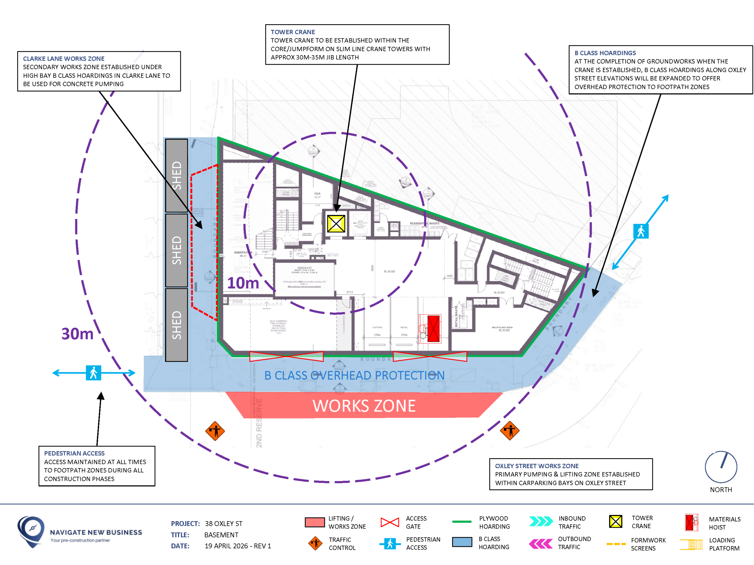
38 Oxley Street, St Leonards
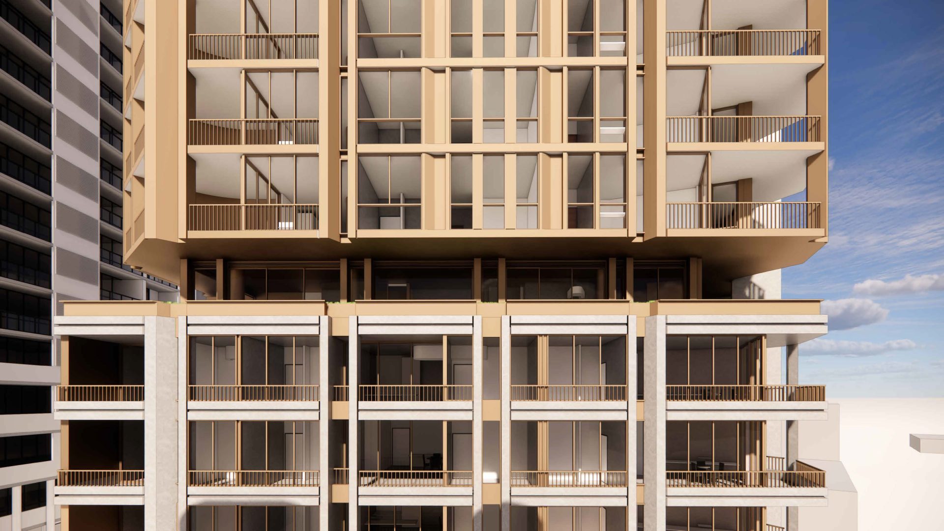
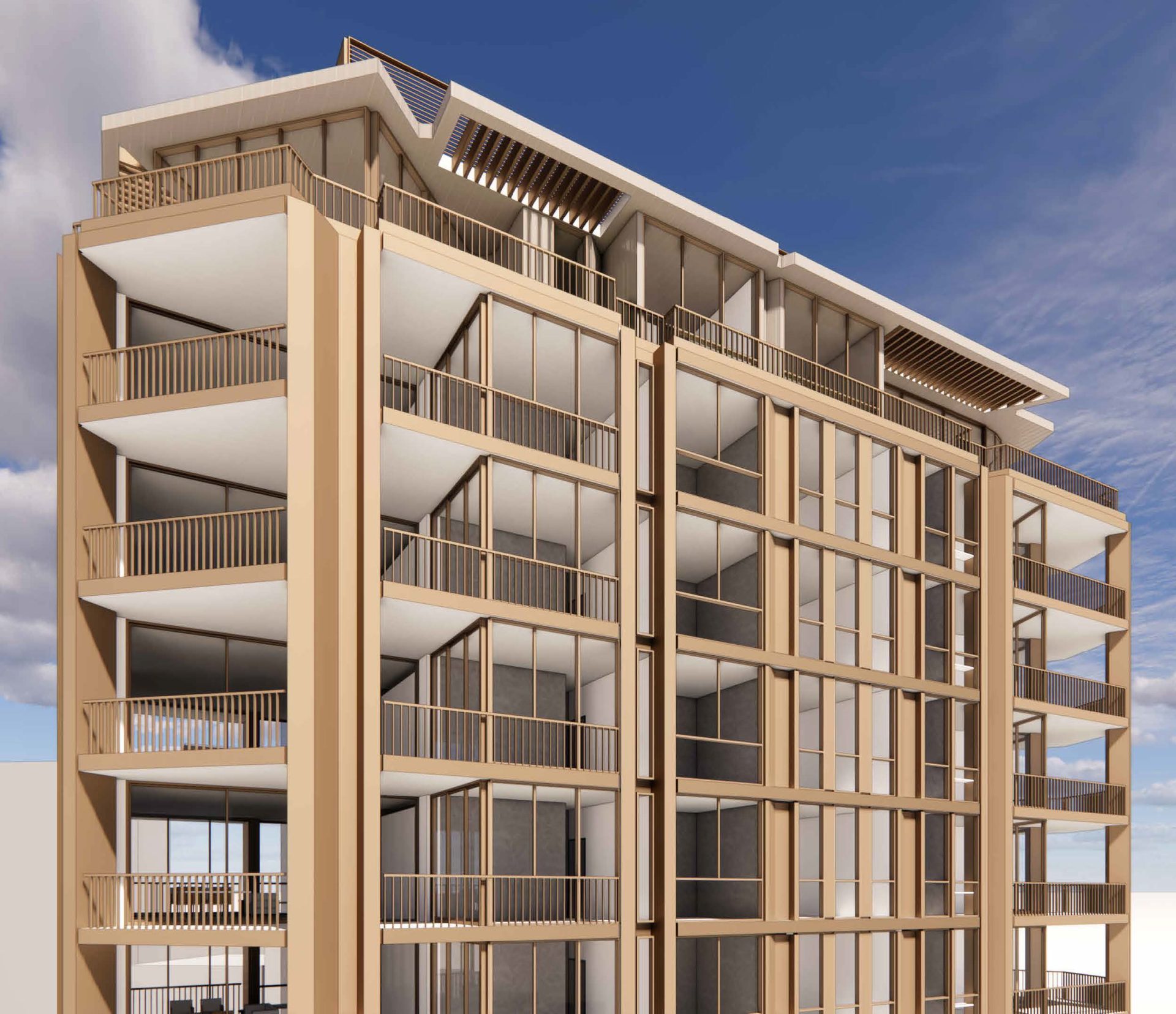
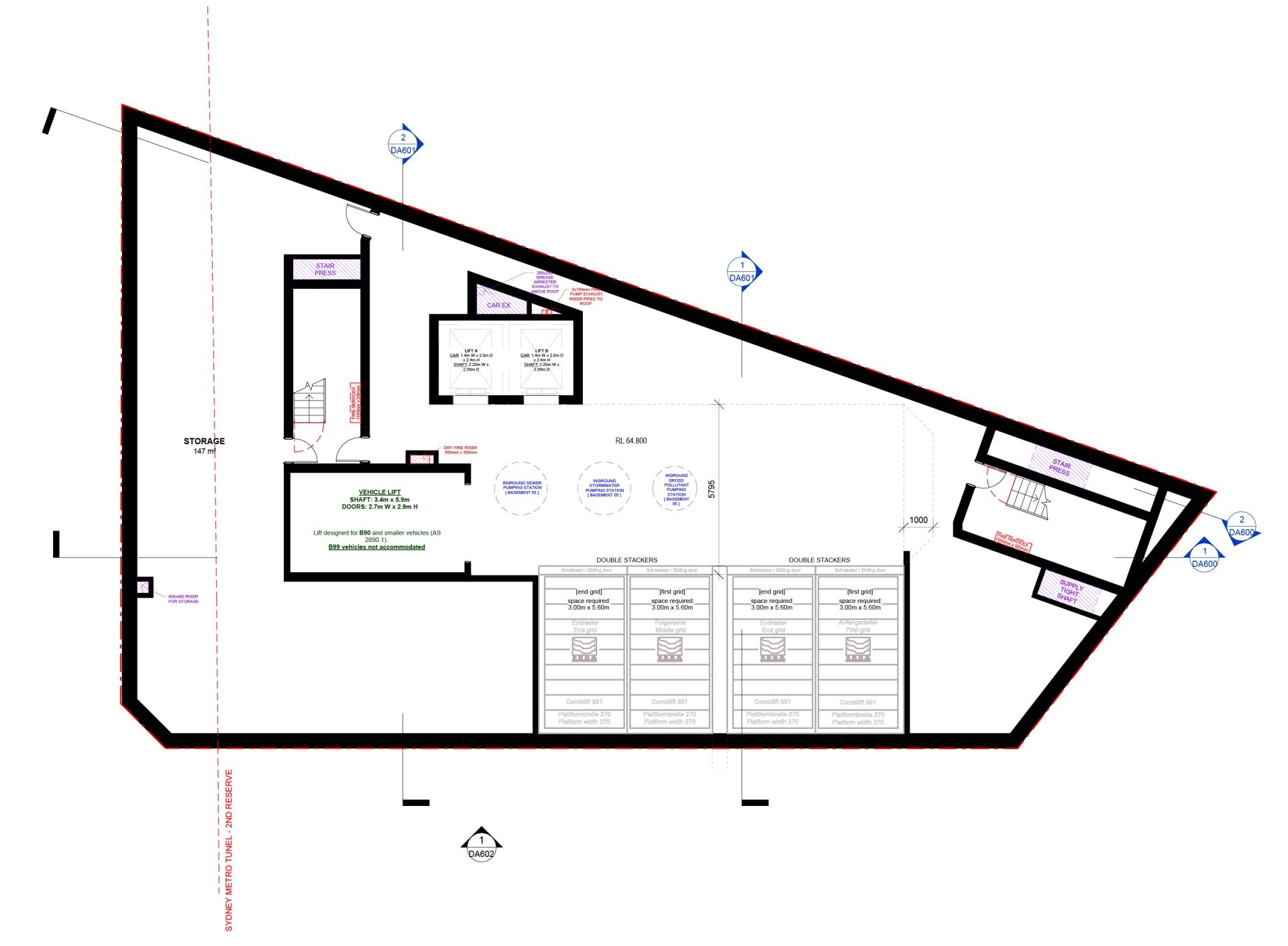
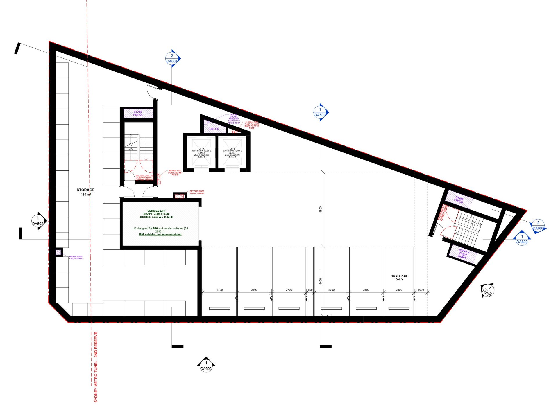
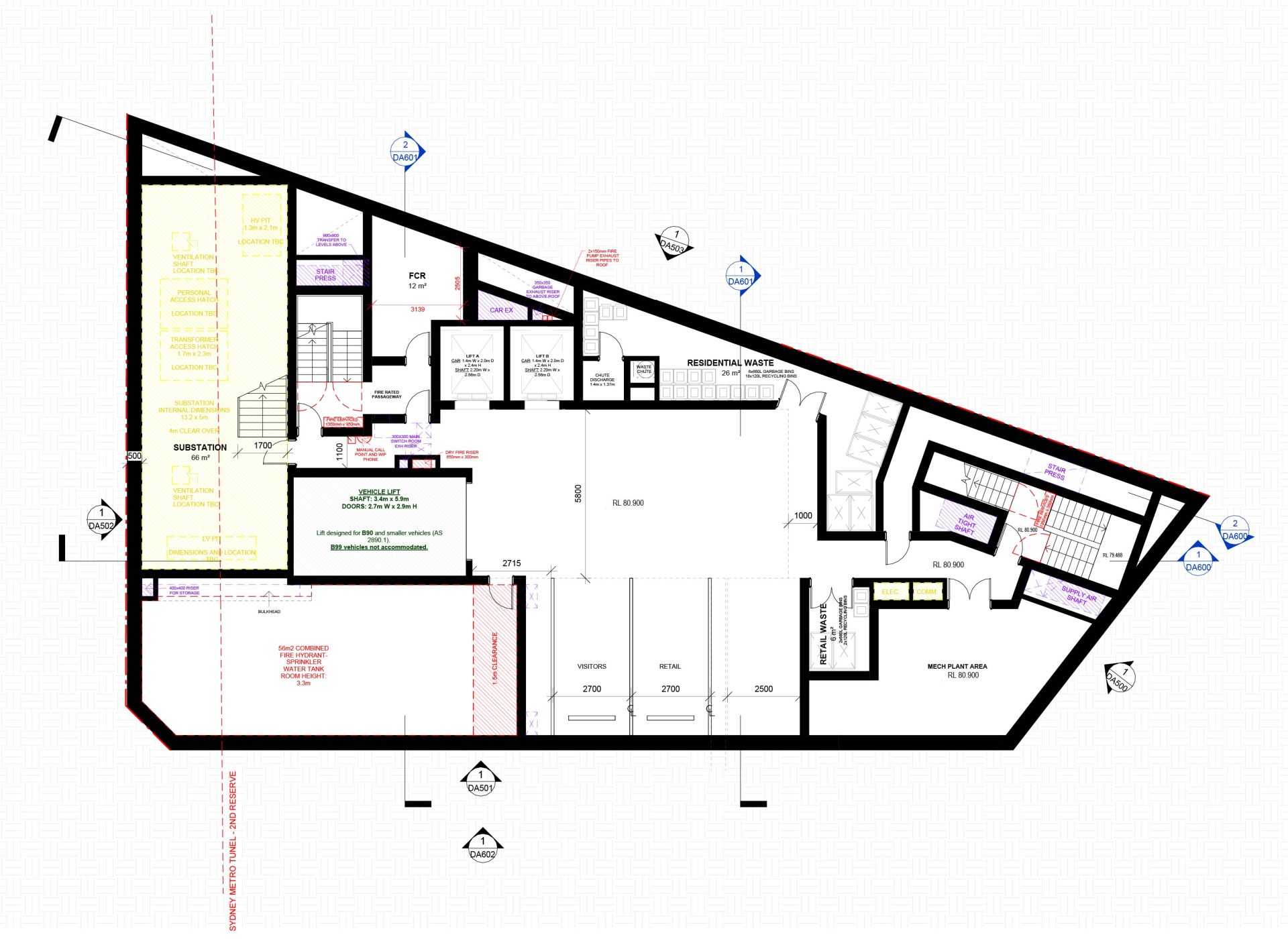
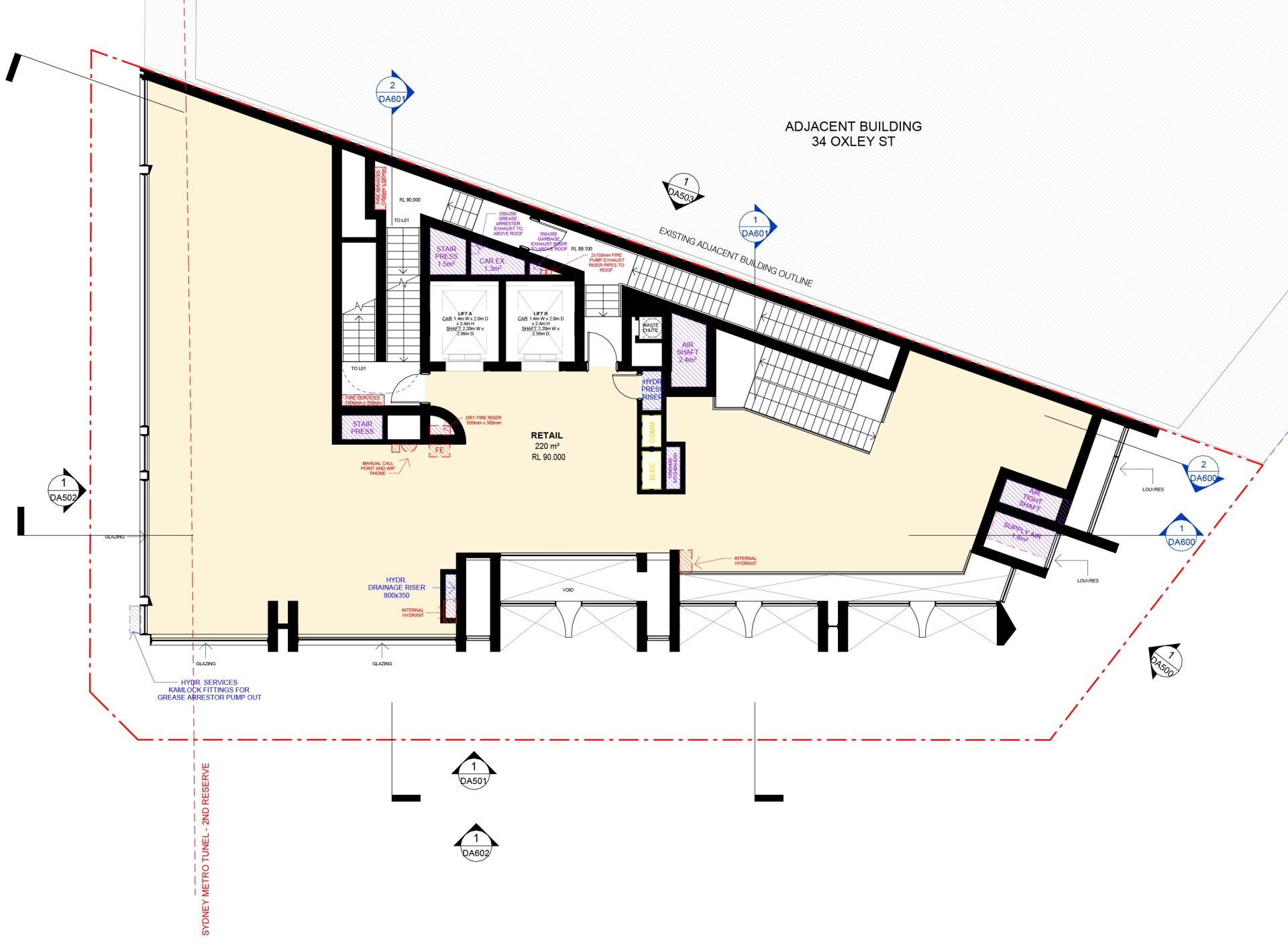
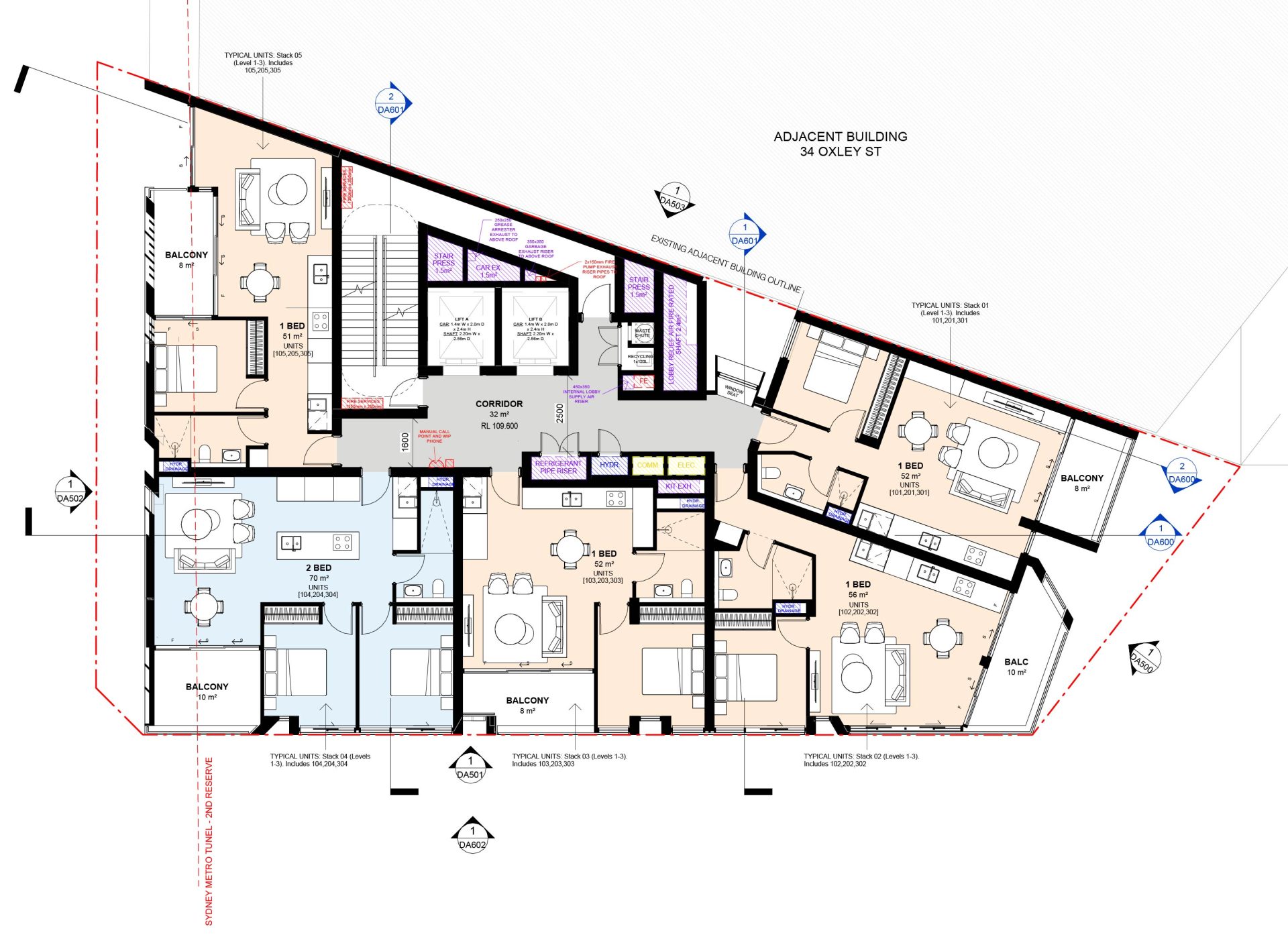
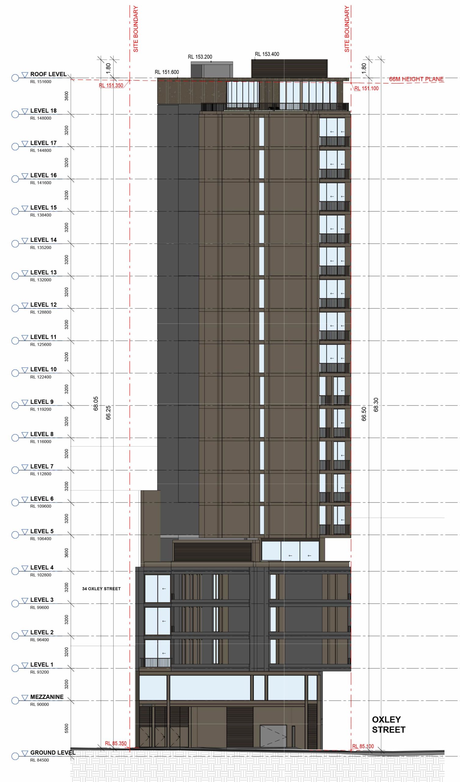
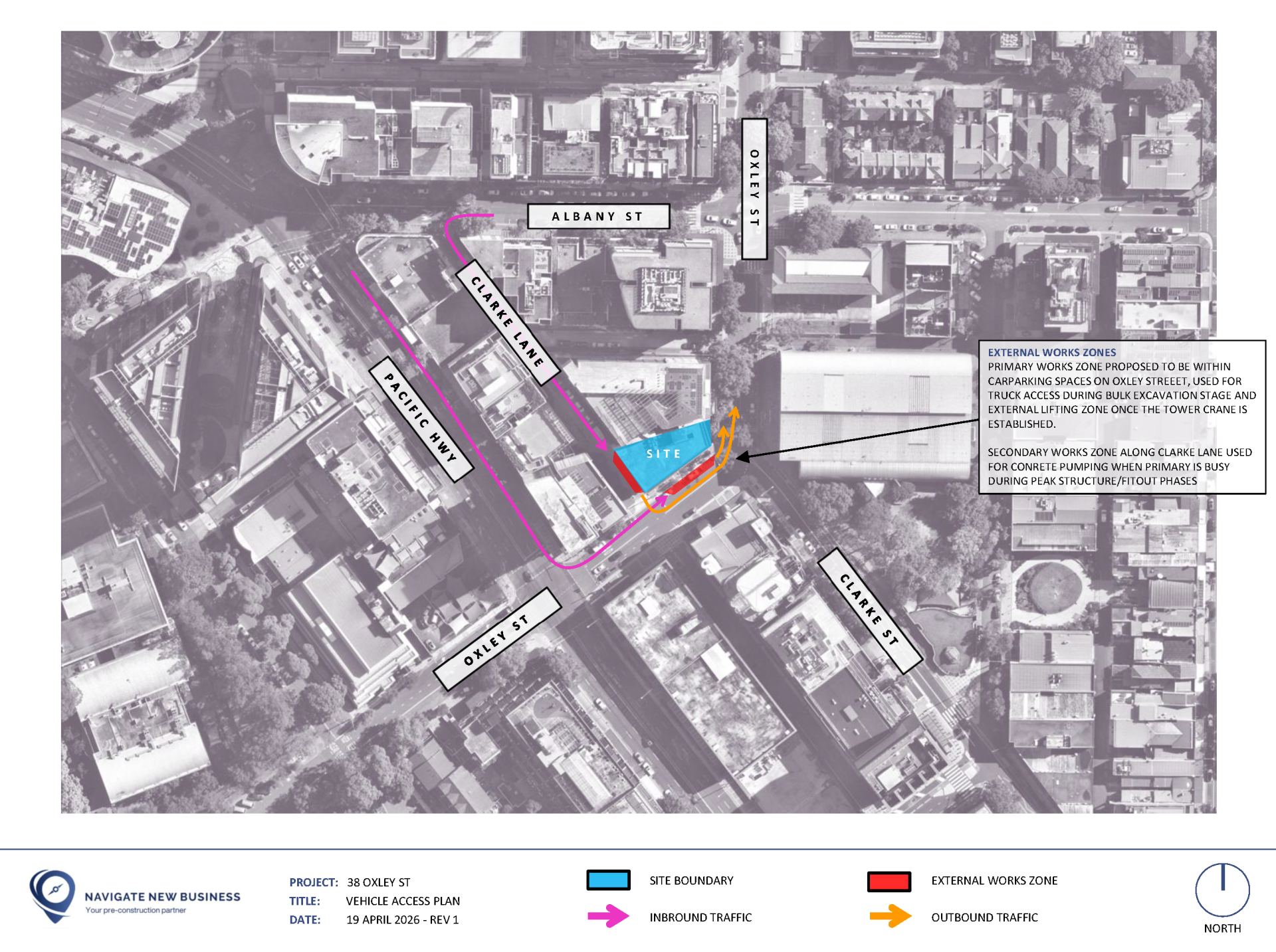
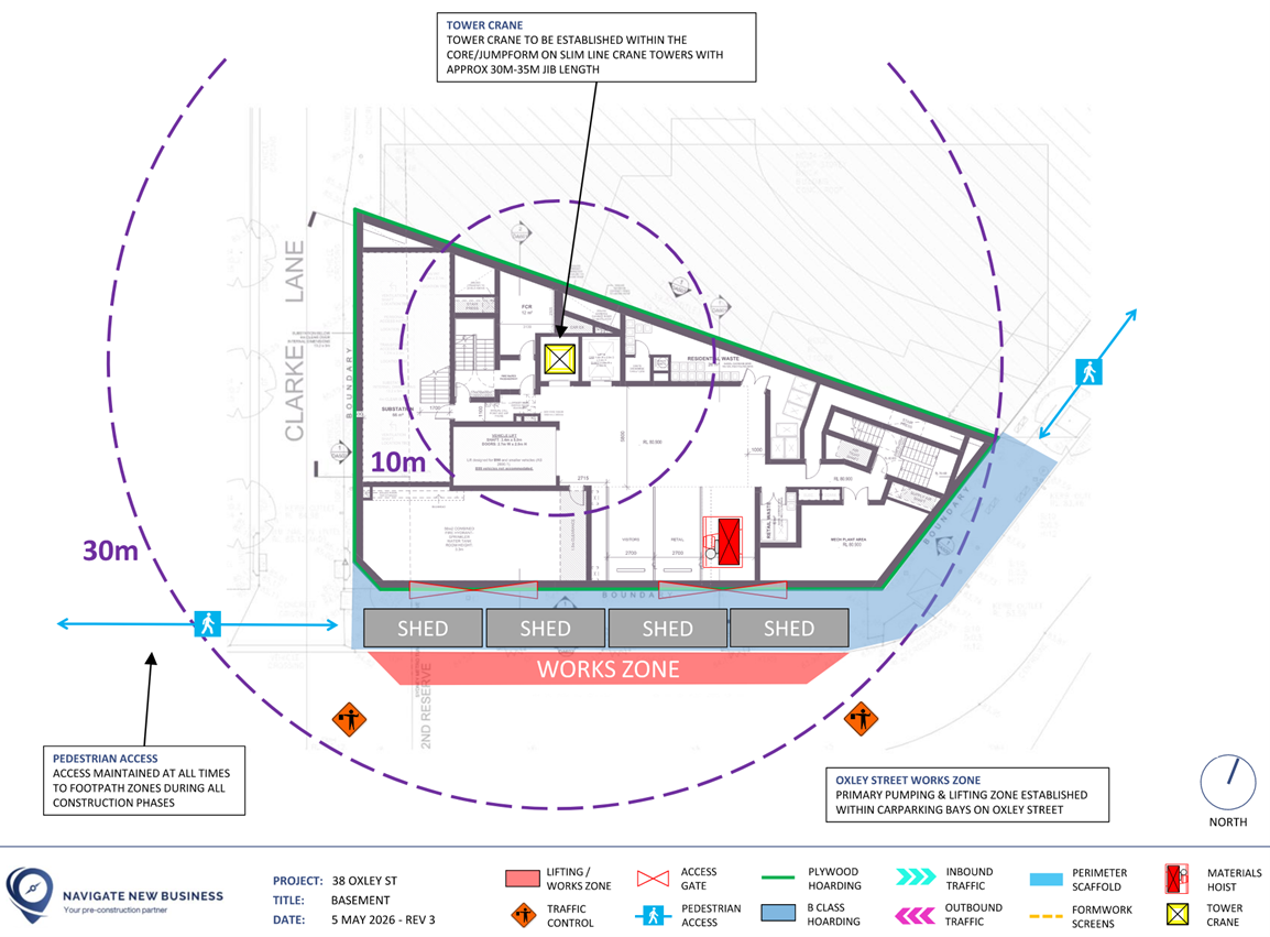
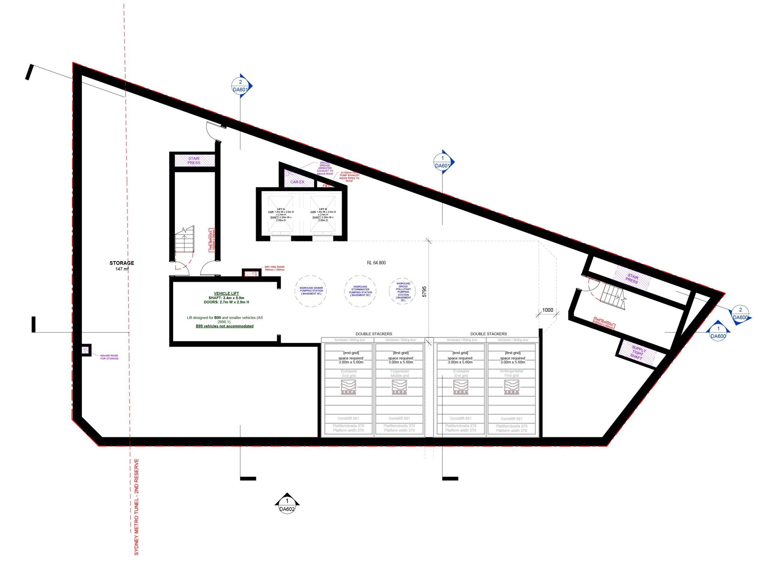
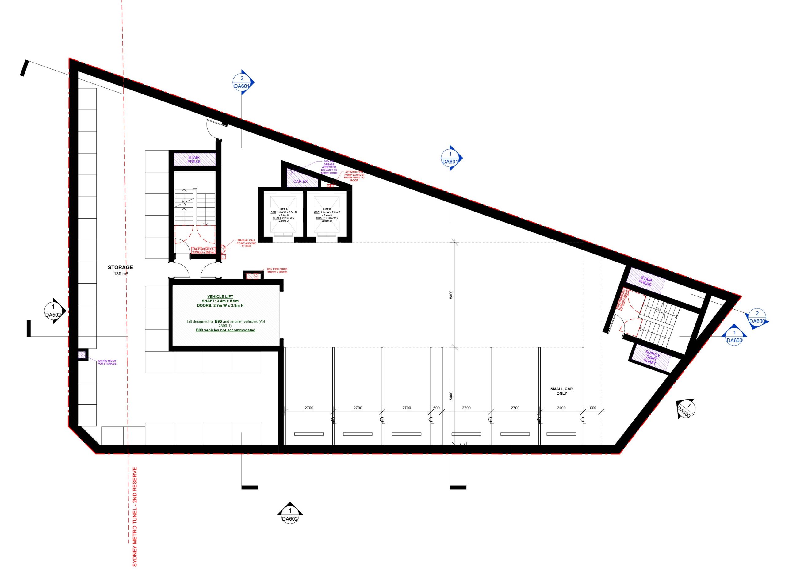
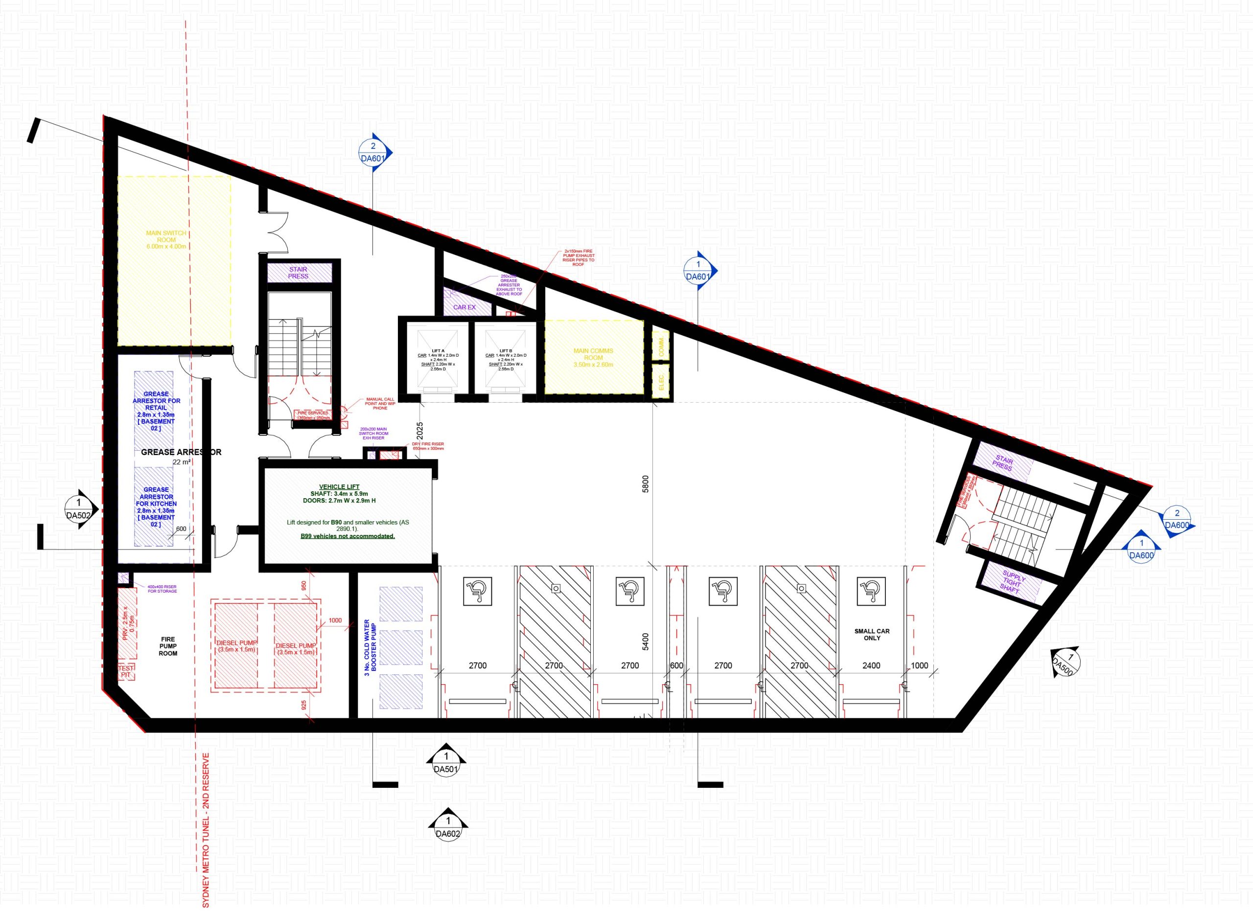
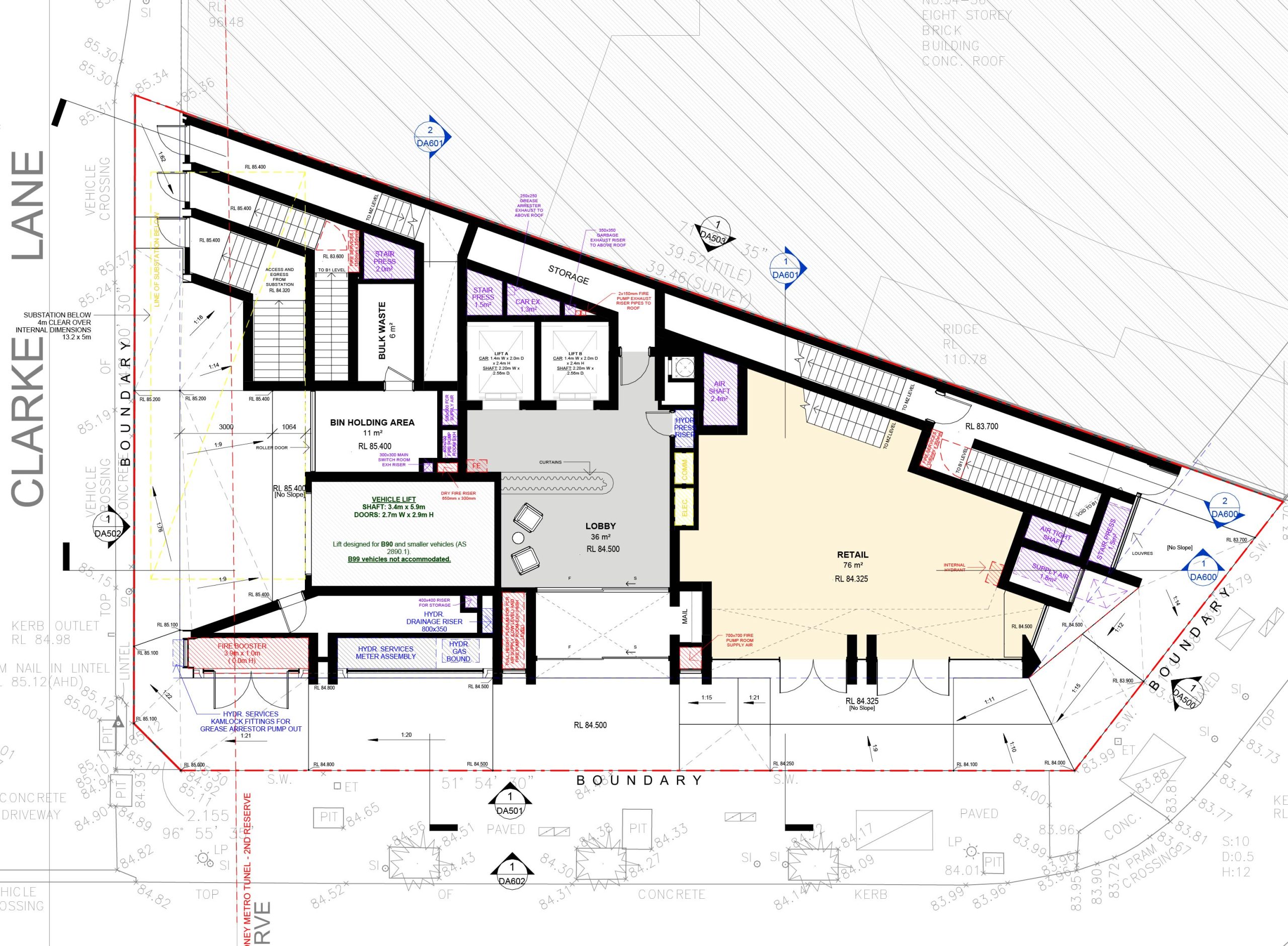
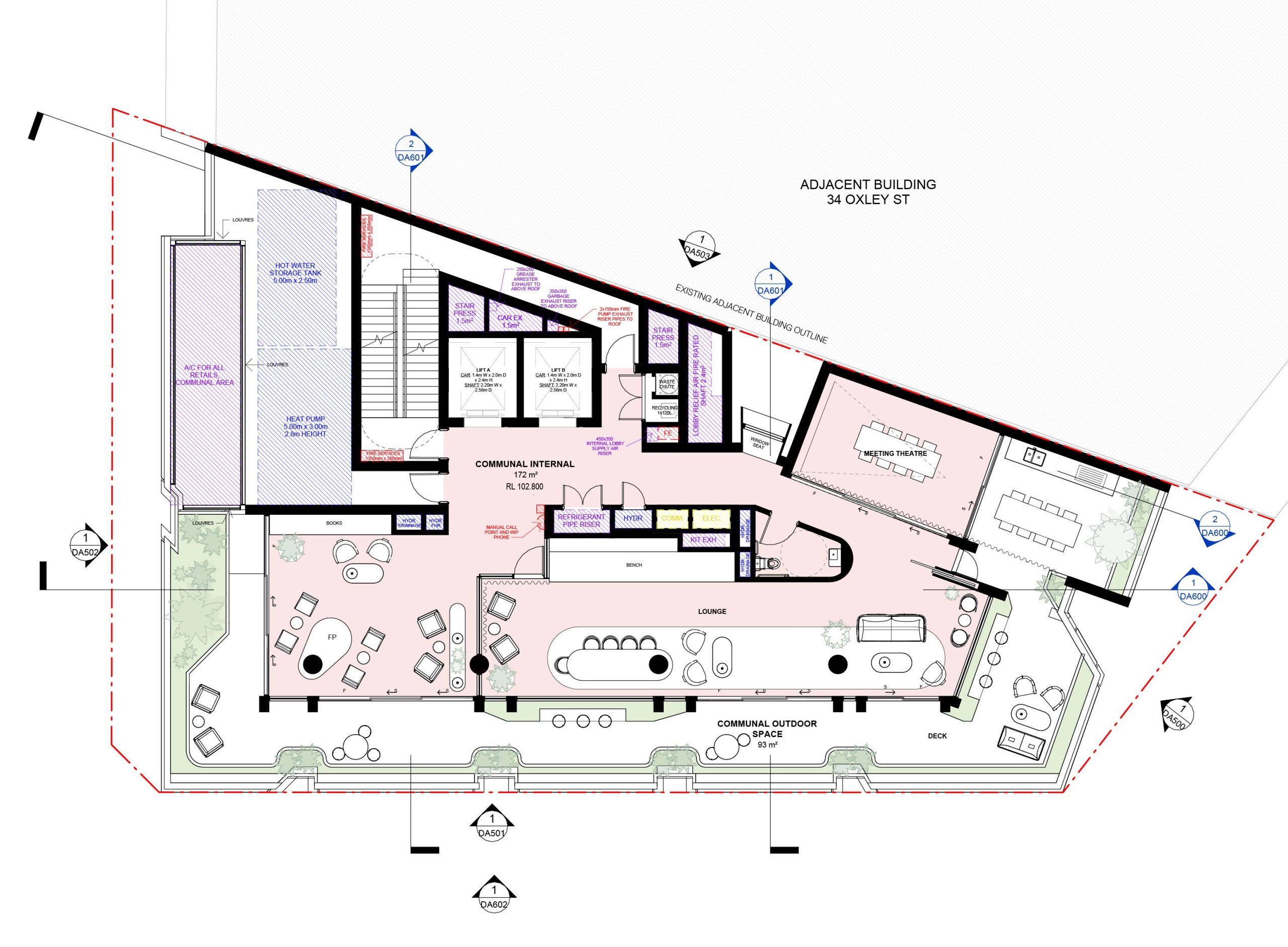
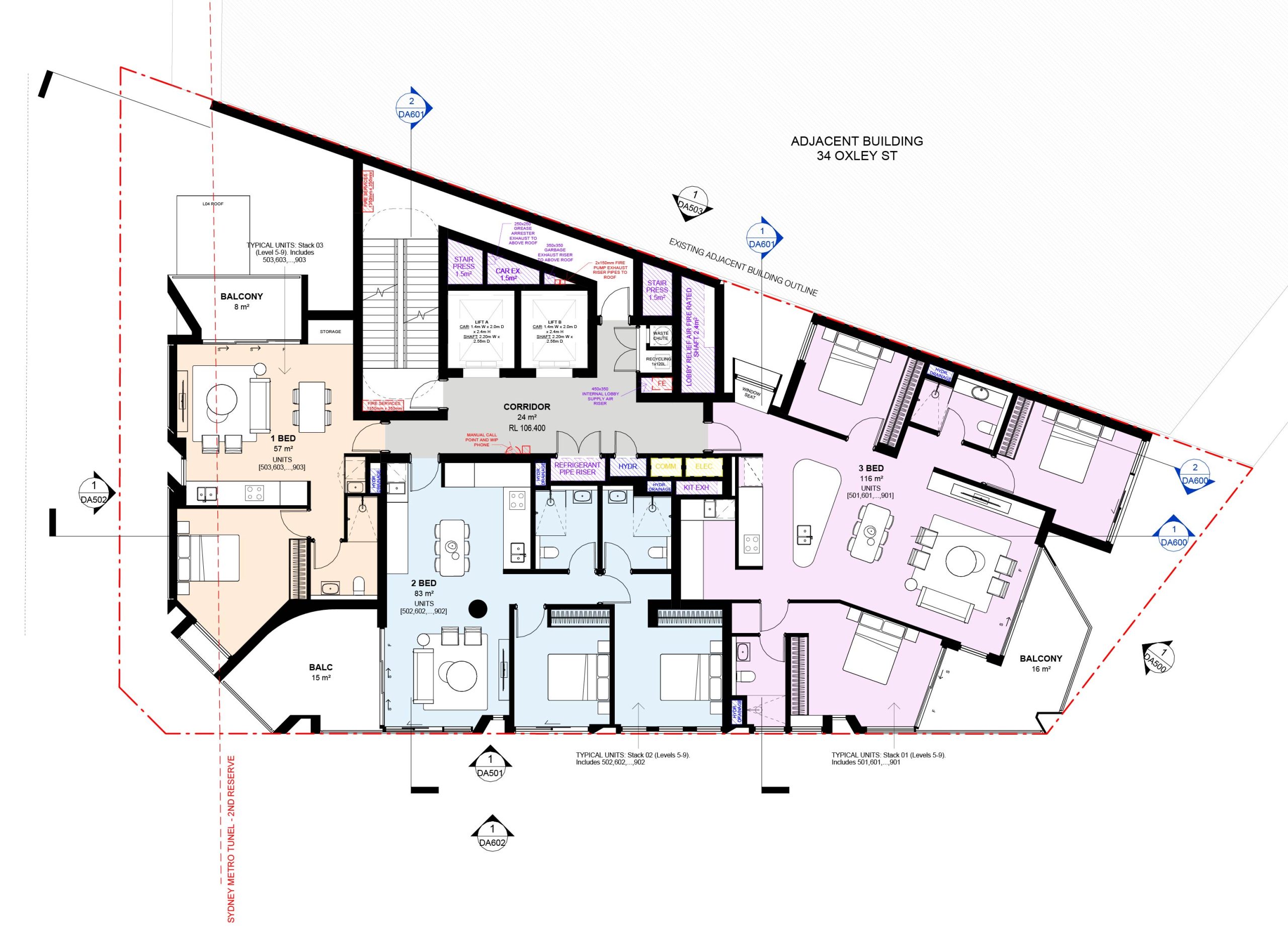
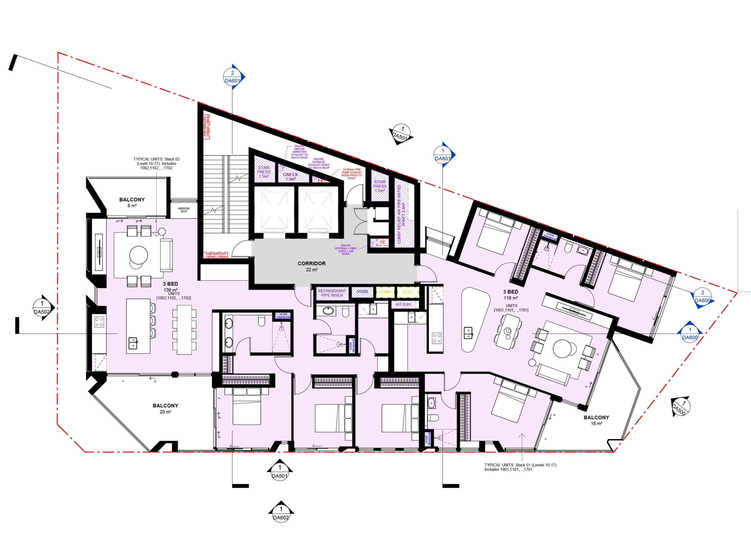
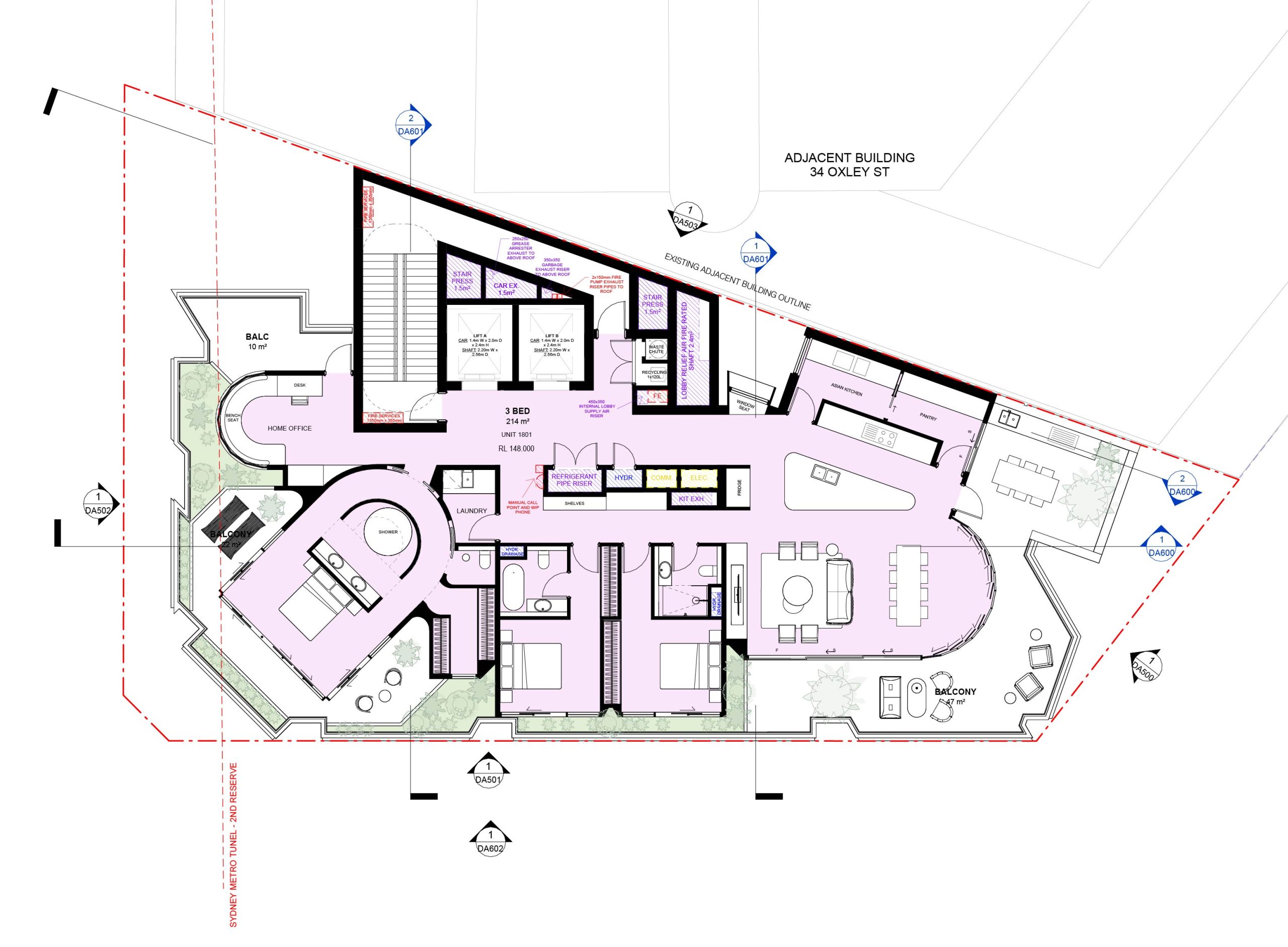
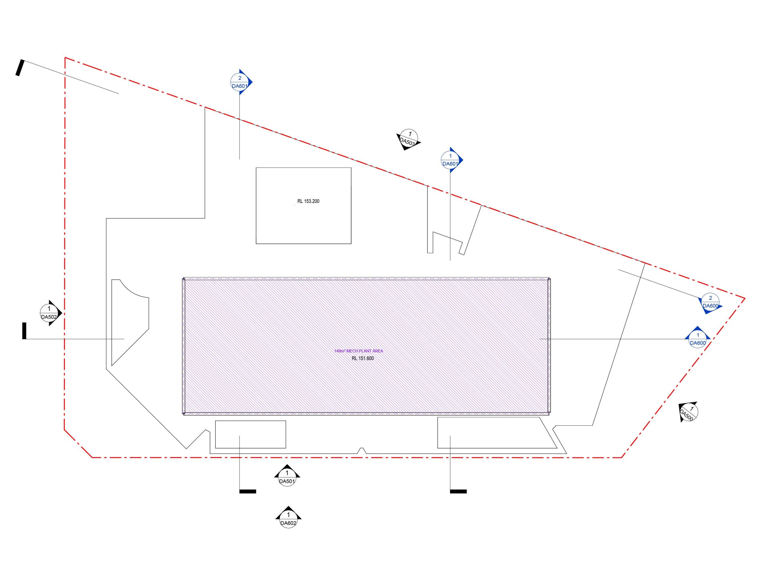
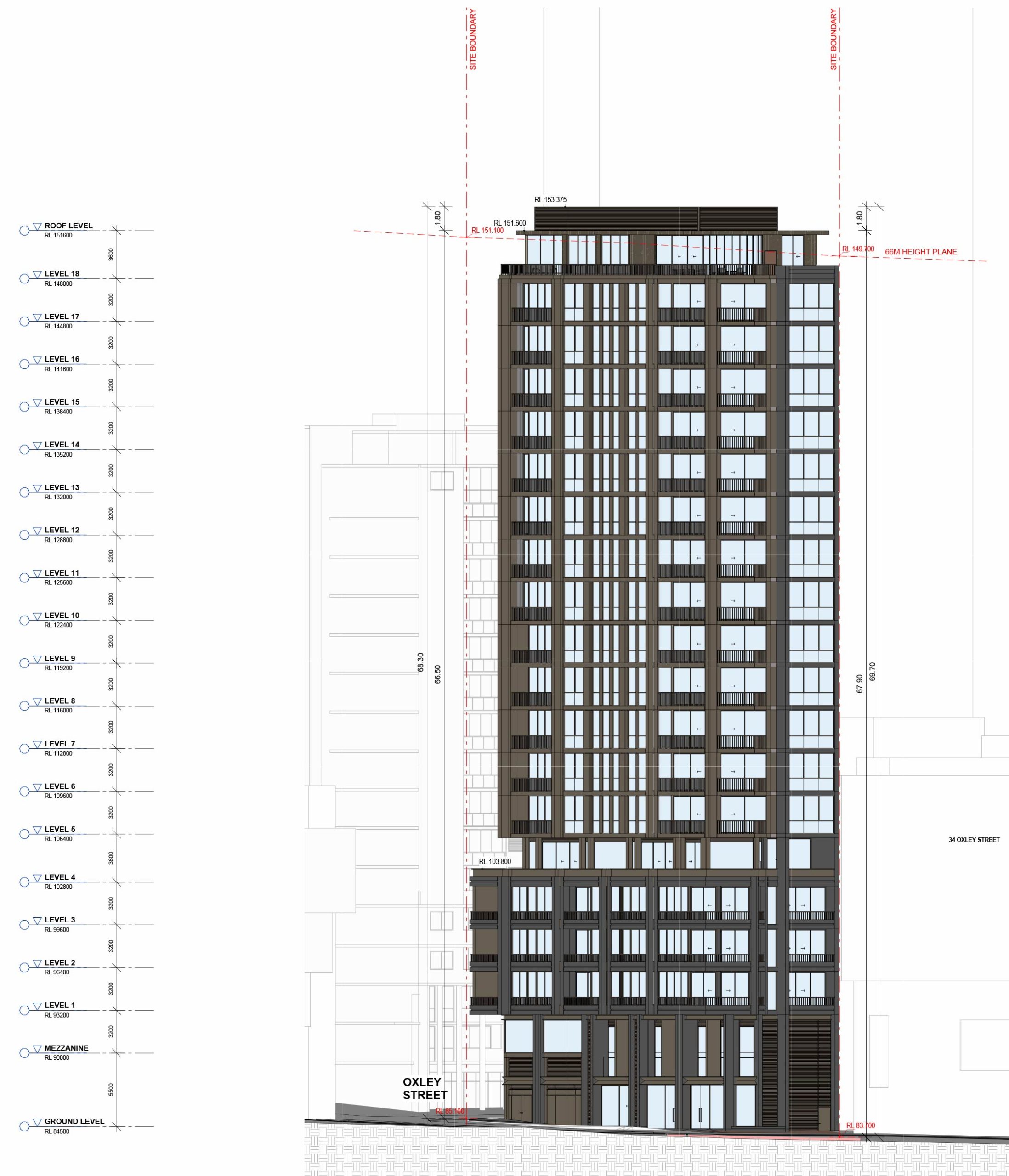
State Significant Development Application (SSDA) No. SSD-91627487 at 38 Oxley Street, St Leonards is being advanced by BMV Developments Pty Ltd. The proposal involves demolishing the existing commercial building and constructing a 20‑storey shop top housing development, containing residential apartments including affordable housing units, above ground and mezzanine level retail space. The development also encompasses communal open space and 6 levels of basement parking.


