Rogans Hill Park

The Planning Proposal and accompanying Master Plan seek to amend the Hills Local Environmental Plan 2019 (Hills LEP 2019) so that the site at 1020 Melia Court, Castle Hill can be developed into a multi-density residential lifestyle and conservation precinct with an offering of community benefits. The project is called Rogans Hill Park.

Welcome

Welcome to the UrbanTalk project listing for Rogans Hill Park.

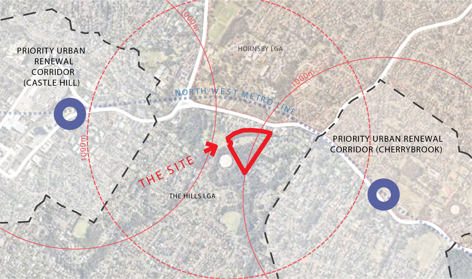
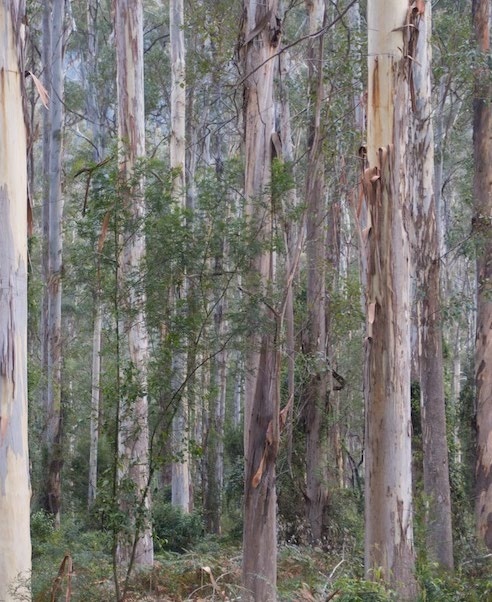
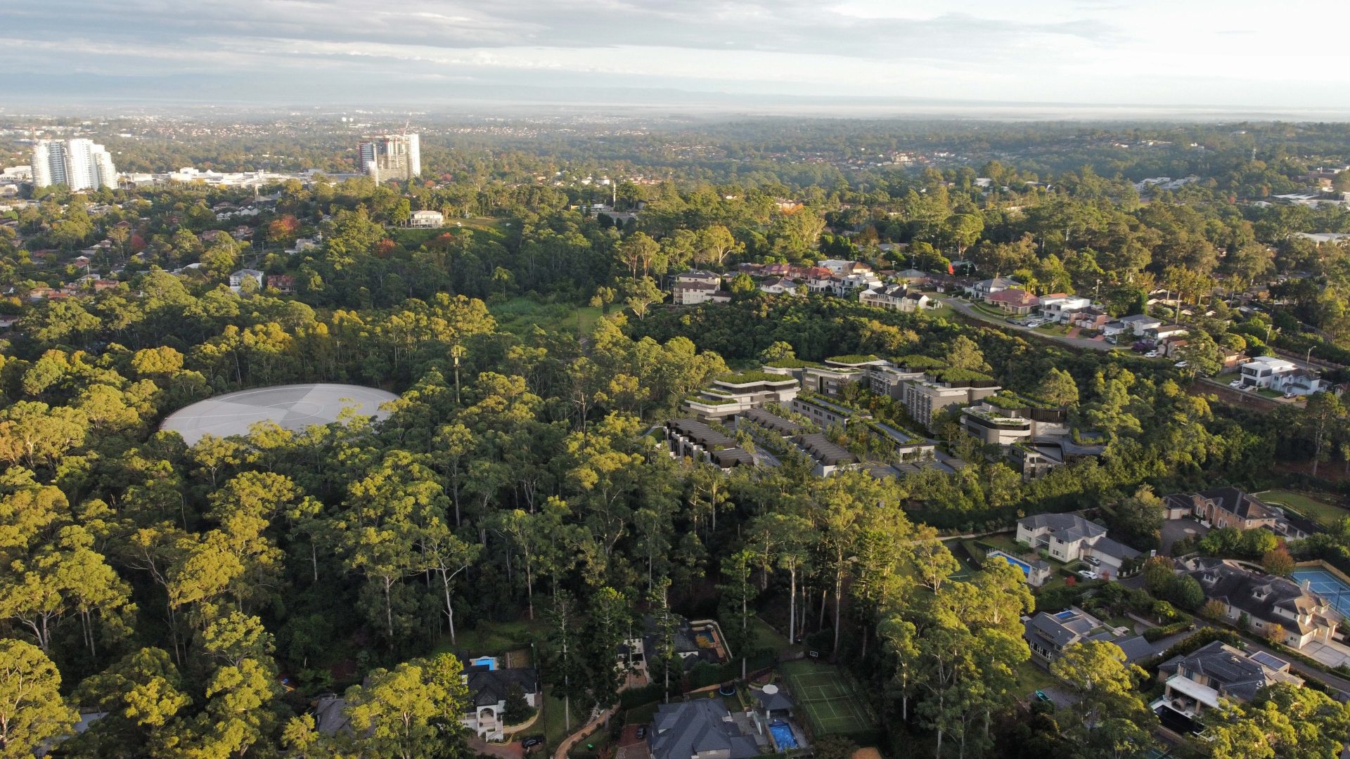
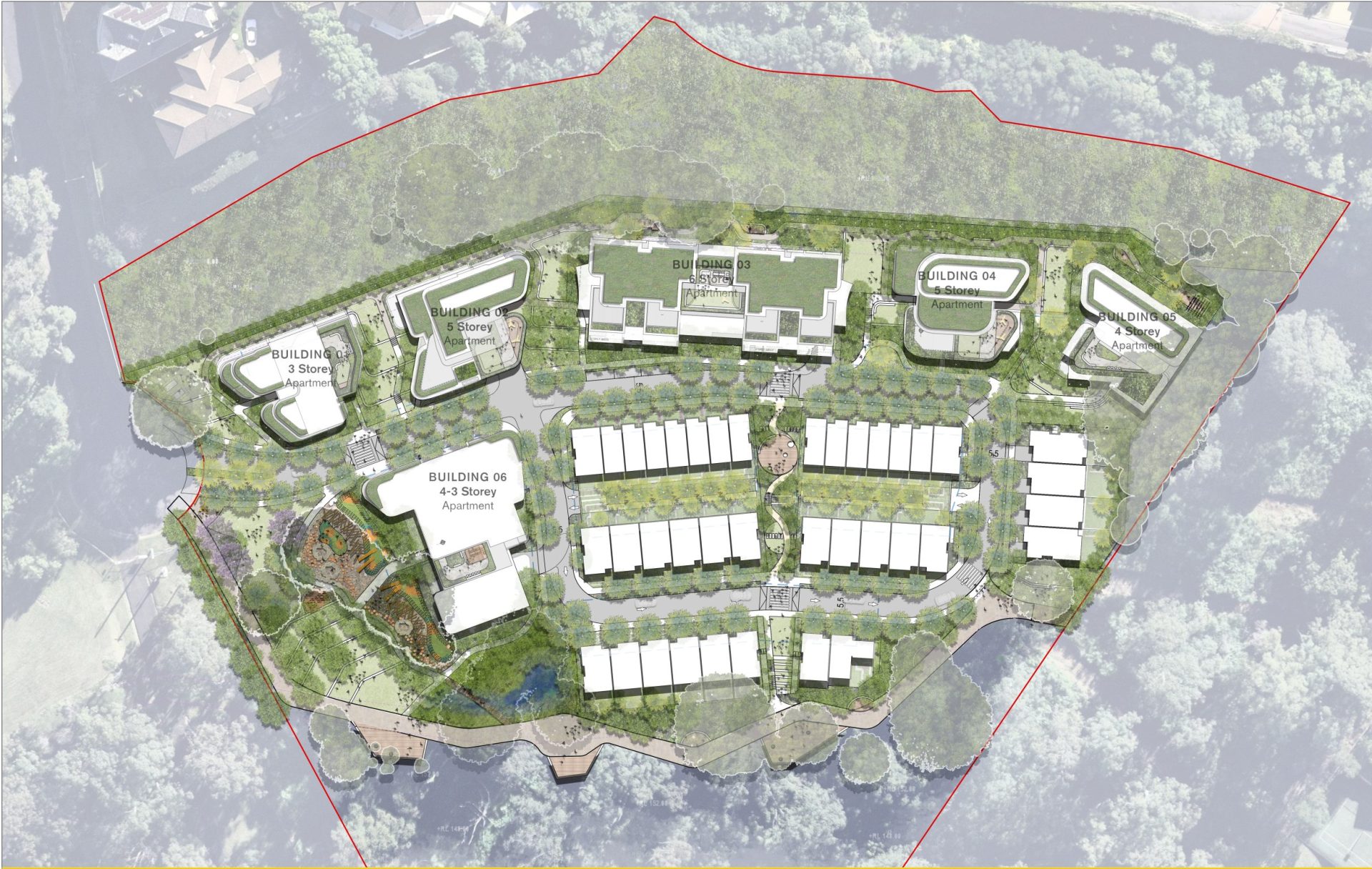
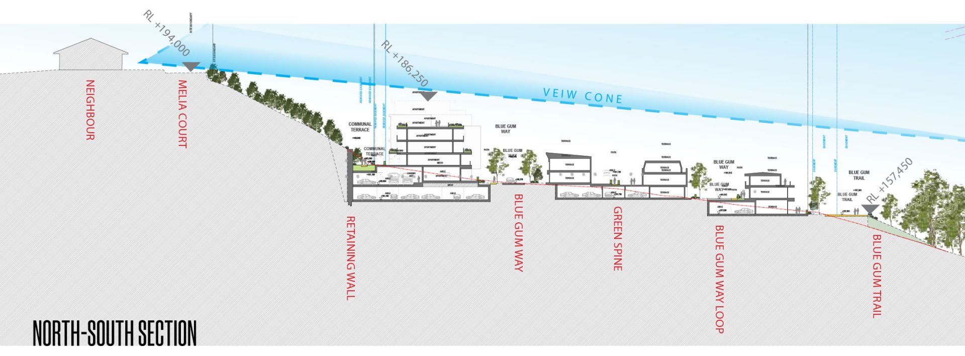
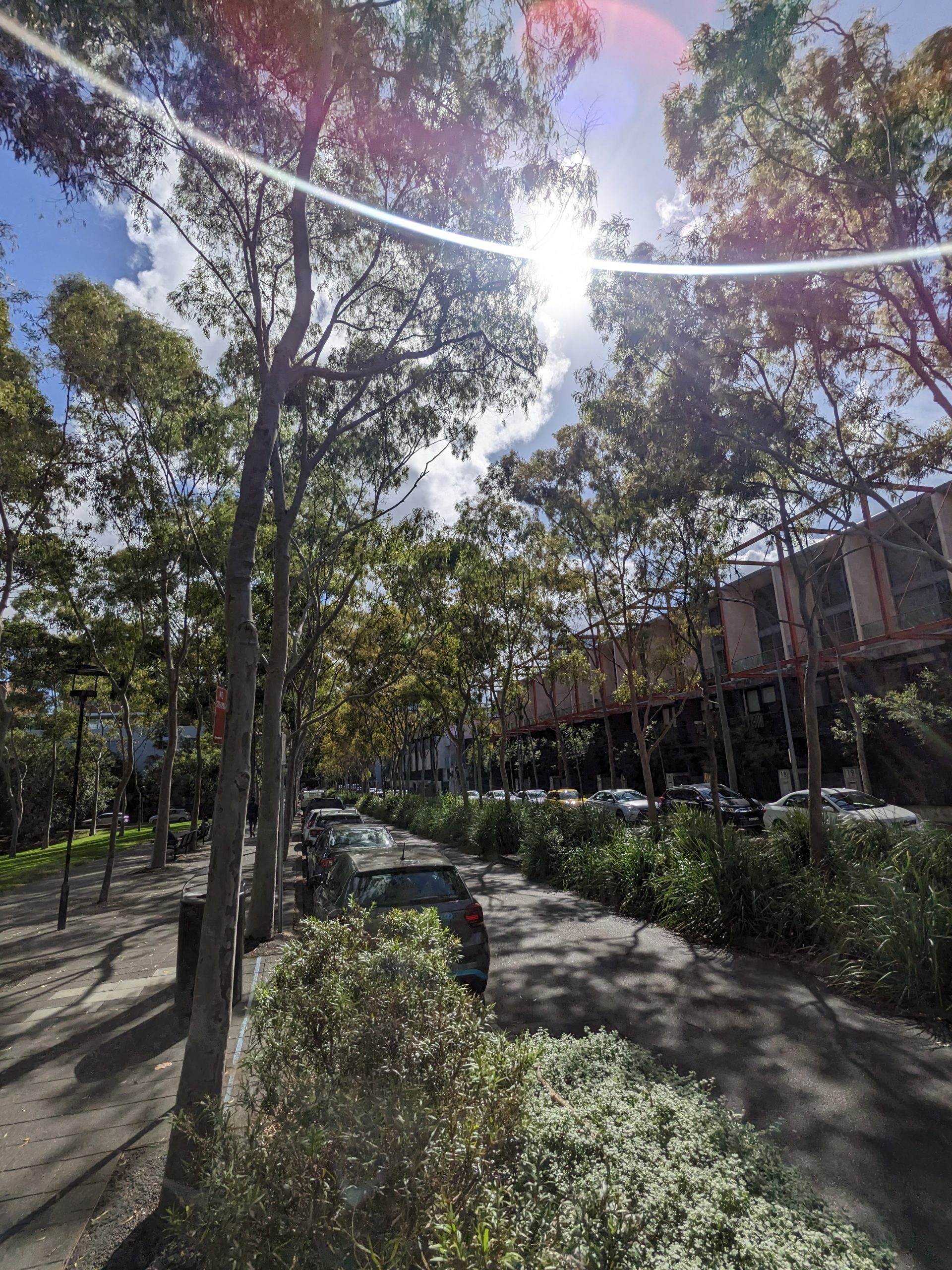
The Rogans Hill Park Project involves master planning and rezoning the 4.5-hectare Site that is located at 1020 Meila Court, Castle Hill in the Hills Shire. The Site is located within a 20-minute walking catchment of both the Castle Hill and Cherrybrook Metro Stations and a 5 minute walking catchment of bus stops along Castle Hill Road.

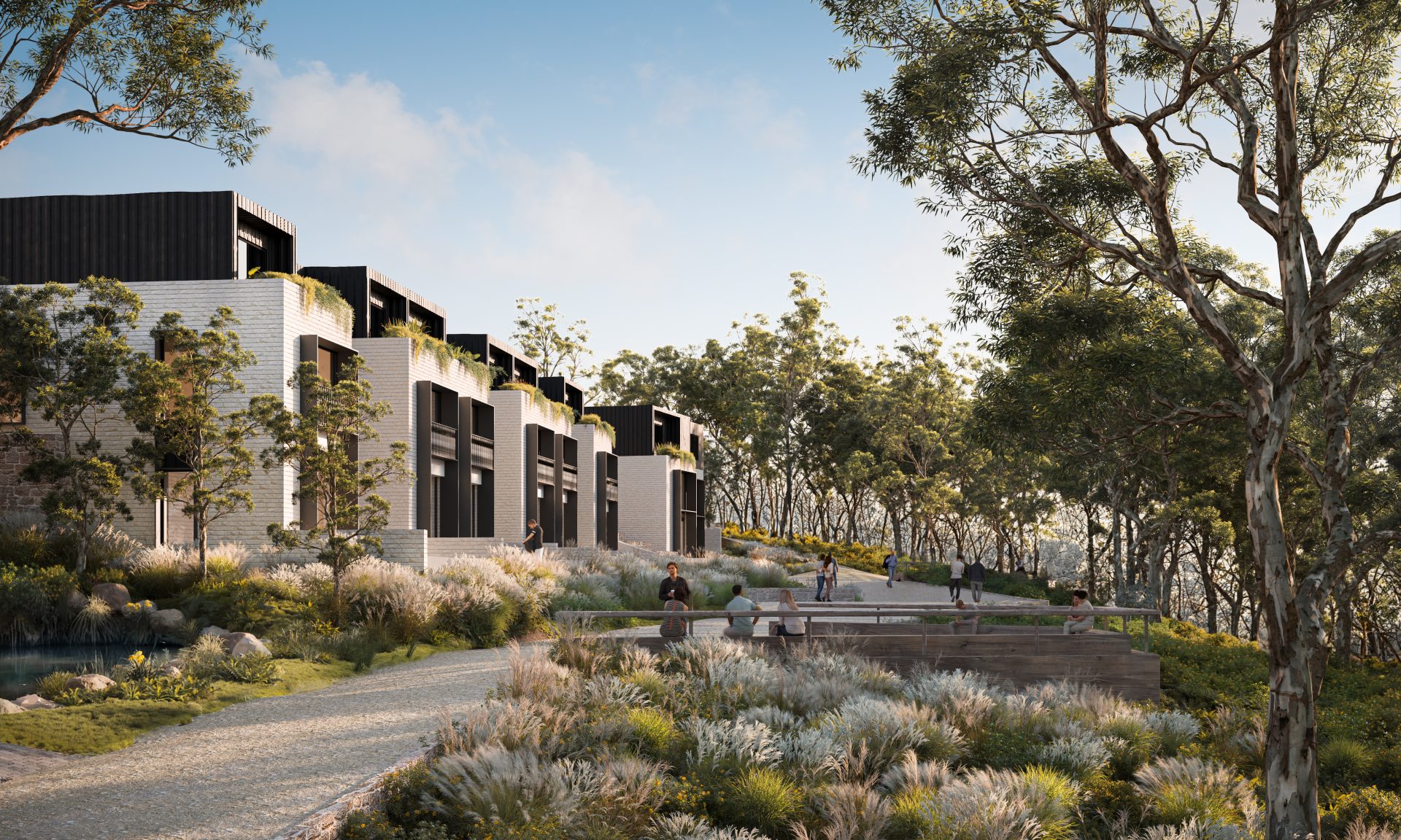
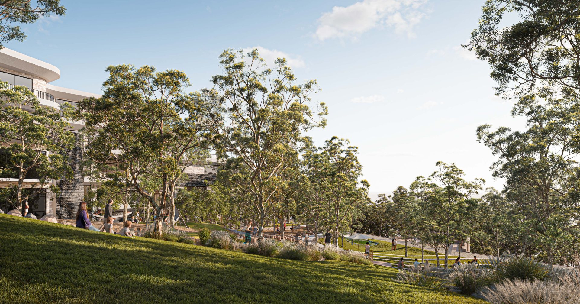
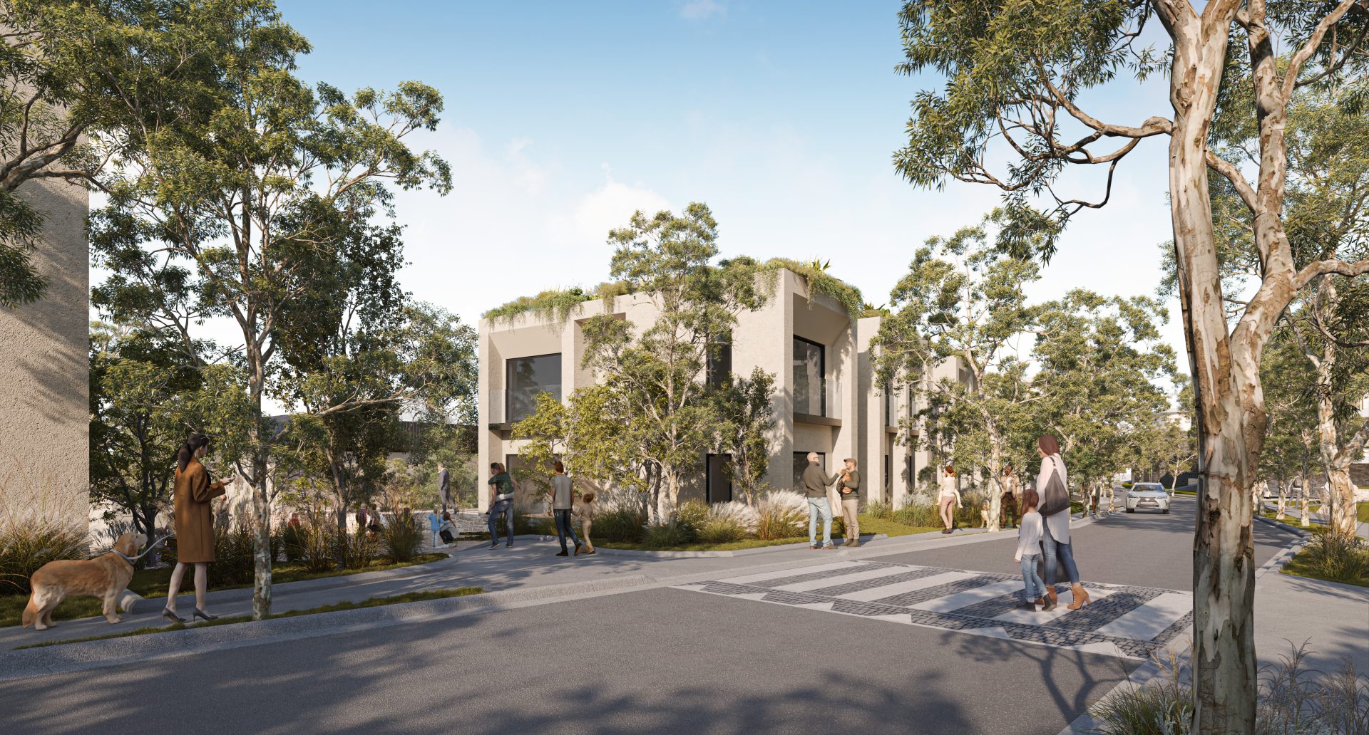
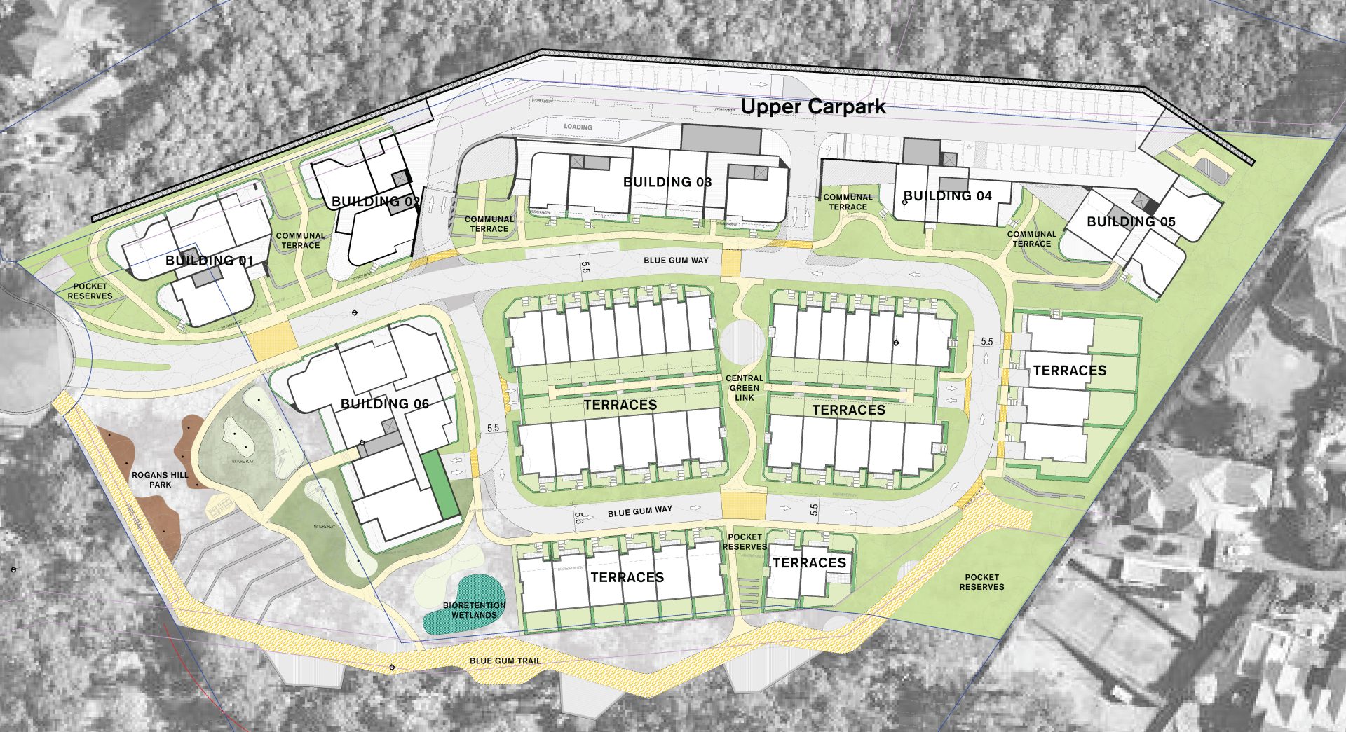
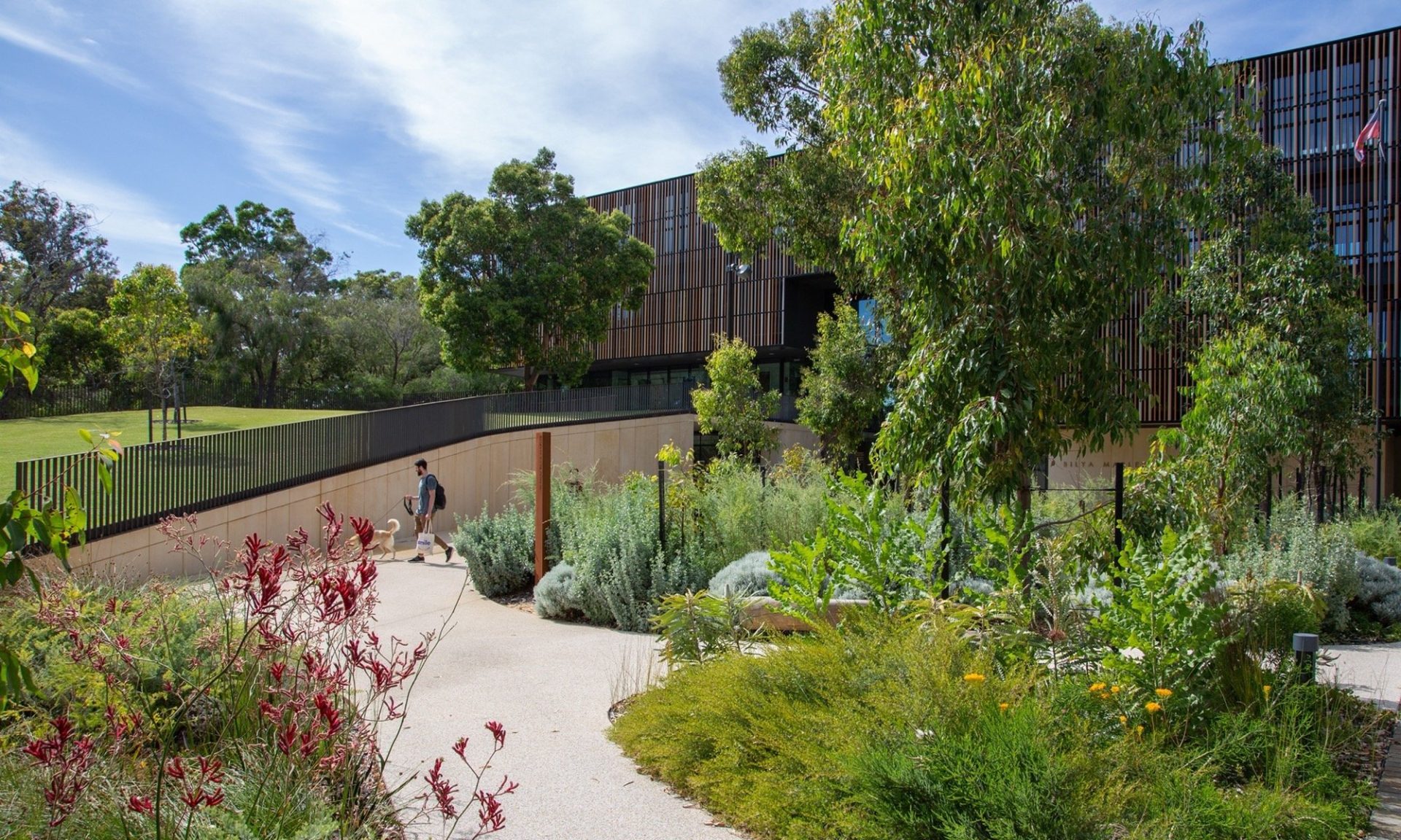
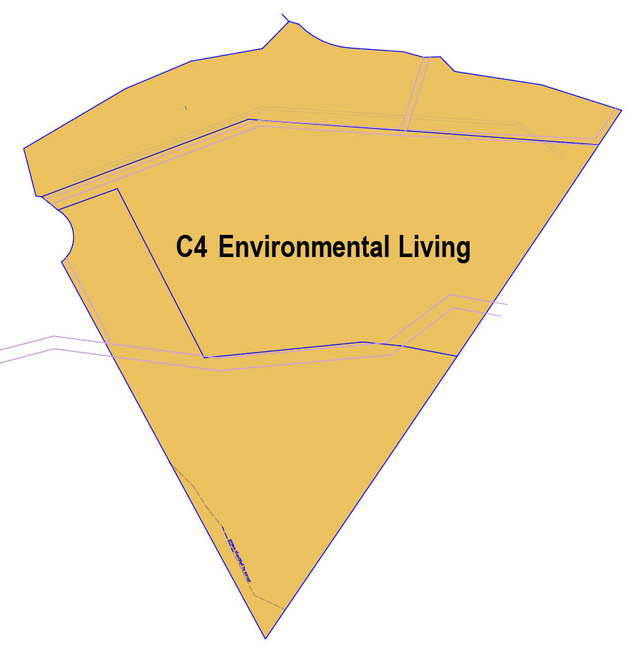
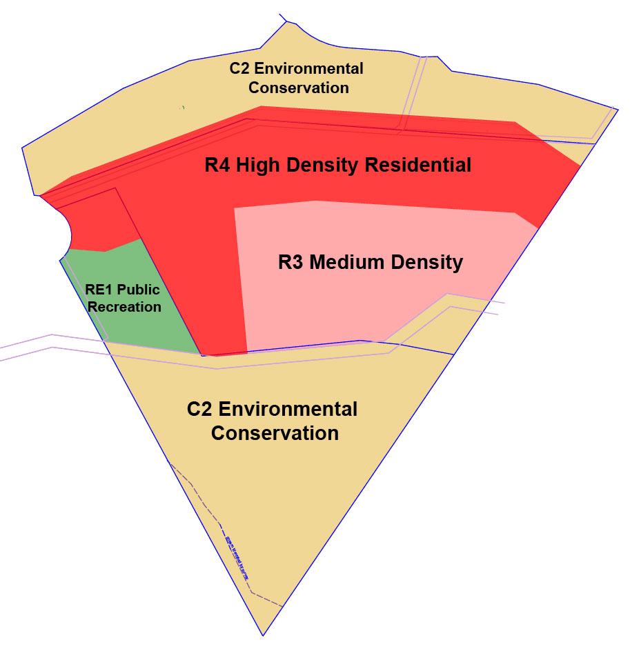
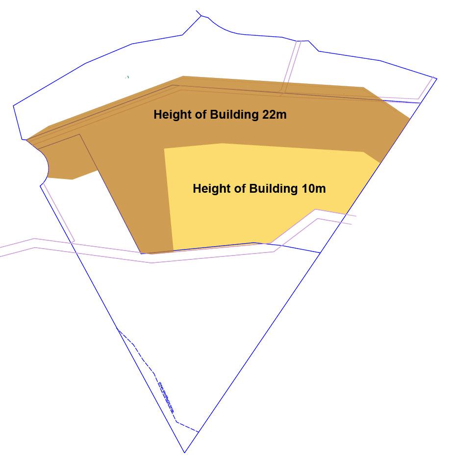
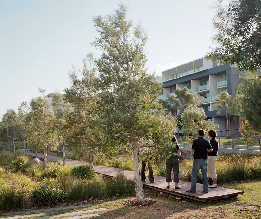
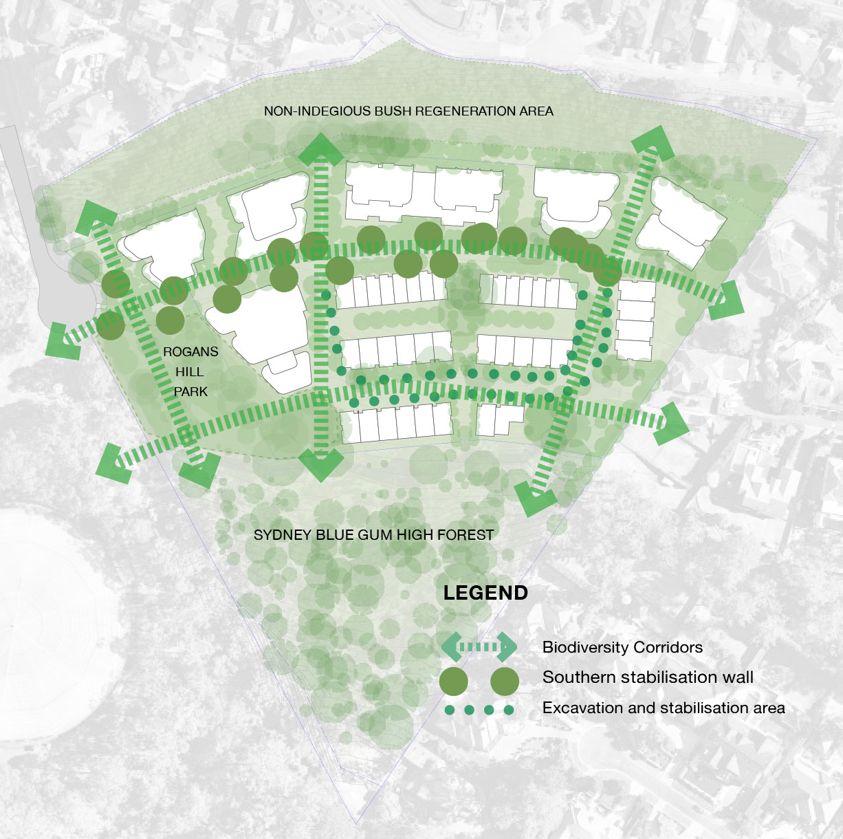
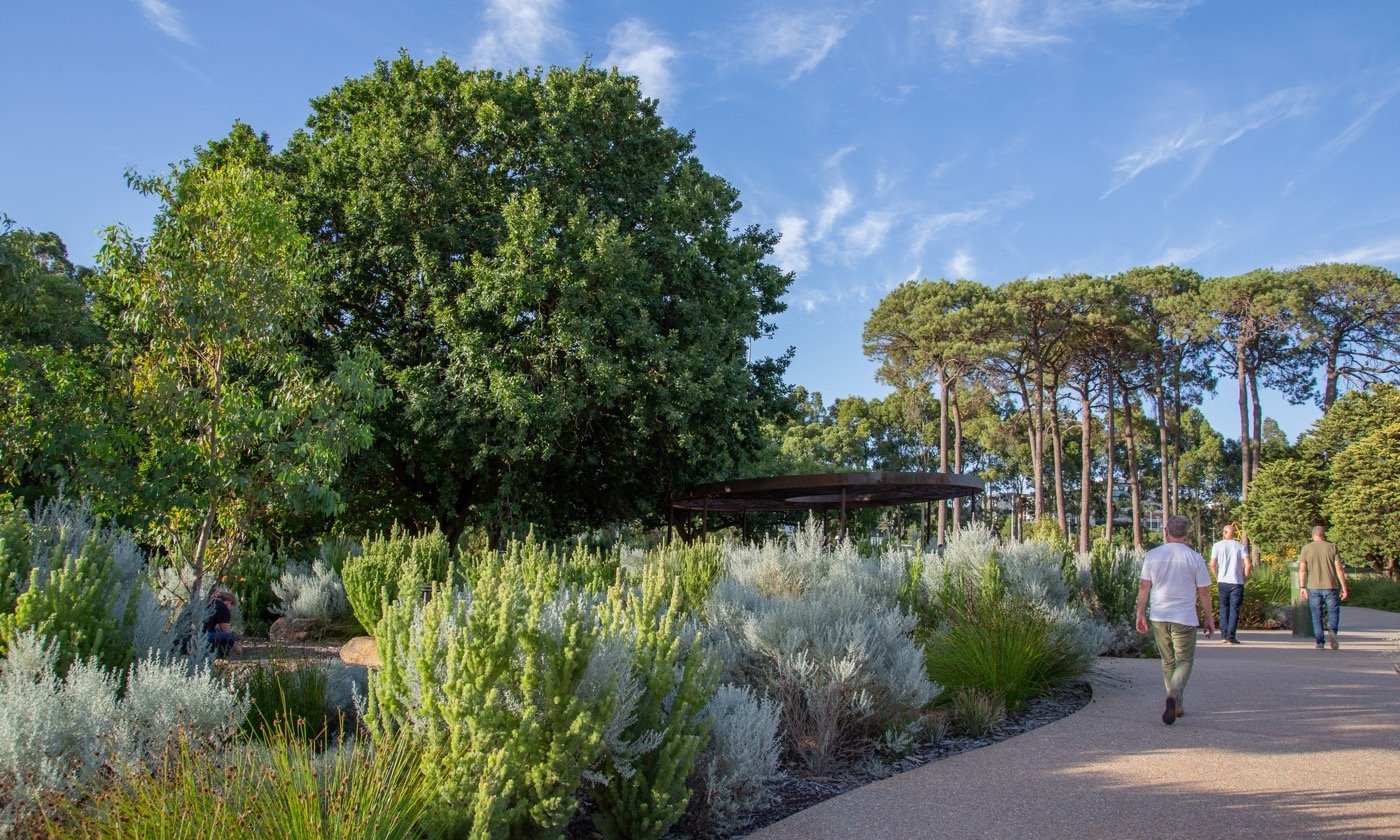
The Master Plan will deliver a new multi-density residential community that comprises of 185 new dwellings in terrace and apartment style buildings ranging in height from 2 to 6 storeys and set within a green environmental conservation precinct. The Master Plan forms the basis of the Planning Proposal Application that has been lodged with the Hills Shire Council.

This listing will be updated as new information becomes available on this project. On this page you will find background information about the project, its status, the vision for the site, a description of the Master Plan that will guide its redevelopment, details of upcoming community consultation and a feedback form to get in contact.

Artist’s impression looking East along the Blue Gum Trail

Project details

Address
1020 Melia Court, Castle Hill
Local Government Area
The Hills Shire
Project Type
Residential
Status
Planning Proposal and Master Plan lodged with Hills Shire Council
Developer
Castle Hill Glen Pty Ltd
Architect

DKO Architects

Project Overview

There is a current and active Development Application (DA) that applies to the Site, DA No.1089/2007/za. This DA was approved by the Land and Environment Court in 2011 and provides for a 23 lot community title residential subdivision with a public access road connecting to Glen Road. The DA has a construction certificate and substantial commencement.

The Site can accommodate a higher density of housing than currently has been approved. The existing DA pre-dated the opening of the Castle Hill and Cherrybrook Metro Stations which opened in 2019. These stations are within a 20-minute walking catchment of the Site making it suitable for a higher density Transit Orientated Development.

The Rogans Hill Park Master Plan proposes the same development footprint as the approved DA, it provides for the delivery of 185 new multi density dwellings and sets aside 72% of the total landholding as deep soil landscaping and publicly accessible open space and bushland reserve.

A Planning Proposal and Master Plan has been lodged with the Hills Shire Council that seeks approval for the following amendments to the Hills Shire Local Environmental Plan 2019:

• Rezoning of the land from C4 Environmental Living to R3 Medium Density Residential, R4 High Density Residential, C2 Environmental Conservation and RE1 Public Recreation; and
• Amending the maximum height standard map to introduce a height control of 10-22 metres over that part of the site that is zoned R3 Medium Density and R4 High Density. No height controls would apply to RE1 and C2 zoned lands.

The overriding vision for Rogans Hill Park is to foster a profound connection between nature, environmental management practices and contemporary apartment and terrace style living.

Artist’s impression of park, looking South

Specifically, the proposed statutory controls under the Planning Proposal will deliver:

• Six residential apartment buildings ranging in height from 2 to 6 storeys and containing a total of 147 apartments. The building heights have been set following extensive urban design and visual impact investigations to ensure they sit below the established tree canopy and ridge height of Melia Court, mitigating potential view impacts for neighbours and from the public domain.

• A total of 38 Terraces, 2-3 storeys in height.

• 15% of the new housing to be dedicated to Hills Shire Council as affordable housing.

• Investment in new open space public infrastructure with a new Public Park, “Rogans Hill Park” that will feature a nature children’s play area and outdoor fitness opportunities.

• Approximately 53% of the Site dedicated to deep soil open space and bushland preservation in perpetuity.

• A network of boardwalks and viewing platforms that will offer residents and visitors a unique nature experience and views over the Sydney Blue-Gum High Forest.

• A pedestrian prioritised loop road for efficient vehicular circulation, access to underground parking areas and pedestrian connectivity.

• The construction of a new public footpath in Glen Road to connect the Rogans Hill Park Precinct into the local pedestrian network.

Over the past six months, a range of site investigations have been ongoing. The Proponent has commissioned a multi-disciplinary team encompassing expertise in architecture, urban design, landscape architecture, urban planning, ecology and environmental management, heritage assessment, land survey, view analysis, traffic and transportation planning, and utility servicing to prepare the Master Plan. The specialist reports accompany the Planning Proposal.

Statistics at a Glance

Proposed Scheme
Site Area45,024sqm (4.5 ha)
Development Area (excluding Rogans Hill Public Park)21,328 sqm (2.1 ha)
Total Landscaped Area36,123 sqm (80%)
Total Deep Soil Area32,475 sqm
Total Dwellings185
Building Height2 – 6 storeys
Apartment Mix147:

1 bedroom – 44

2 bedroom – 78

3 bedroom – 25
Terrace Mix38:

3 & 4 Bedroom
Vehicular AccessSingle spinal road
Car Parking265 basement spaces
Public Park2000sqm
Trees Canopy Cover61%
New trees to be planted418
New trees to be planted200
Streetscape upgrades & shared linkages2,250sqm
.

Image Gallery

Project Status

EINV Group are the proponents for a planning proposal that seeks to amend The Hills Local Environment Plan 2019 (The Hills LEP 2019). This planning proposal is in the preparation and pre-lodgement stage, but more detailed design is being undertaken concurrently. There are still a number of steps this planning proposal must go through before it is approved.

Planning Proposal Process

Stage 1 – Pre-Lodgement

Completed

This stage involves reviewing the strategic planning framework set by the State Government and considering the development potential of the land in accordance with this framework.

It also involves identifying if changes are required to the land use zoning and development controls are required. The proponent prepares and submits a scoping proposal to council, who then issues advice on the requirements of the Planning Proposal and its strategic merit.

Stage 2 – Prepare and Lodge

Completed

The proponent will prepare and lodge the Planning Proposal with the local council.

The Council must review, assess and decide whether to support and submit the Planning Proposal to the Department of Planning and Environment (NSW DPE) for Gateway Determination. This may include referral to a Local Planning Panel.

Stage 3 – Gateway Determination
In Progress

The NSW DPE assesses the proposal’s strategic and site-specific merit, potential impacts and obtains relevant advice. They prepare a report and provide a recommendation to the Minister (or delegate). The Minister will then issue a Gateway determination on whether the Planning Proposal is supported to proceed and the requirements/conditions under which it will proceed.

Stage 4 – Post-Gateway
Not Yet Commenced

The Gateway determination may identify the need to undertake additional studies, require consultation with authorities and government agencies and/or require amendments to the planning proposal prior to public exhibition.

Stage 5 – Public Exhibition and Assessment
Not Yet Commenced

The Proposal is exhibited per the conditions of the Gateway determination. The community, key authorities and government agencies are invited to make public submissions. Council reviews the Planning Proposal to address conditions of Gateway Determination and submissions. Platino Properties is required to address concerns raised and modify the Proposal where required.

Stage 6 – Making the Local Environment Plan
Not Yet Commenced

Council undertakes its final assessment of the Planning Proposal and, if supported, prepares the draft LEP. Once finalised, the LEP may be made, notified and come into effect.

To learn more about the planning proposal, head to the Planning Considerations section further down this page.

What is a Planning Proposal?

A Planning Proposal is a formal planning application that seeks to rezone a site by amending the statutory planning controls that apply to a parcel of land under a Local Environmental Plan (LEP). A Planning Proposal sets out the proposed amendments and justifies why the proposed amendments should be supported.

If a Planning Proposal is supported, the new planning controls are gazetted and formerly incorporated into the relevant LEP. A Development Application is then progressed, seeking Consent for the development. No development can occur on a site under a Planning Proposal. Development of the Site will require the approval of a Development Application.

Site Description

The Site is in the Hills Shire Local Government Area. It is located midway between the Castle Hill Railway Station, which is 1.1 kilometres to the west and the Cherrybrook Railway Station which is 900 metres to the east.

The Site is on the southern side of Melia Court and is a triangular land parcel that comprises of three separate Torrens Title allotments, Lot 1020 in DP 876671, Lot 2021 in DP 876671 and Lot 2 in DP 576773. The Site is owned by the proponent, Castle Hill Glen Pty Ltd.

Site Location

The Site is a rare and sizable land offering with a combined site area of 45,024 square metres or 4.5 hectares. The Site is serviced by the Hills Shire Council reticulated water and sewer services. Electricity and telecommunication services are also available.

The topography of the Site generally drops from north to south with the widest portion of the wedge being approximately 21-28 metres below Melia Court at Contour Line RL 192, The lowest part of the Site is at RL 130.45 which means there is a change in elevation of approximately 60 metres between the Sites northern and southern boundary. This means the Site sits at a lower topographical point than the adjoining Melia Court residences to the north.

Artist’s impression of the completed project in context

Surrounding Land Uses

The Site is surrounded by land that is zoned C4 Environmental Living and R2 Low Density Residential. It is located adjacent to the Sydney Water Rogans Hill Reservoir.

Surrounding residential development comprises of substantial 1-3 storey Torrens Title dwelling houses of mixed architectural style set within well landscaped gardens with multi car garages and recreational amenities such as tennis courts, swimming pools and the like. These areas are focused around Melia Court which aligns the northern boundary, Doris Hirst Place, Hoop Pine Place and Forest Knoll which are all local roads that align the eastern boundary and Castle Hill/ and Glen Road to the west. Melia Court is elevated above the Site and sits atop the steep embankment that forms the sites northern boundary.

Council mapping identifies the centre of the site contains Sydney Blue Gum High Forest and Cattai Alluvial Tall Forest which are identified as a Critically Endangered Ecological Community under the Biodiversity Conservation Act 2016. The site is also identified as purple on the Biodiversity Value Map which means clearing is regulated by the State Environmental Planning Policy (Biodiversity and Conservation) 2021.

The Master Plan

Vision

The overarching urban design and landscape vision for Rogans Hill Park is:

To create a unique multi-density neighbourhood that is interconnected to nature.

DKO Architecture has formulated the Master Plan that accompanies the Planning Proposal. The land use mix, built form and landscaped spaces in the Master Plan demonstrate how Site would be redeveloped under the proposed amendments to the Hills Shire LEP 2019. The Master Plan is illustrative and does not present a fully developed scheme. A Development Application would need to be formulated and lodged before any development can occur on the Site.

Artist’s impression of Blue Gum Way looking West

The development concept envisioned under the Master Plan is a new multi-density residential estate that will provide three new housing typologies currently not available in the immediate locality. These are:

• Apartments;
• Garden apartments; and
• Terraces.

Under the Master Plan the housing offering comprises of six residential apartment buildings ranging in height from 2 to 6 storeys and containing a total of 147, (1, 2 and 3 bedroom) apartments and 38 (3-4 bedroom) terraces that span 2-3 storeys in height. This equates to a total of 185 dwellings.

The Master Plan is illustrated below.

Illustrative Master Plan

Design and Landscape Principles

Design and landscape principles have informed the Master Plan.

Principle 1: Prioritisation of a Public Open Space Network.

The Rogans Hill Park precinct has open space and recreational living at its heart. The Master Plan sets aside 72% of the Site as deep soil landscaped area and publicly accessible open space and bushland reserve. It provides a northern and southern biodiversity zone, pocket parks, community gardens, boardwalks, bushland viewing platforms, communal roof top gardens, green roofs, private landscaped garden balconies and terraces.

A new public park, Rogans Hill Park, is proposed at the entrance to the new precinct. The park will be a place where existing and future residents can interact and socialise. It will reinforce the cultural identity of Rogans Hill.

Principle 2: Preservation of Biodiversity through dedicated Conservation Zones

The retention and management of ecologically significant and remnant bushland communities will preserve the Site’s scenic character and creates an important nature connection for future and existing residents.

The northern and southern biodiversity zones ensure existing endemic communities are managed and conserved. New green corridors link the biodiversity zones and provide habitat for local flora and fauna. The proposal to plant 418 new trees achieves an onsite tree canopy cover target of 61%.

Principle 3: Considered height and density to mitigate amenity impacts on neighbours.

The maximum height of the development will sit below both the established tree canopy on the Site and the ridge height of Melia Court. The tallest 6 storey building forms are set well back from Melia Court, Glen Road and Doris Hirst and Hoop Pine Place residents. Building heights step down towards the edges and transition to 2-3 storeys at the southern, eastern, and western boundaries. Landscape and open space setbacks reduce direct view lines, and soften building forms when viewed from the public and private domain.

North-South Cross Section of view lines from neighbouring properties.

Principle 4: Pedestrian Connectivity and wayfinding.

The Master Plan gives priority to pedestrians. The precinct will have a private road network that is accessed via a single-entry boulevard off Glen Road. It will operate as a shared pedestrian zone. It connects all buildings and open spaces within the precinct. A nature boardwalk with viewing platforms sits within the southern biodiversity zone and in the event of a fire can be used as a fire service trail. The precinct and the new Rogans Hill Public Park will be connected to Castle Hill Road by a new footpath in Glen Road.

Principle 5: Sustainable Building Design and Technology.

Rogans Hill Park dwellings will be of contemporary architectural design, and constructed from high performing building materials to ensure they resource efficient. Dwellings will include water tanks, solar panels, and light-coloured roofs. Sustainable technologies will be incorporated such as electric vehicle chargers, environmental sensors, and smart electrical waste and water fixtures.

Principle 6: Scenic character and neighbourhood views are preserved.

The proposed massing has a low level of visibility within the existing viewing context of the Site. Individual building forms sit within landscaping and the new bushland and open space network. Building heights are below the existing tree canopy and the ridge height of Melia Court. The tallest six storey building forms are below the line of sight from local vantage points in adjacent residential streets.

Planning Considerations

Planning Proposal

What is a Planning Proposal?

A Planning Proposal is a formal planning application that seeks to rezone a site by amending the statutory planning controls that apply to a parcel of land under a Local Environmental Plan (LEP). A Planning Proposal sets out the proposed amendments and justifies why the proposed amendments should be supported.

If a Planning Proposal is supported, the new planning controls are gazetted and formerly incorporated into the relevant LEP. A Development Application is then progressed, seeking Consent for the development. No development can occur on a site under a Planning Proposal. Development of the Site will require the approval of a Development Application.

What Will This Planning Proposal Change?

To enable the Site to accommodate the landscape and built form envisaged under the Master Plan, the Planning Proposal requests Hills Shire Council to amend the Hills Shire LEP 2019 land use zoning and height controls. Specifically, it requests:

  • That the Site be rezoned from C4 Environmental Living to part R3 Medium Density, part R4 High Density, part C2 Environmental Conservation and part RE1 Public Reserve.
  • That the maximum height standard map be amended to reflect heights ranging from 10 metres to 22 metres to accommodate new buildings forms ranging in height from 3 to 6 storeys. The existing height control is 9 metres.
Existing & Proposed Planning Controls
Existing Controls under the Hills Shire LEP 2019Proposed Controls under the Hills Shire LEP 2019
C4 Environmental LivingR3 Medium Density, part R4 High Density, part C2 Environmental Conservation and part RE1 Public Reserve
9 metres10-22 metres over that part of the site that is zoned R3 Medium Density and R4 High Density

Existing land use zoning

Proposed land use zoning

Existing height controls

Proposed height controls

Site-Specific Development Control Plan

The Hills DCP contains development controls for residential flat buildings and multiple dwelling housing. The reference design has been prepared with consideration to the DCP controls were necessary and reasonable. However, for the intended outcome to be realised and to provide additional built form parameters to manage future development, it is necessary to apply site-specific development controls. The application of site-specific development controls is reasonable in these circumstances as, along with LEP amendments, they will facilitate the renewal of the site. Applying the generic residential controls to this site ignores the site’s complexities and would likely constrain future development potential.

The Planning Proposal is also accompanied by a Site-Specific Development Control Plan that would regulate the following built form and landscape parameters:

• Site coverage
• Landscaped area
• Deep soil
• Building height
• Setbacks
• Basement design
• Through-site link
• Site access and traffic arrangements
• Details of land management and slip
• Details of future park and bushland
• Footpath and public domain works

Strategic Merit

A Planning Proposal sets out justification based on the strategic merit for why existing planning controls should be amended. The strategic merit for this Planning Proposal is provided for under the following plans and policies.

Greater Sydney Regional Plan

‘A Metropolis of Three Cities – The Greater Sydney Region Plan’ was released by the Greater Sydney Commission in March 2018. It sets out the 40-year vision objectives, strategies and actions for developing a three city metropolis model for greater Sydney.

The Plan’s Vision for 2056 promotes the ‘30-minute city’ concept across greater metropolitan Sydney, allowing people to live, work and access amenities and services in a highly accessible manner. The Plan also advocates for more housing in the specific locations and encourages urban renewal of particular sites which benefit from existing and proposed infrastructure. The Plan identifies emphasises the importance of aligning population growth with infrastructure investment to create liveable and well serviced cities.

The plan includes 40 separate objectives, the following are some that would be addressed by this project:

• Objective 10 – Greater housing supply;
• Objective 11 – Housing is more diverse and affordable;
• Objective 14 – A Metropolis of Three Cities – integrated land use and transport creates walkable and 30-minute cities
• Objective 27 – Biodiversity is protected, urban bushland and remnant vegetation is enhanced; and
• Objective 30 – Urban tree canopy cover is increased.

The Planning Proposal aligns with the objectives of the Greater Sydney Region Plan by amending the existing planning framework to allow for additional residential capacity and improving housing choice in an accessible and appropriate location near the Strategic Centre of Castle Hill. This improves the level of housing supply in an area close to shops and public transport and improves the diversity of new housing in the area.

Local Plans and Vision

Hills Future 2036, The Hills Shire Council’s Local Strategic Planning Statement (LSPS), links the State’s regional planning framework with Council’s local planning framework and sets out Council’s short, medium and long-term priorities on infrastructure, liveability, productivity and sustainability to a 20 year horizon. The LSPS was endorsed by Council on 22 October 2019.

The LSPS presents 23 Planning Priorities which seek to shape the growth of the LGA. Here are the five that this project aligns with:

• Planning Priority 6: Plan for new housing to support Greater Sydney’s growing population
• Planning Priority 7: Plan for new housing in the right locations
• Planning Priority 8: Plan for a diversity of housing
• Planning Priority 17: Protect areas of high environmental value and significance
• Planning Priority 20: Prepare residents for environmental and urban risks and hazards.

NSW Government Transit Orientated Development Principles

The Planning Proposal aligns with the NSW Governments urban growth policies that encourage additional residential capacity and improved housing choice in areas that are close to public transport and shops. The State Government Transit Orientated Development Principles recognise a 1.2 Kilometre walking catchment for higher density development. The Site is within 1.2 kilometres of both the Cherrybrook and Castle Hill Metro Stations that opened in 2019.

NSW Government Affordable Housing Provision

The proposed terrace and apartment housing typologies support a more inclusive community than the current C4 land use zone. Providing new housing choices that are suitable for singles, professional couples, empty nesters, and families caters to a broader demographic. The provision of 15% of all new housing as affordable housing that is to be managed by a community housing provider is an important outcome of the Project for the Castle Hill community and will support essential worker accommodation in the Shire for school teachers, paramedics, fire fighters and the like.

Site Specific Merit

The starting point for this Project involved formulating a range of development options that enabled the ecology of the Site to be preserved and restored whilst concentrating new development in that part of the Site that has an existing approval for urban development. A range of master plan options were considered including a senior’s living scheme. The Proponent considered the Master Plan  was the optimum development outcome for following reasons:

• Planning Priority 6: Plan for new housing to support Greater Sydney’s growing population
• It provides housing diversity for a broad demographic.
• It has a 47% development area which is less then the development footprint of the existing approved development.
• It delivers 72% deep soil open space and bushland reserves.

• It has a well-positioned public park at the gateway to the Precinct.
• It establishes northern and southern biodiversity zones that sit outside of the development footprint.
• It provides for the restorative conservation of endangered Sydney Blue-Gum High Forest communities and the riparian corridor.
• It delivers 185 new dwellings across two housing typologies: 2-6 storey residential apartment buildings, 2-3 storey terraces.

Inspirational Images

• Dwellings have legible front addresses to promote pride of ownership and a sense of community.
• The private road layout prioritises pedestrians over cars.
• Site excavation occurs within the development footprint and is minimised to 2 basement levels.
• The northern slope hazard is stabilised and retained.

Heritage

There is a local heritage listed item adjacent to the site and a number of heritage items in the broader locality. Heritage investigations have concluded that the future development of the site will not be readily discernible from any of the heritage items or impact upon the heritage significant curtilage. A Heritage Impact Assessment forms part of the Planning Proposal Documentation.

Biodiversity

Vegetation and Sydney Blue-Gum High Forrest

The Master Plan has adopted a landscape-led design approach. The starting point was to create a northern and southern biodiversity zone to support the engendered Sydney Blue-Gum High Forest community in perpetuity.

Preservation of biodiversity

The Planning Proposal is accompanied by a Vegetation Management Plan that will be implemented under the community benefit offer. While some existing trees will require removal, the Project provides for the planting of 418 endemic native tree species and achieves a tree canopy cover target of 61%.

The Planning Proposal seeks to rezone more than half of the land to C2 Environmental Conservation and RE1 Public Recreation. Whilst the proposal results in the removal of a portion of existing vegetation within the centre of the land, the proposed future environmental conservation zone will ensure the most significant vegetation will be conserved and will act as a catalyst for bush regeneration through removal of invasive weed species and planting of endemic native plant species.

The Biodiversity Offsets Scheme will be applicable or this project and includes a framework for offsetting unavoidable impacts on biodiversity from development with biodiversity gains through landholder stewardship agreements. The Biodiversity Offsets Scheme (BOS) was established under the Biodiversity Conservation Act 2016 and relates to, applications for development or clearing approvals must set out how impacts on biodiversity will be avoided and minimised. The remaining residual impacts will need to be offset by the purchase and/or retirement of biodiversity credits or payment to the Biodiversity Conservation Fund or potentially a Biodiversity Stewardship Agreements on their land to generate biodiversity credits.

The proposal is not considered to decrease other environmental protections in the LEP, The Hills DCP 2012, or the State Environmental Planning Policy (Biodiversity and Conservation) 2021.

The Planning Proposal will be subject to consultation with the NSW Environment and Heritage Group – Biodiversity and Conservation Division to give further consideration to this matter. The Proposal incorporates a tree replacement strategy to mitigate any potential tree loss at the rate of 2:1. This equates to the planting of 418 trees across the Site.

Current view from Melia Court looking South

Riparian Corridor Restoration

There is a 1st order riparian corridor adjacent to the southern site boundary. The Master Plan adopts water sensitive urban design principles to filter stormwater along streets and in the public domain creating permeable surfaces to recharge groundwater.

Land Stabilisation

The proposed development scenario incorporates essential land stabilisation measures that address potential slip hazards at the northern boundary. The construction of a new concrete piled retaining wall will mitigate movement of the northern embankment. This site stabilisation work is not provided for under the existing approved development and statutory controls.

A Landslide Risk Assessment Report forms part of the Planning Proposal documentation and concludes development can occur at the site, subject to appropriate stabilisation measures being implemented at the design and construction phases of development.

Mitigating Impacts to Neighbours

The maximum height of the development sits below both the established tree canopy on the Site and the ridge height of Melia Court. The tallest 6 storey building forms are set well back from Melia Court, Glen Road and Doris Hirst and Hoop Pine Place residents. Building heights step down towards the edges and transition to 2-3 storeys at the southern, eastern, and western boundaries. Landscape and open space setbacks reduce direct view lines, and soften building forms when viewed from the public and private domain.

Community Consultation

Castle Hill Glen understands the sensitivity of increasing housing density in established areas and is committed to actively working with neighbours and the broader community to deliver a positive and beneficial outcome for the community.

Castle Hill Glen will commence the community consultation process for this project in the coming months. Information about upcoming events will be provided here as it becomes available. We invite you to pre-register to participate in future events using the feedback form below.

The Developer

Castle Hill Glen Pty Ltd is supported by a seasoned developer with extensive experience overseeing medium to large-scale projects in Australia and globally. Their collective expertise covers various sectors, including residential, commercial, and infrastructure. Known for their innovative approach and commitment to excellence, they consistently deliver successful projects that meet the highest standards. With their depth of experience, Castle Hill Glen Pty Ltd. is a trusted partner for complex and prestigious developments.

Provide your feedback